Sandy Creek (village), New York facts for kids
Quick facts for kids
Sandy Creek, New York
|
|
|---|---|
|
Village
|
|

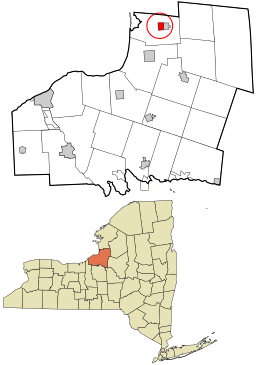
Location in Oswego County and the state of New York.
|
|
| Country | United States |
| State | New York |
| County | Oswego |
| Area | |
| • Total | 1.35 sq mi (3.49 km2) |
| • Land | 1.35 sq mi (3.49 km2) |
| • Water | 0.00 sq mi (0.00 km2) |
| Elevation | 499 ft (152 m) |
| Population
(2020)
|
|
| • Total | 646 |
| • Density | 478.87/sq mi (184.91/km2) |
| Time zone | UTC-5 (Eastern (EST)) |
| • Summer (DST) | UTC-4 (EDT) |
| ZIP code |
13145
|
| Area code(s) | 315 |
| FIPS code | 36-65068 |
| GNIS feature ID | 0964425 |
Sandy Creek is a small village located in Oswego County, New York, in the United States. In 2010, about 771 people lived there.
This village is found in the central part of the larger Town of Sandy Creek. You can find the village right by U.S. Route 11.
A Look Back in Time
The oldest part of Sandy Creek village is special. It was added to the National Register of Historic Places in 1983. This means it's an important place with a lot of history.
Several buildings in Sandy Creek are also on this list:
- The Methodist Church
- The First Baptist Church
- The Samuel Sadler House
- The Newton M. Pitt House
These buildings help tell the story of Sandy Creek's past.
Where is Sandy Creek?
Sandy Creek is located at coordinates 43.647037 degrees North and -76.086305 degrees West. This helps people find it on a map.
A small stream called "Little Sandy Creek" flows right past the northern side of the village.
The United States Census Bureau says the village covers an area of about 1.4 square miles (3.7 square kilometers). All of this area is land.
Who Lives in Sandy Creek?
| Historical population | |||
|---|---|---|---|
| Census | Pop. | %± | |
| 1870 | 986 | — | |
| 1880 | 951 | −3.5% | |
| 1890 | 723 | −24.0% | |
| 1900 | 692 | −4.3% | |
| 1910 | 617 | −10.8% | |
| 1920 | 566 | −8.3% | |
| 1930 | 648 | 14.5% | |
| 1940 | 646 | −0.3% | |
| 1950 | 708 | 9.6% | |
| 1960 | 697 | −1.6% | |
| 1970 | 731 | 4.9% | |
| 1980 | 765 | 4.7% | |
| 1990 | 793 | 3.7% | |
| 2000 | 789 | −0.5% | |
| 2010 | 771 | −2.3% | |
| 2020 | 646 | −16.2% | |
| U.S. Decennial Census | |||
In the year 2000, there were 789 people living in Sandy Creek. These people lived in 311 homes, and 208 of these were families.
Most of the people living in the village were White (98.73%). A small number were Native American or from other backgrounds. About 0.38% of the population was Hispanic or Latino.
Many homes had children under 18 living there (30.2%). About half of the homes (51.8%) were married couples living together. The average home had about 2.54 people.
The people in Sandy Creek had different ages. About 27% were under 18 years old. The average age in the village was 37 years old.
See also
 In Spanish: Sandy Creek (villa) para niños
 | Bayard Rustin |
 | Jeannette Carter |
 | Jeremiah A. Brown |

