Sankt Leonhard im Pitztal facts for kids
Quick facts for kids
St. Leonhard im Pitztal
|
||
|---|---|---|
 |
||
|
||

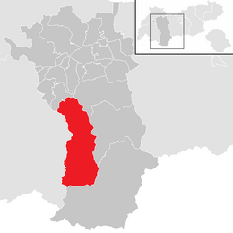
Location in the district
|
||
| Country | Austria | |
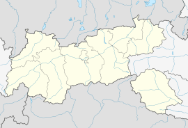
| State | Tyrol | |
| District | Imst | |
| Area | ||
| • Total | 223.53 km2 (86.31 sq mi) | |
| Elevation | 1,366 m (4,482 ft) | |
| Time zone | UTC+1 (CET) | |
| • Summer (DST) | UTC+2 (CEST) | |
| Postal code |
6481
|
|
| Area code | 05413 | |
| Vehicle registration | IM | |
| Website | www.st-leonhard.tirol.gv.at | |
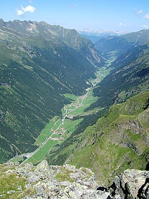
Sankt Leonhard im Pitztal is a village in Austria. It is located in the Imst District in western Austria. The village is about 20 kilometers (12 miles) south of the town of Imst.
Sankt Leonhard is found along the upper part of the Pitze River. It is a very long village, stretching about 25 kilometers (15 miles). This makes it one of the largest communities in Tyrol by land area.
The weather here can be quite cold because of the surrounding mountains. The village was first settled around the year 1300. Today, its main way of making money is through tourism. Many people visit to enjoy the beautiful mountain scenery.
Weather in Sankt Leonhard
Sankt Leonhard im Pitztal has a mountain climate. This means it can get very cold in winter and mild in summer. The weather is affected by its high location in the Alps.
| Climate data for St.Leonhard Pitztal: 1454m (1991−2020) | |||||||||||||
|---|---|---|---|---|---|---|---|---|---|---|---|---|---|
| Month | Jan | Feb | Mar | Apr | May | Jun | Jul | Aug | Sep | Oct | Nov | Dec | Year |
| Record high °C (°F) | 11.7 (53.1) |
13.4 (56.1) |
18.8 (65.8) |
21.6 (70.9) |
25.8 (78.4) |
31.2 (88.2) |
30.3 (86.5) |
29.3 (84.7) |
24.8 (76.6) |
22.3 (72.1) |
19.2 (66.6) |
12.3 (54.1) |
31.2 (88.2) |
| Mean daily maximum °C (°F) | 0.9 (33.6) |
2.7 (36.9) |
6.0 (42.8) |
10.1 (50.2) |
14.3 (57.7) |
18.2 (64.8) |
19.3 (66.7) |
18.8 (65.8) |
15.3 (59.5) |
11.1 (52.0) |
5.5 (41.9) |
1.3 (34.3) |
10.3 (50.5) |
| Daily mean °C (°F) | −4.7 (23.5) |
−3.7 (25.3) |
0.2 (32.4) |
4.0 (39.2) |
8.6 (47.5) |
12.0 (53.6) |
13.8 (56.8) |
13.4 (56.1) |
9.5 (49.1) |
5.5 (41.9) |
0.3 (32.5) |
−3.8 (25.2) |
4.6 (40.3) |
| Mean daily minimum °C (°F) | −9.5 (14.9) |
−10.2 (13.6) |
−5.4 (22.3) |
−1.8 (28.8) |
2.4 (36.3) |
5.8 (42.4) |
7.4 (45.3) |
7.3 (45.1) |
4.0 (39.2) |
0.1 (32.2) |
−4.5 (23.9) |
−8.0 (17.6) |
−1.0 (30.1) |
| Record low °C (°F) | −23.6 (−10.5) |
−28.4 (−19.1) |
−25.2 (−13.4) |
−15.9 (3.4) |
−6.8 (19.8) |
−2.7 (27.1) |
−0.5 (31.1) |
−1.0 (30.2) |
−5.3 (22.5) |
−14.2 (6.4) |
−18.4 (−1.1) |
−22.3 (−8.1) |
−28.4 (−19.1) |
| Source: Central Institute for Meteorology and Geodynamics | |||||||||||||
How Many People Live Here?
The number of people living in Sankt Leonhard im Pitztal has changed over time. In the past, the population was smaller. It has grown steadily in recent decades.
Here is a look at how the population has changed:
| Historical population | ||
|---|---|---|
| Year | Pop. | ±% |
| 1869 | 1,147 | — |
| 1880 | 1,057 | −7.8% |
| 1890 | 1,039 | −1.7% |
| 1900 | 986 | −5.1% |
| 1910 | 1,032 | +4.7% |
| 1923 | 932 | −9.7% |
| 1934 | 983 | +5.5% |
| 1939 | 989 | +0.6% |
| 1951 | 1,042 | +5.4% |
| 1961 | 1,150 | +10.4% |
| 1971 | 1,224 | +6.4% |
| 1981 | 1,299 | +6.1% |
| 1991 | 1,404 | +8.1% |
| 2001 | 1,472 | +4.8% |
| 2011 | 1,463 | −0.6% |
See also
 In Spanish: St. Leonhard im Pitztal para niños
 | Aurelia Browder |
 | Nannie Helen Burroughs |
 | Michelle Alexander |


