Sant Antoni de Portmany (municipality) facts for kids
Quick facts for kids
Sant Antoni de Portmany
|
||
|---|---|---|
|
Town & Municipality
|
||
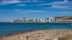
The skyline of Sant Antoni de Portmany
|
||
|
||
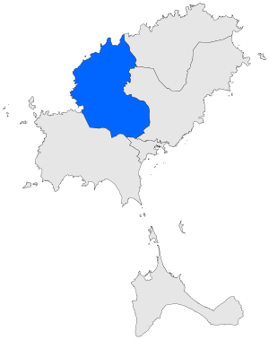
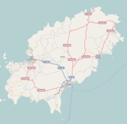
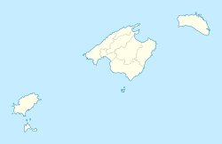
Municipal location
|
||
| Country | ||
| Region | Balearic Islands | |
| Area | ||
| • Total | 48.96 sq mi (126.80 km2) | |
| Population | ||
| • Total | 25,779 | |
| Time zone | UTC+1 (CET) | |
| • Summer (DST) | UTC+2 (CEST) | |
Sant Antoni de Portmany is a town and municipality located on the beautiful island of Ibiza. It's part of the Balearic Islands, which are a group of islands belonging to Spain. This lovely place sits right on Sant Antoni Bay, on the northwest side of Ibiza.
Contents
About Sant Antoni de Portmany
Sant Antoni de Portmany is a popular spot, especially during the summer. It's known for its stunning sunsets and lively atmosphere. The town is a mix of old traditions and modern fun.
Where is Sant Antoni de Portmany?
This municipality is found on the north central coast of Ibiza. It stretches along the Sant Antoni Bay, offering beautiful views of the Mediterranean Sea. Ibiza is one of the larger islands in the Balearic Islands group, which is located off the eastern coast of Spain.
How Many People Live Here?
As of 2018, about 25,779 people live in the municipality of Sant Antoni de Portmany. The population can change a lot during the tourist season when many visitors come to enjoy the sun and sea.
Towns and Villages in the Municipality
The municipality of Sant Antoni de Portmany includes several smaller towns and villages. Each has its own unique charm. Here are some of them:
- Sant Antoni de Portmany (the main town)
- San Rafael de Sa Creu (with a population of 2,047 in 2008)
- Sant Mateu d’Albarca
- Buscastell
- Santa Agnès de Corona
These villages offer a quieter look at island life, often surrounded by nature and traditional farms.
See also
 In Spanish: San Antonio Abad para niños
 | John T. Biggers |
 | Thomas Blackshear |
 | Mark Bradford |
 | Beverly Buchanan |


