
Santa Sofía, Boyacá facts for kids
Quick facts for kids
Santa Sofía
Guatoque
|
|
|---|---|
|
Municipality and town
|
|

Central square of Santa Sofía
|
|

Location of the municipality and town of Santa Sofía in the Boyacá Department of Colombia
|
|
| Country | |
| Department | Boyacá Department |
| Province | Ricaurte Province |
| Founded | 10 January 1810 |
| Founded by | Spanish colonists ordered by Amar y Borbón |
| Area | |
| • Municipality and town | 78 km2 (30 sq mi) |
| • Urban | 18 km2 (7 sq mi) |
| Elevation | 2,387 m (7,831 ft) |
| Population
(2015)
|
|
| • Municipality and town | 2,704 |
| • Density | 34.67/km2 (89.8/sq mi) |
| • Urban | 721 |
| Time zone | UTC-5 (Colombia Standard Time) |
Santa Sofía is a town and municipality in the Boyacá Department of Colombia. It is part of the Ricaurte Province. The town is located high up, about 2,387 metres (7,831 ft) above sea level. This area is known as the Altiplano Cundiboyacense. Some parts of the municipality are even higher, reaching 3,000 metres (9,800 ft). These high areas have a special type of ecosystem called a páramo.
Santa Sofía shares its borders with several other places. To the north is Moniquirá. To the west, it borders Gachantivá and Puente Nacional in the Santander Department. To the southeast, you'll find Villa de Leyva. Sutamarchán is to the south, and Saboyá is to the southwest.
Contents
What's in a Name? The Story of Santa Sofía
Santa Sofía was not always called by its current name. It was first known as Guatoque. This name comes from Muysccubun, the language of the Muisca people. It means "creek of the mountain."
The name changed in 1906. This happened because mail meant for Guateque, another town in Boyacá, kept getting sent to Guatoque by mistake. To avoid confusion, the town was renamed Santa Sofía. This new name honored Sofía Ángulo de Reyes. She was the wife of Rafael Reyes, who was the president of Colombia at that time.
A Look Back: The History of Santa Sofía
Long ago, before the Spanish arrived, the area where Santa Sofía is now was home to the Muisca people. They used this land as a path to travel to the northern parts of their territory, which was called the Muisca Confederation.
An important discovery happened nearby in a place called Sorocotá. In 1537, a Spanish explorer named Gonzalo Jiménez de Quesada and his group found potatoes there for the first time. They also found maize (corn) and beans. The Spanish learned a lot about the local culture and customs from the Muisca people. This information was written down in a book called History of the conquest of the New kingdom of Granada.
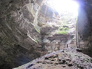
Within the municipality of Santa Sofía, there is a natural hole in the ground called the Hoyo de la Romera. In Muisca times, this sinkhole was a place where women who were considered unfaithful were punished.
Santa Sofía, then still called Guatoque, was officially founded on January 10, 1810. This was done by Spanish colonists. They were following orders from Amar y Borbón. This founding happened just before Colombia declared its independence from the Spanish Empire.
Weather and Climate in Santa Sofía
Santa Sofía has a subtropical highland climate. This type of climate is known for having mild temperatures all year round. It's never too hot or too cold. The climate classification for Santa Sofía is Cfb according to the Köppen climate classification system.
| Climate data for Santa Sofía (Inst Agr Sta Sofia), elevation 2,300 m (7,500 ft), (1981–2010) | |||||||||||||
|---|---|---|---|---|---|---|---|---|---|---|---|---|---|
| Month | Jan | Feb | Mar | Apr | May | Jun | Jul | Aug | Sep | Oct | Nov | Dec | Year |
| Mean daily maximum °C (°F) | 21.9 (71.4) |
22.4 (72.3) |
22.2 (72.0) |
21.9 (71.4) |
21.6 (70.9) |
21.4 (70.5) |
21.1 (70.0) |
21.4 (70.5) |
21.8 (71.2) |
21.6 (70.9) |
21.2 (70.2) |
21.4 (70.5) |
21.6 (70.9) |
| Daily mean °C (°F) | 16.1 (61.0) |
16.3 (61.3) |
16.3 (61.3) |
16.4 (61.5) |
16.4 (61.5) |
16.2 (61.2) |
15.9 (60.6) |
16.1 (61.0) |
16.1 (61.0) |
16.0 (60.8) |
15.9 (60.6) |
15.9 (60.6) |
16.1 (61.0) |
| Mean daily minimum °C (°F) | 10.5 (50.9) |
10.7 (51.3) |
11.2 (52.2) |
11.7 (53.1) |
11.9 (53.4) |
11.6 (52.9) |
11.3 (52.3) |
11.5 (52.7) |
11.3 (52.3) |
11.1 (52.0) |
11.1 (52.0) |
10.9 (51.6) |
11.2 (52.2) |
| Average precipitation mm (inches) | 49.5 (1.95) |
74.2 (2.92) |
109.5 (4.31) |
146.5 (5.77) |
120.9 (4.76) |
69.0 (2.72) |
60.8 (2.39) |
55.7 (2.19) |
86.7 (3.41) |
155.4 (6.12) |
136.1 (5.36) |
81.2 (3.20) |
1,136.3 (44.74) |
| Average precipitation days (≥ 1.0 mm) | 9 | 13 | 17 | 19 | 19 | 14 | 13 | 12 | 15 | 20 | 18 | 13 | 176 |
| Average relative humidity (%) | 73 | 73 | 74 | 76 | 75 | 74 | 73 | 72 | 72 | 75 | 77 | 76 | 74 |
| Source: Instituto de Hidrologia Meteorologia y Estudios Ambientales | |||||||||||||
Economy: How Santa Sofía Makes a Living
The main ways people make money in Santa Sofía are through farming and raising animals. Farmers grow many different crops. Some of the most important ones are curuba, tomatoes, and strawberries. Other crops grown here include potatoes, maize (corn), peas, beans, sugarcane, and yuca.
Tourism: Exploring Santa Sofía's Natural Beauty
Santa Sofía is a rural area, meaning it's mostly countryside. It's a great place for tourists who love nature. From here, you can reach the Guatoque Páramo, which is a unique high-altitude ecosystem. You can also visit the Paso del Ángel. This was an ancient road used by the Muisca people long ago. Around Santa Sofía, there are also many interesting caves and beautiful waterfalls to explore.
Images for kids
-
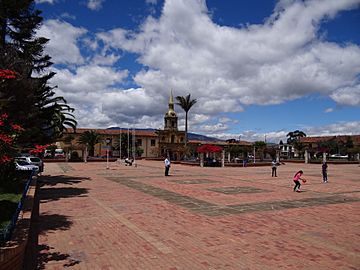
Central square
-
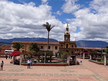
Central square
-
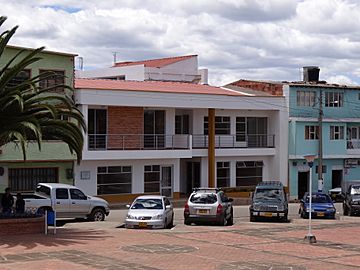
Town council building
-
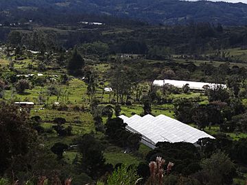
Greenhouses


-
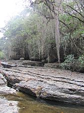
Guatoque creek
-
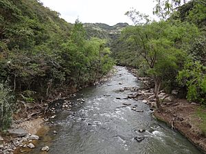
Moniquirá River
-
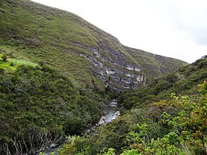
Paso del Ángel
-
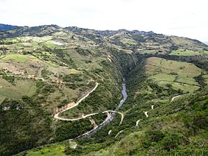
Ancient road, Paso del Ángel
-
Hoyo de la Romera


See also
 In Spanish: Santa Sofía (Boyacá) para niños
