Sarameriza (Peru) facts for kids
Quick facts for kids
Saramiriza
|
|
|---|---|

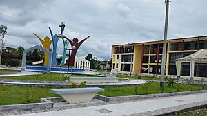
Main square in Saramiriza
|
|
| Country | |
| Department | Loreto |
| Province | Datem del Marañón |
| District | Manseriche |
| Population | |
| • Total | 2,000 |
| Demonym(s) | Saramirizano, -na |
| Time zone | UTC-5 (PET) |
Saramiriza is a small port town in Peru. It is located in the Loreto department. This town is very important because of its special location on the Marañón River. It is the first place where boats can easily travel after a tricky part of the river called the Pongo de Manseriche. From Saramiriza, boats can travel all the way to the Amazon River and then to the city of Iquitos. It is also close to the border with Brazil.
Its Special Location
Saramiriza is known as a fluvial port. This means it is a port on a river, not on the ocean. Its location is very strategic. It sits right after the Pongo de Manseriche, which is a narrow canyon. This canyon makes it hard for boats to pass. Once boats get past the Pongo, Saramiriza is the first safe and easy place to stop. This makes it a key spot for river travel and trade.
An Important Agreement
After a conflict called the Cenepa War in 1995, Peru and Ecuador signed an agreement. This agreement was called the Brasilia Presidential Act. As part of this act, Peru agreed to let Ecuador use two areas for 50 years. One of these areas is in Saramiriza. The other is in a place called Pijuayal.
What is CECONA?
The agreement allowed Ecuador to set up special places called Trade and Navigation Centers. In Spanish, these are known as Centros de Comercio y Navegación, or CECONA for short. The main idea behind CECONA was to give Ecuador a way to reach the Amazon River. This is important because Ecuador does not have its own direct access to the Amazon. Having access helps with trade and transportation for Ecuador.
Why the Protests?
Even though the agreement was signed, the process has been slow. Local tribes living in the area have protested against the plan. They have concerns about how these centers might affect their land and way of life. Their protests have made it harder to fully set up the CECONA centers in Saramiriza.
See also
 In Spanish: Saramiriza para niños
 | Laphonza Butler |
 | Daisy Bates |
 | Elizabeth Piper Ensley |

