Sarben, Nebraska facts for kids
Quick facts for kids
Sarben, Nebraska
|
|
|---|---|

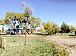
"A Street" in Sarben
|
|
| Country | United States |
| State | Nebraska |
| County | Keith |
| Area | |
| • Total | 0.16 sq mi (0.41 km2) |
| • Land | 0.16 sq mi (0.41 km2) |
| • Water | 0.00 sq mi (0.00 km2) |
| Elevation | 3,005 ft (916 m) |
| Population
(2020)
|
|
| • Total | 31 |
| • Density | 197.45/sq mi (76.34/km2) |
| Time zone | UTC-7 (Central (CST)) |
| • Summer (DST) | UTC-6 (CDT) |
| ZIP Code |
69155
|
| Area code(s) | 308 |
| FIPS code | 31-43560 |
| GNIS feature ID | 2583898 |
Sarben is a small community located in Keith County, Nebraska, in the United States. It is an unincorporated community, meaning it doesn't have its own local government like a city or town. However, it is also a census-designated place, which means the U.S. government counts it as a separate area for population studies. As of the 2010 census, 31 people lived there.
History of Sarben
Sarben began when the Union Pacific Railroad was built through this area. The community got its unique name from the word "Aksarben." If you spell "Aksarben" backwards, it spells "Nebraska," which is the state Sarben is in!
Where is Sarben Located?
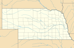
Sarben is in the eastern part of Keith County. It sits in the valley of the North Platte River.
- It is about 5 miles northeast of Paxton by local roads.
- It is about 10 miles west of Sutherland.
- Sarben is also about 25 miles northeast of Ogallala, which is the main town and county seat of Keith County.
According to the U.S. Census Bureau, the Sarben census-designated place covers an area of 0.41 square kilometers (about 0.16 square miles). All of this area is land.
Who Lives in Sarben?
The population of Sarben is counted by the U.S. Census Bureau.
| Historical population | |||
|---|---|---|---|
| Census | Pop. | %± | |
| 2020 | 31 | — | |
| U.S. Decennial Census | |||
See also

- In Spanish: Sarben (Nebraska) para niños
 | Claudette Colvin |
 | Myrlie Evers-Williams |
 | Alberta Odell Jones |


