Paxton, Nebraska facts for kids
Quick facts for kids
Paxton, Nebraska
|
|
|---|---|
|
Village
|
|

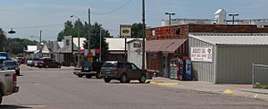
Downtown Paxton
|
|

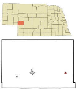
Location of Paxton, Nebraska
|
|
| Country | United States of America |
| State | Nebraska |
| County | Keith |
| Area | |
| • Total | 1.03 sq mi (2.67 km2) |
| • Land | 1.03 sq mi (2.67 km2) |
| • Water | 0.00 sq mi (0.00 km2) |
| Elevation | 3,058 ft (932 m) |
| Population
(2020)
|
|
| • Total | 516 |
| • Density | 500.00/sq mi (193.05/km2) |
| Time zone | UTC-7 (Mountain (MST)) |
| • Summer (DST) | UTC-6 (MDT) |
| ZIP code |
69155
|
| Area code(s) | 308 |
| FIPS code | 31-38610 |
| GNIS feature ID | 2399636 |
Paxton is a small village located in Keith County, Nebraska, in the United States. In 2020, about 516 people lived there. Paxton started as a simple stop along the very first railroad that crossed America.
Contents
History of Paxton
Paxton was first called Alkali. It got its start because of the Transcontinental Railroad being built in the late 1860s. The name "Alkali" came from the soil, which had a lot of alkaline minerals. This small community began as a train stop for the Union Pacific Railroad. It had a telegraph station, a water tower, and a depot.
Early Days and First Settlers
The village's story began with Edwin Searle Sr. He was an 18-year-old telegraph operator who arrived in 1867. Edwin first lived in a tent. He quickly became an important person in the new settlement. His son, Edwin Searle Jr., born in 1873, was the first white child born in Keith County.
Before Alkali became a train stop, there was a small fort nearby called Fort Alkali. This fort protected settlers traveling on the Oregon Trail. Later, it also protected the railroad workers.
From Alkali to Paxton
The area around Alkali started to change in the 1870s. This was after the large buffalo herds were gone and ranching became popular. William A. Paxton, a well-known rancher and businessman from Omaha, bought a lot of land here. Other important people like John Bratt and Morrell Keith also bought land. William A. Paxton was involved in many businesses, from cattle ranching to banking. The village was renamed Paxton in 1885, honoring him.
Growth and Challenges
By the 1880s, there was plenty of rain, which encouraged more people to settle. Pioneers like Ann LeDioyt were among the first to claim land. The Lawler family brought cattle to the area. These early settlers helped create a strong farming community. The village of Paxton officially became a village in 1885. It then started building important things like bridges and a school. More businesses also opened.
The 1890s brought both good times and hard times. There was a serious drought and a tough economic period. But Paxton stayed strong. Its Bank of Paxton was the last bank in Keith County to close during that difficult time. The community also grew culturally. Churches were built, like the Methodist church in 1886 and the Catholic church in 1887. The Globe Hotel, run by the Stafford family, became a popular place for railroad workers and visitors.
Modern Times and Community Spirit
In the early 1900s, Paxton's economy got a boost. The Lincoln Highway, which was the first road to cross the entire United States, passed right through Paxton. The village also got a municipal light plant, bringing electricity. However, the lights initially turned off at 10 p.m., which frustrated some residents!
The 1930s were hard because of the Great Depression and farming problems. But Paxton found ways to adapt. The building of Kingsley Dam and new water systems helped the local economy. The village also became known for Ole's Tavern, which opened in 1933. This business became a lasting and important part of the community.
Today, Paxton remains a small but strong community. Its history shows the determined spirit of the American West. Pioneers, ranchers, and business owners helped turn a simple railroad stop into a lively town.
Geography
Paxton covers a total area of about 1.03 square miles (2.67 square kilometers). All of this area is land.
Population Information
| Historical population | |||
|---|---|---|---|
| Census | Pop. | %± | |
| 1910 | 179 | — | |
| 1920 | 430 | 140.2% | |
| 1930 | 507 | 17.9% | |
| 1940 | 551 | 8.7% | |
| 1950 | 606 | 10.0% | |
| 1960 | 566 | −6.6% | |
| 1970 | 503 | −11.1% | |
| 1980 | 568 | 12.9% | |
| 1990 | 536 | −5.6% | |
| 2000 | 614 | 14.6% | |
| 2010 | 523 | −14.8% | |
| 2020 | 516 | −1.3% | |
| U.S. Decennial Census | |||
2010 Census Details
In 2010, there were 523 people living in Paxton. These people lived in 226 households, and 146 of these were families. The population density was about 507.8 people per square mile (196.1 people per square kilometer). This means how many people live in a certain area.
Most of the people in Paxton were White (98.3%). A small number were Asian (1.0%) or from other backgrounds. About 1.9% of the population identified as Hispanic or Latino.
Out of the 226 households, 28.3% had children under 18 living there. More than half (53.1%) were married couples living together. About 31.4% of all households were made up of single individuals. Around 11.1% of households had someone living alone who was 65 years old or older.
The average age of people in Paxton was 41.9 years old. About 25.8% of residents were under 18. Another 12.8% were 65 years old or older. The village had slightly more males (52.2%) than females (47.8%).
Notable person
- Josh Rouse, a well-known singer-songwriter, is from Paxton.
See also
 In Spanish: Paxton (Nebraska) para niños
 | Georgia Louise Harris Brown |
 | Julian Abele |
 | Norma Merrick Sklarek |
 | William Sidney Pittman |

