Sardis, Ohio facts for kids
Quick facts for kids
Sardis, Ohio
|
|
|---|---|

Methodist church, Monroe and Fifth
|
|

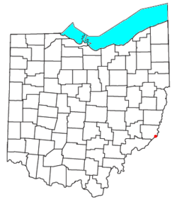
Location of Sardis, Ohio
|
|
| Country | United States |
| State | Ohio |
| County | Monroe |
| Area | |
| • Total | 1.26 sq mi (3.27 km2) |
| • Land | 1.26 sq mi (3.27 km2) |
| • Water | 0.00 sq mi (0.00 km2) |
| Elevation | 1,034 ft (315 m) |
| Population
(2020)
|
|
| • Total | 522 |
| • Density | 413.96/sq mi (159.86/km2) |
| Time zone | UTC-5 (Eastern (EST)) |
| • Summer (DST) | UTC-4 (EDT) |
| ZIP code |
43946
|
| FIPS code | 39-70548 |
| GNIS feature ID | 2628967 |
Sardis is a small community in Ohio, United States. It is located in Monroe County. Sardis is known as a census-designated place (CDP). This means it's an area that the government counts for population statistics. Even though it's not an official city or town, it has its own post office and a ZIP code of 43946. In 2020, about 522 people lived in Sardis.
Contents
Where is Sardis?
Sardis is easy to find on a map. It sits where two main roads meet. These roads are Ohio State Route 7 and Ohio State Route 255. The community is located between two other small places. These are Duffy and Fly.
History of Sardis
Early settlers came to this area a long time ago. One important person was Major Earl Sproat. He was part of the Ohio Company. This company helped start Marietta in 1788. Marietta was the first permanent settlement in the Northwest Territory. Later, in 1843, a man named James Patton planned out the village of Sardis.
Schools in Sardis
Students from Sardis attend schools in a nearby town. They go to River Elementary and River High School. Both schools are located in Hannibal. The Switzerland of Ohio Local School District serves these students. This school district is shared with other communities. These include Antioch, Duffy, Fly, Hannibal, Laings, Powhatan Point, and Clarington.
Land and Area
Sardis covers a small area of land. According to the United States Census Bureau, the total area of Sardis is about 3.2 square kilometers. All of this area is land. There is no water within the boundaries of Sardis.
Population Information
The population of Sardis changes over time. Here's how many people lived there in recent years:
- 2010: 559 people
- 2020: 522 people
See also
 In Spanish: Sardis (Ohio) para niños
 | Claudette Colvin |
 | Myrlie Evers-Williams |
 | Alberta Odell Jones |

