Powhatan Point, Ohio facts for kids
Quick facts for kids
Powhatan Point, Ohio
|
|
|---|---|
|
Village
|
|

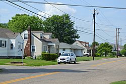
Houses on Main Street
|
|

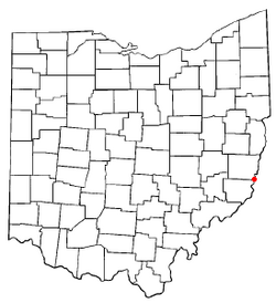
Location of Powhatan Point, Ohio
|
|

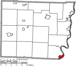
Location of Powhatan Point in Belmont County
|
|
| Country | United States |
| State | Ohio |
| County | Belmont |
| Township | York |
| Area | |
| • Total | 1.63 sq mi (4.23 km2) |
| • Land | 1.47 sq mi (3.81 km2) |
| • Water | 0.16 sq mi (0.42 km2) |
| Elevation | 646 ft (197 m) |
| Population
(2020)
|
|
| • Total | 1,461 |
| • Density | 993.88/sq mi (383.87/km2) |
| Time zone | UTC-5 (Eastern (EST)) |
| • Summer (DST) | UTC-4 (EDT) |
| ZIP code |
43942
|
| Area code(s) | 740 |
| FIPS code | 39-64542 |
| GNIS feature ID | 2399016 |
Powhatan Point is a small village located in southeastern Belmont County, Ohio, in the United States. It sits right along the Ohio River. In 2020, about 1,461 people lived there. It's part of the larger Wheeling metropolitan area.
The name "Powhatan" probably comes from the Native-American tribe. The "Point" part of the name refers to where the Captina Creek flows into the Ohio River. Powhatan Point is the closest town on the Ohio side to Captina Island in the Ohio River.
Contents
History of Powhatan Point
Powhatan Point was officially planned and laid out in 1849. Before that, a post office had already been open in the area since 1828. This means people were living and sending mail there even before the village was formally established.
Geography of Powhatan Point
The village covers a total area of about 1.63 square miles (4.23 square kilometers). Most of this area, about 1.47 square miles (3.81 square kilometers), is land. The rest, about 0.16 square miles (0.42 square kilometers), is water, mainly from the Ohio River and Captina Creek.
Population and People
The number of people living in Powhatan Point has changed over the years. Here's a quick look at the population counts from different years:
| Historical population | |||
|---|---|---|---|
| Census | Pop. | %± | |
| 1880 | 225 | — | |
| 1900 | 470 | — | |
| 1910 | 415 | −11.7% | |
| 1920 | 406 | −2.2% | |
| 1930 | 2,329 | 473.6% | |
| 1940 | 2,054 | −11.8% | |
| 1950 | 2,135 | 3.9% | |
| 1960 | 2,147 | 0.6% | |
| 1970 | 2,167 | 0.9% | |
| 1980 | 2,181 | 0.6% | |
| 1990 | 1,807 | −17.1% | |
| 2000 | 1,744 | −3.5% | |
| 2010 | 1,592 | −8.7% | |
| 2020 | 1,461 | −8.2% | |
| U.S. Decennial Census | |||
What the 2010 Census Showed
In 2010, there were 1,592 people living in Powhatan Point. These people lived in 710 households, and 462 of those were families.
Most of the people in the village were White (98.7%). A small number were African American (0.4%), Native American (0.3%), or Asian (0.1%). About 0.6% of the population identified as two or more races. A very small percentage (0.3%) were of Hispanic or Latino background.
The average age of people in the village was about 43.6 years old.
- About 21.4% of residents were under 18 years old.
- About 8% were between 18 and 24 years old.
- About 22.4% were between 25 and 44 years old.
- About 30.6% were between 45 and 64 years old.
- About 17.5% were 65 years old or older.
Slightly more than half of the residents were female (52.2%), and 47.8% were male.
Local Economy
In the past, the main way people in Powhatan Point earned money was through the coal industry. However, most of the coal mines are no longer active. Today, many residents travel outside the village to find jobs in nearby towns and cities like Moundsville and Wheeling, West Virginia.
Education in Powhatan Point
Powhatan Point has an elementary school that teaches students from kindergarten through 8th grade. After finishing elementary school, most students go to River High School. This high school is located in Hannibal and also serves students from other small villages along the Ohio River, such as Clarington, Sardis, Hannibal, and Cameron.
The village also has a public library. It's a branch of the Belmont County District Library, which means it's part of a larger library system in the county.
See also
 In Spanish: Powhatan Point (Ohio) para niños
 | Isaac Myers |
 | D. Hamilton Jackson |
 | A. Philip Randolph |

