Saxman, Kansas facts for kids
Quick facts for kids
Saxman, Kansas
|
|
|---|---|

|
|
| Country | United States |
| State | Kansas |
| County | Rice |
| Township | Wilson |
| Elevation | 1,631 ft (497 m) |
| Time zone | UTC-6 (CST) |
| • Summer (DST) | UTC-5 (CDT) |
| ZIP code |
66861
|
| Area code | 620 |
| FIPS code | 20-63300 |
| GNIS ID | 475806 |
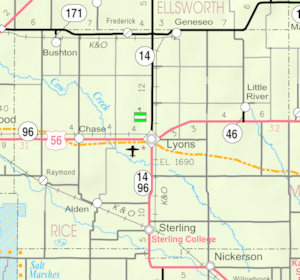
Saxman is a small, unincorporated community located in Rice County, Kansas, United States. This means it's not a city or town with its own local government. It's a collection of homes and farms found along Cow Creek, a small stream. Saxman is situated southeast of the larger town of Lyons.
Contents
A Look Back at Saxman's History
Early Days and Kansas's Growth
For thousands of years, the land where Saxman is now was home to Native American people.
In 1803, the United States gained control of most of what is now Kansas. This happened as part of the Louisiana Purchase, a huge land deal.
Later, in 1854, the area was officially organized as the Kansas Territory. Kansas then became the 34th U.S. state in 1861. Rice County, where Saxman is located, was created in 1867.
Saxman's Post Office
A post office opened in Saxman in 1891. This was an important place for people to send and receive mail. The post office served the community for many years until it closed down in 1952.
Dealing with Flooding
In May 2007, Saxman experienced severe flooding. Cow Creek overflowed its banks, causing a lot of damage. Roads and farms were washed away, and many homes in the community were harmed. Some residents had to leave their homes for safety.
Education in Saxman
Students in the Saxman community attend schools in the Sterling USD 376 public school district. This district provides education for children from the area.
 | Dorothy Vaughan |
 | Charles Henry Turner |
 | Hildrus Poindexter |
 | Henry Cecil McBay |


