Schermer facts for kids
Quick facts for kids
Schermer
|
|||
|---|---|---|---|
|
Former municipality
|
|||

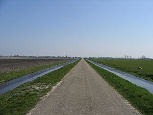
Polder in Schermer
|
|||
|
|||

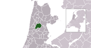
Location in North Holland
|
|||
| Country | Netherlands | ||
| Province | North Holland | ||
| Municipality | Alkmaar | ||
| Area | |||
| • Total | 64.39 km2 (24.86 sq mi) | ||
| • Land | 61.39 km2 (23.70 sq mi) | ||
| • Water | 3.00 km2 (1.16 sq mi) | ||
| Elevation | −3 m (−9.8 ft) | ||
| Population
(May 2014)
|
|||
| • Total | 5,507 | ||
| • Density | 90/km2 (200/sq mi) | ||
| Time zone | UTC+1 (CET) | ||
| • Summer (DST) | UTC+2 (CEST) | ||
| Postcode |
1636, 1840–1847
|
||
| Area code | 072 | ||
Schermer (Dutch pronunciation: [ˈsxɛrmər]) was a municipality in the Netherlands. It was located in the province of North Holland. The name "Schermer" comes from old words meaning "bright lake."
Since 2015, Schermer has been part of the larger municipality of Alkmaar. The area of Schermer included not only the main Schermer polder (land reclaimed from water) but also other polders like Oterleek, Mijzenpolder, and Eilandspolder.
Contents
History of Schermer
From River to Lake
Around the year 800 AD, the area that became Schermer was covered in a spongy, muddy material called peat. A small river, also named Schermer, flowed through this land.
Over time, people started digging up the peat. Also, big storms caused floods. By 1250, the small river had grown into a large inland lake. This lake was openly connected to the Zuyderzee, which was a large sea inlet.
Draining the Lake
In the 1600s, a big project began to drain most of this large lake. Private investors put money into the project. They used windmills to pump the water out, turning the lakebed into dry land.
By 1635, about 47.7 square kilometers (18.4 square miles) of new land, called a polder, had been created. This new land was then divided among the people who had invested money in the project. The southern part of the lake, known as the Alkmaardermeer, was left as a lake.
Modern Changes
In 1970, a village called Zuid- en Noord-Schermer became part of the Schermer municipality. Later, in 2015, the entire municipality of Schermer joined with Alkmaar.
Villages in Schermer
The municipality of Schermer was made up of several small towns and villages. These included:
- Driehuizen
- Grootschermer
- Oterleek
- Schermerhorn
- Stompetoren
- Zuidschermer
The villages of Stompetoren and Zuidschermer are located right in the middle of the Schermer polder.
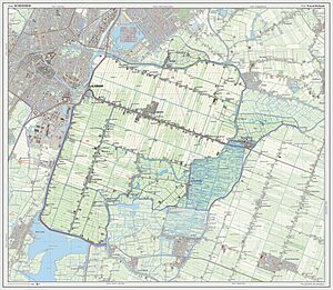
Map of the Area
 | Laphonza Butler |
 | Daisy Bates |
 | Elizabeth Piper Ensley |


