Schmalkalden-Meiningen Rural District facts for kids
Quick facts for kids
Landkreis Schmalkalden-Meiningen
|
|
|---|---|
 |
|
| Country | |
| State | Thuringia |
| Capital | Meiningen |
| Area | |
| • Total | 1,210 km2 (470 sq mi) |
| Population
(2002)
|
|
| • Total | 141,055 |
| • Density | 116.6/km2 (301.9/sq mi) |
| Time zone | UTC+1 (CET) |
| • Summer (DST) | UTC+2 (CEST) |
| Vehicle registration | SM |
| Website | http://www.lk-sm.de |
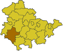
Schmalkalden-Meiningen is a Landkreis, which means a rural district, located in the western part of Thuringia, Germany. It's a region with a rich history and beautiful landscapes.
Contents
A Look at the History of Schmalkalden-Meiningen
This district was formed in 1994. It was created by combining three older areas: the districts of Schmalkalden, Meiningen, and a part of Suhl-Land. This joining helped bring different communities together.
Special Friendships: District Partnerships
The Schmalkalden-Meiningen district has special "partnerships" with other regions. These are like friendships between different places. They work together on projects and learn from each other.
One partnership is with the Vogelsbergkreis in Hesse, another German state. They also have a partnership with Komitat Pest in Hungary. These connections help build bridges between different cultures.
Understanding the Coat of Arms
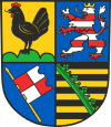
A coat of arms is a special design that represents a family, city, or region. It often tells a story about its history. The coat of arms for Schmalkalden-Meiningen is made up of symbols from its past.
 |
The symbols on the coat of arms come from the three old districts that formed this area. They also represent the historic states that once owned this land.
|
Towns and Villages in the District
The Schmalkalden-Meiningen district is home to many towns and smaller communities. Some of these places are independent towns. Others are part of groups called Verwaltungsgemeinschaften, which are like administrative communities that work together.
Here are some of the towns and municipalities in the district:
| Verwaltungsgemeinschaft-free towns | and municipalities | |
|---|---|---|
|
|
|
| Verwaltungsgemeinschaften (Administrative Communities) | ||
|---|---|---|
|
1. Dolmar
2. Haselgrund
|
3. Hohe Rhön
|
4. Salzbrücke
5. Wasungen-Amt Sand
|
| 1seat of the Verwaltungsgemeinschaft;2town | ||
 | Aaron Henry |
 | T. R. M. Howard |
 | Jesse Jackson |

