Scree Lake facts for kids
Quick facts for kids Scree Lake |
|
|---|---|
| Location | Custer County, Idaho |
| Coordinates | 44°03′42″N 114°35′43″W / 44.06167°N 114.59528°W |
| Type | Glacial |
| Primary outflows | Little Boulder Creek to East Fork Salmon River |
| Basin countries | United States |
| Max. length | 546 m (1,791 ft) |
| Max. width | 330 m (1,080 ft) |
| Surface elevation | 2,820 m (9,250 ft) |
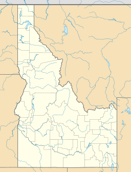
Scree Lake is a beautiful alpine lake found in Custer County, Idaho, United States. It is located high up in the White Cloud Mountains, which are part of the amazing Sawtooth National Recreation Area.
An alpine lake is a lake that is found at a high altitude, usually in the mountains. Scree Lake is quite high up, at an elevation of about 2,820 meters (9,250 feet) above sea level.
Where is Scree Lake Located?
Scree Lake is in a pretty remote area. It sits northeast of a mountain called Merriam Peak.
It is also upstream from Baker Lake and the Noisy Lakes. This means water from Scree Lake flows into these other lakes. It is also downstream from Shallow Lake, meaning water flows from Shallow Lake into Scree Lake.
How Can You Visit Scree Lake?
Even though there are no official hiking trails that lead directly to Scree Lake, you can still reach it! Adventurous hikers can get there by following Sawtooth National Forest trail 047. This trail helps people explore the beautiful nature around the lake.
What Kind of Lake is Scree Lake?
Scree Lake is a glacial lake. This means it was formed a very long time ago by glaciers. Glaciers are huge, slow-moving rivers of ice. As they moved across the land, they carved out hollows and valleys. When the glaciers melted, these hollows filled with water, creating lakes like Scree Lake.
The lake is about 546 meters (1,791 feet) long and 330 meters (1,083 feet) wide. Water flows out of Scree Lake into a stream called Little Boulder Creek. This creek then flows into the East Fork Salmon River.
 | Sharif Bey |
 | Hale Woodruff |
 | Richmond Barthé |
 | Purvis Young |


