Merriam Peak (Idaho) facts for kids
Quick facts for kids Merriam Peak |
|
|---|---|

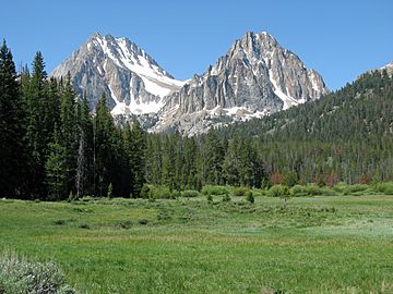
Merriam Peak (right) and Castle Peak (left)
|
|
| Highest point | |
| Elevation | 10,920 ft (3,330 m) |
| Prominence | 520 ft (160 m) |
| Geography | |
| Parent range | White Cloud Mountains |
| Topo map | USGS Boulder Chain Lakes |
| Climbing | |
| Easiest route | Scrambling, class 3 |
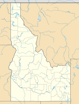
Merriam Peak is a tall mountain in the White Cloud Mountains of Idaho. It stands at about 10,920 feet (3,328 meters) high. This peak is found in Custer County, Idaho, in the western U.S..
Merriam Peak is special because it's named after John H. Merriam. He was very important in helping to protect this beautiful area. He worked to stop mining for a metal called molybdenum here. The peak is in the middle of the White Cloud Mountains. It sits just north of Castle Peak, which is the highest point in the range. This mountain is also part of the White Clouds roadless area. This means it's a wild place without roads, located within the Sawtooth National Recreation Area.
Where is Merriam Peak?
Merriam Peak is located in a special natural area. Its water flows into Little Boulder Creek. This creek then joins the East Fork of the Salmon River. A watershed is an area of land where all the water drains into one main river or lake. So, Merriam Peak is part of the Salmon River's watershed.
Lakes Around the Peak
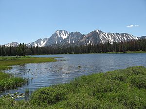
Many beautiful lakes surround Merriam Peak. Castle Lake is right at the mountain's southern base. It helps separate Merriam Peak from Castle Peak. To the east of Merriam Peak, you can find Baker Lake. If you look north and west of the peak, you'll discover Noisy Lake and Quiet Lake. These lakes add to the stunning scenery around the mountain.

 | Precious Adams |
 | Lauren Anderson |
 | Janet Collins |


