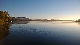
Sept Îles Lake (Saint-Raymond) facts for kids
Quick facts for kids Sept Îles Lake |
|
|---|---|
 |
|
| Location | Saint-Raymond (municipality), Portneuf Regional County Municipality, Capitale-Nationale, Quebec, Canada |
| Coordinates | 46°56′02″N 71°44′48″W / 46.9338°N 71.7466°W |
| Lake type | Naturel |
| Primary inflows | (Clockwise from the mouth) Gosford River, discharge of Lac au Chien and discharge of Lac au Cèdre |
| Primary outflows | Portneuf River |
| Basin countries | Canada |
| Max. length | 4.2 km (2.6 mi) |
| Max. width | 2.2 km (1.4 mi) |
| Max. depth | 37 m (121 ft) |
| Surface elevation | 209 m (686 ft) |
Lac Sept Îles (which means Seven Islands Lake in English) is a beautiful lake in Quebec, Canada. It is sometimes also called Lac aux Sept-Isles. This lake is found in the area of Saint-Raymond, within the Portneuf Regional County Municipality. It is part of the Capitale-Nationale region.
The lake is surrounded by forests and mountains, making it a popular spot. It has many islands and quiet bays. Because it is close to Quebec City and the Duchesnay tourist resort, many people visit or have vacation homes here. A road goes all the way around the lake, making it easy for people to get around. People started vacationing at Sept Îles Lake as early as 1857.
Contents
Geography of Sept Îles Lake
Sept Îles Lake is located about 6 kilometers northeast of the town center of Saint-Raymond. It is also close to other lakes. Sergent Lake is about 2.3 kilometers to the south. Saint-Joseph Lake is about 2.2 kilometers to the southeast.
How the Lake Gets Its Water
Sept Îles Lake gets its water from three main sources:
- From the northwest: The Gosford River flows down from the mountains. It travels about 5.7 kilometers southwest. This river then flows into a narrow bay that leads to Lac des Aulnaies. Lac des Aulnaies is connected to Sept Îles Lake by a bridge.
- From the northeast: Water comes from Lac au Chien through a short channel, about 0.9 kilometers long. Lac au Chien itself gets water from several other lakes. These include Lac à la Perche, Lac du Ventre Rouge, Lac des Roches, Lac Maher, and Lac aux Deux Truites.
- From the southeast: An outlet, about 680 meters long, brings water from Lac au Cèdre into Sept Îles Lake.
Mountains Around the Lake
High mountain peaks surround Sept Îles Lake.
- To the north, the peaks are between 397 and 533 meters high.
- To the southeast, they are between 267 and 381 meters high.
- To the south, they are between 349 and 372 meters high.
- To the west, they are between 254 and 335 meters high.
Where the Water Goes
The lake has several bays, including Vachon Bay in the southeast. The water flows out of the lake from its southwest side. This outflow forms the start of the Portneuf River. The Portneuf River flows southwest until it reaches the town of Portneuf. There, its waters join the mighty St. Lawrence River.
Why It's Called Sept Îles Lake
The name "Lac Sept Îles" is perfect because the lake truly has seven islands! It has three larger islands and four smaller islets. People started building homes around the lake in the years 1857-1858. By 1861, about eleven families lived there.
Over the years, many houses and chalets were built all around the lake. Genois Island is the largest island and cannot be reached by road. It has about twenty homes. The other islands also have some houses. The official name "Lac Sept Îles" was recognized on December 5, 1968, by the Commission de toponymie du Québec.
 | Delilah Pierce |
 | Gordon Parks |
 | Augusta Savage |
 | Charles Ethan Porter |


