Sheep Rock facts for kids
Quick facts for kids Sheep Rock |
|
|---|---|
 |
|
| Highest point | |
| Elevation | 6,847 ft (2,087 m) |
| Geography | |
| Location | Adams County, Idaho, United States |
| Geology | |
| Mountain type | Lava flows of Columbia River Basalt Group |
| Designated: | 1976 |
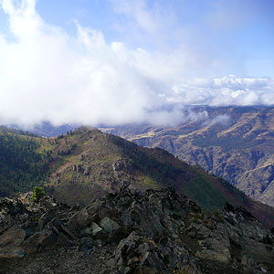
Sheep Rock is an amazing viewpoint in Idaho. It looks out over Hells Canyon, which is one of the deepest river gorges in North America. This special place is found in the Payette National Forest. It is about 45 miles northwest of a town called Council, Idaho.
Sheep Rock was named a National Natural Landmark in 1976. This means it is a very important natural area in the United States. It shows off unique geological features that are worth protecting and studying.
Contents
What Makes Sheep Rock Special?
Sheep Rock is made of two different kinds of rock layers. These layers come from the Columbia River Basalt Group. This group is a huge area of volcanic rock. It formed from ancient lava flows that covered parts of the Pacific Northwest.
Understanding Rock Layers
The two rock layers at Sheep Rock are separated by something called an unconformity. Imagine stacking books on a shelf. An unconformity is like a missing book or a gap in the stack. It shows a time when rock layers were either eroded away or when no new layers were formed for a long time.
At Sheep Rock, you can see this geological gap very clearly. It helps scientists understand the Earth's long history. It also shows how landscapes change over millions of years.
Why is it Called Sheep Rock?
This landmark gets its name from the bighorn sheep. These wild sheep used to live in the area a long time ago. They are known for their large, curved horns. While you might not see them there today, their history is part of the place's name.
Exploring the Area
The Payette National Forest helps people visit and learn about Sheep Rock. There is a special trail that is about one mile long. This trail leads you to a great spot to see Hells Canyon. It's a perfect place to enjoy nature and the amazing views.
Nearby Places to Visit
Close to Sheep Rock, you can find Kinney Point. This was once an old lookout spot. It also offers great views of the canyon. The National Forest Service has an interpretive site here. This means you can learn more about the area's history and nature.

