Ship Creek (Alaska) facts for kids
Quick facts for kids Ship Creek |
|
|---|---|

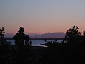
Sunset view of Cook Inlet and Ship Creek, Mount Susitna in background.
|
|

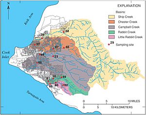
Watersheds of Anchorage rivers, with Ship Creek in yellow
|
|
|
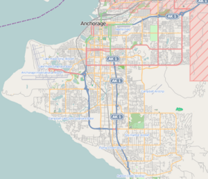
Location of Mouth of Ship Creek
|
|
| Country | United States |
| State | Alaska |
| Municipality | Anchorage |
| Physical characteristics | |
| Main source | Ship Lake Chugach Mountains 2,700 ft (820 m) 61°08′35″N 149°32′28″W / 61.143°N 149.541°W |
| River mouth | Knik Arm, Anchorage 61°13′26″N 149°53′35″W / 61.224°N 149.893°W |
| Length | 25 mi (40 km) |
| Basin features | |
| Basin size | 114 square miles (183 square km) |
| Tributaries |
|
Ship Creek is a river in Alaska that flows from the Chugach Mountains into Cook Inlet. The local Dena'ina people call it Dgheyaytnu. The Port of Anchorage is located at the mouth of Ship Creek. This port gave its name, "Knik Anchorage," to the city of Anchorage that grew up nearby.
The entire river is located within the city limits of Anchorage. Much of its upper part flows through Joint Base Elmendorf-Richardson, which is a military base.
History of Ship Creek and Anchorage
Ship Creek played a big role in the founding of Anchorage. In early 1915, a "tent city" appeared at the mouth of the creek. This was where workers lived who were building the Alaska Railroad. This temporary community soon moved south to higher ground along the creek. This new spot became the early town of Anchorage.
In July 1923, President Warren G. Harding visited the Ship Creek rail station. He was on a tour of Alaska to celebrate the completion of the Alaska Railroad. He also gave speeches in Anchorage during his visit.
Fun Activities at Ship Creek
Ship Creek is a very popular place for fishing. It's known as the only city in the world where you can fish for large Chinook salmon, also called king salmon. Every year, two types of salmon, Coho salmon and Chinook salmon, swim up the creek. The creek often hosts a salmon derby, which is a fishing competition.
Understanding Ship Creek's Water Flow
Ship Creek starts high up in the Chugach Mountains at a place called Ship Lake. The water flows quickly down the mountains over rocks. Then, it moves across a flat area made of sand and gravel from glaciers as it gets closer to Knik Arm. The area that drains into Ship Creek is more than 100 square miles (160 square km). A large part of this area is inside the Joint Base Elmendorf Richardson military base.
The amount of water flowing in Ship Creek has been measured since 1946. On average, between 1946 and 2020, about 262 cubic feet per second (7.4 m3/s) of water flowed through the creek. The lowest amount of water recorded in one day was 56 cubic feet per second (1.6 m3/s) in 1971. The highest amount was 870 cubic feet per second (25 m3/s) in 1960.
The water temperature in Ship Creek changes throughout the year. In winter (December to March), it's around 0 °C (32 °F) (freezing). In July, the water can get as warm as 15 °C (59 °F).
 | Janet Taylor Pickett |
 | Synthia Saint James |
 | Howardena Pindell |
 | Faith Ringgold |


