Shire of Peak Downs facts for kids
Quick facts for kids Shire of Peak DownsQueensland |
|||||||||||||||
|---|---|---|---|---|---|---|---|---|---|---|---|---|---|---|---|

Location within Queensland
|
|||||||||||||||
| Population | 3,188 (2006 census) | ||||||||||||||
| Council seat | Capella | ||||||||||||||
| Region | Central Queensland | ||||||||||||||
 |
|||||||||||||||
| Website | Shire of Peak Downs | ||||||||||||||
|
|||||||||||||||
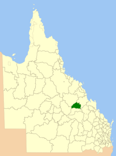
The Shire of Peak Downs was a special area in Queensland, Australia, that had its own local government. It was located in the central part of Queensland, about 320 kilometers west of big cities like Rockhampton and Mackay. On March 15, 2008, the Shire of Peak Downs joined with three other shires (Duaringa, Emerald, and Bauhinia) to form a new, bigger area called the Central Highlands Region.
Contents
History of Peak Downs Shire
The area now known as Peak Downs has a long history. The Yambina people are the traditional owners of this land. Their language is an Australian Aboriginal language from Central Queensland. Their traditional country includes Peak Downs, Logan Creek, and areas stretching to Avon Downs, Denham Range, and Elgin Downs.
How the Shire Was Formed
Local government in Queensland started with "Divisions." On November 11, 1879, the Belyando Division was created. This was one of 74 divisions set up across Queensland.
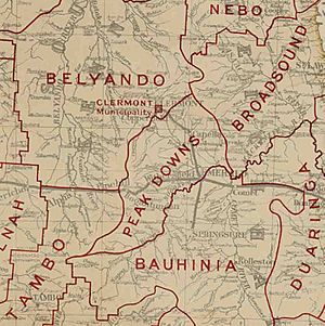
Later, on September 20, 1884, the Peak Downs Division was separated from the southern part of the Belyando Division. This meant it became its own local area. On March 31, 1903, the Peak Downs Division officially became the Shire of Peak Downs.
Shire Offices and Cemetery
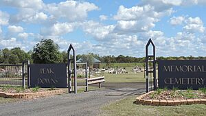
In 1927, the main offices for the Shire of Peak Downs were located in the town of Capella. By 2008, the shire's offices were still in Capella, at 24 Conran Street. The Peak Downs Cemetery, a local burial ground, was also located in Capella.
Towns and Localities
The Shire of Peak Downs included a few important settlements. These were the main places where people lived and worked within the shire.
Main Towns in Peak Downs
The two main towns in the Shire of Peak Downs were:
Economy and Industries
The Shire of Peak Downs had about 4,000 residents. The main ways people made a living in the shire were through coal mining, farming, and raising livestock (grazing).
Coal Mining in the Bowen Basin
The shire was part of the Bowen Basin, which is a very large area rich in coal. Coal mining started in the Peak Downs area in the late 1970s. The Gregory coal mine opened in 1979. After that, the Mount Isa Mines' Oaky Creek coal mine began operating in 1983.
The Oaky Creek mine was so big that a whole new town, Tieri, was built just to house the workers needed for the mine. In the 1990s, three more mines opened: Ensham/Yongala, Crinum, and Gordonstone. Gordonstone was later bought by Rio Tinto and renamed the Kestrel coal mine.
Farming and Agriculture
Peak Downs was also a very important area for farming. The land has rich black soil plains, which are great for growing crops. Many different types of grains were grown here.
Farmers in the shire planted grains like sorghum, wheat, barley, and sunflower. More recently, they also started growing chickpeas.
Leaders of the Shire
The people in charge of the local government in the Shire of Peak Downs were called "Chairmen" and later "Mayors."
Chairmen of Peak Downs
Before 1993, the head of a local government council was known as a Chairman.
- 1927: Percy Charles Allan was the Chairman.
Mayors of Peak Downs
In 1993, a new law called the Local Government Act Number 70 changed the titles. From then on, the head of a local government council was called a Mayor. Other elected representatives were known as councillors.
- 2008: John Brown was the Mayor when the shire joined to form the Central Highlands Region.
 | Bayard Rustin |
 | Jeannette Carter |
 | Jeremiah A. Brown |


