Shumagin Islands facts for kids
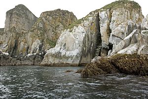
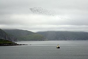
The Shumagin Islands are a group of about 20 islands. They are located south of the main part of Alaska in the United States. These islands are part of the Aleutians East Borough. In the Aleut language, they are called Qagiiĝun.
The total land area of the islands is about 1,192 square kilometers (460 square miles). In the year 2000, about 953 people lived there. Most of these people lived in the city of Sand Point, which is on Popof Island.
Contents
Where Are the Shumagin Islands?
The Shumagin Islands are found in the Pacific Ocean. They are located south of the Alaskan mainland. Their position is between 54°54' and 55°20' North latitude. They are also between 159°15' and 160°45' West longitude.
What Are the Main Islands?
The largest islands in the group are Unga Island, Popof Island, Korovin Island, and Nagai Island. Other islands include Andronica, Big Koniuji, Little Koniuji, Simeonof, Chernabura, and Bird Island.
How Did They Get Their Name?
The Shumagin Islands were named after a sailor named Nikita Shumagin. He was part of an important expedition in 1741. This expedition was led by Vitus Bering and explored North America. Nikita Shumagin sadly died from scurvy during this trip. He was buried on Nagai Island, one of the Shumagin Islands.
See also
 In Spanish: Islas Shumagin para niños
 | Kyle Baker |
 | Joseph Yoakum |
 | Laura Wheeler Waring |
 | Henry Ossawa Tanner |


