
Sierra Bermeja facts for kids
Quick facts for kids Sierra Bermeja |
|
|---|---|

Sierra Bermeja
|
|
| Highest point | |
| Peak | Cerro Mariquita |
| Elevation | 908 ft (277 m) |
| Naming | |
| Etymology | Spanish for vermilion mountain range |
| Geography | |
| Location | Cabo Rojo and Lajas, Puerto Rico |
Sierra Bermeja is a mountain range located in southwestern Puerto Rico. It forms the southern edge of the Lajas Valley and reaches the Caribbean Sea coast near La Parguera. These mountains stretch from the town of Cabo Rojo in the west to Lajas in the east. They are made of very old rocks, possibly the oldest known in Puerto Rico! Long ago, the native Taíno people used these mountains as a safe place from the Spanish. Later, smugglers also used them to hide.
Contents
What is Sierra Bermeja?
The Sierra Bermeja mountains are special because they have a mix of volcanic rocks. These rocks are crossed by unique types of faults called serpentinite and amphibolite. Scientists think these could be the oldest rocks ever found in Puerto Rico. The highest point in this mountain range is called Cerro Mariquita. It is located in the municipality of Cabo Rojo.
Home to Amazing Wildlife
The Sierra Bermeja is a very important home for many animals. Many birds and other creatures that live in the Laguna Cartagena National Wildlife Refuge come here to nest. This area is one of the few forested places in the dry southwestern coastal plain. Because of this, Sierra Bermeja provides everything a lot of wildlife needs to survive. Many of these animals are endangered, meaning they are at risk of disappearing forever.
Interesting Facts and Efforts
In 2015, volunteers searched the area for a meteorite. NASA believed this space rock might have landed in Sierra Bermeja.
Even though it is a very important natural area, new buildings and developments have become a threat. People are working to protect this special place. In June 2018, money was given to universities in Puerto Rico. This money helps them research the Sierra Bermeja region.
There's also some local folklore about the area. Some people say there is a secret UFO base hidden somewhere in the Sierra Bermeja!
Many people are working hard to protect these mountains. The United States Fish and Wildlife Service and local landowners are leading these efforts.
Gallery
-
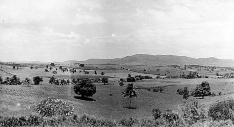
Sierra Bermeja mountain range, 1935

See also
 In Spanish: Sierra Bermeja (Puerto Rico) para niños
