Sierra Madera crater facts for kids

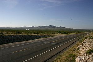
Sierra Madera viewed from US Hwy 385
|
|
| Impact crater/structure | |
|---|---|
| Confidence | Confirmed |
| Diameter | 8 mi (13 km) |
| Age | 100 million years |
| Exposed | Yes |
| Drilled | Yes |
| Location | |
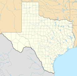
| Location | Pecos County, West Texas |
| Coordinates | 30°36′N 102°55′W / 30.600°N 102.917°W |
| Country | United States |
| Topo map | Sierra Madera |
The Sierra Madera crater is a special place in West Texas. It's a huge bowl-shaped mark left on Earth by a space rock, like a meteorite, that crashed here a long, long time ago. This amazing spot is in Pecos County, Texas, in the United States.
Contents
Discovering the Sierra Madera Crater
A Giant Space Rock Impact
The Sierra Madera crater is what scientists call an "impact crater." This means it was formed when a large object from space, like a meteorite, hit the Earth. It's also known as an "astrobleme," which is another word for an ancient, eroded impact crater.
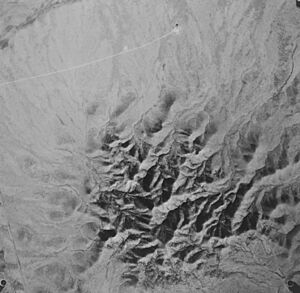
When the space rock hit, it created a huge hole. Then, the ground in the middle bounced back up, forming a tall hill. This hill is called the central peak of the rebound structure. It rises about 793 feet (242 meters) above the land around it.
Where to See It
You can see this central peak from U.S. Highway 385. This road is between the towns of Fort Stockton, Texas and Marathon, Texas. The Sierra Madera crater itself is on private land, part of the La Escalera Ranch.
How Big and How Old?
The crater is very large, about 13 kilometers (8 miles) across. Scientists believe it is less than 100 million years old. This means it formed during a time period called the Cretaceous period, or maybe even more recently.
Astronaut Training Ground
Did you know that astronauts used to train here? Apollo 17 astronauts Gene Cernan and Jack Schmitt visited Sierra Madera. They practiced their geology skills here before going to the Moon. This helped them learn about rocks and landforms they might see in space.


