Sierra de Alhama facts for kids
Quick facts for kids Sierra de Alhama |
|
|---|---|

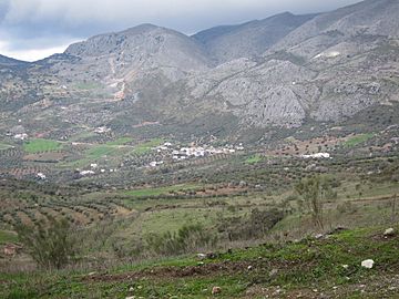
View of the Sierra de Alhama
|
|
| Highest point | |
| Peak | Pico de la Torca |
| Elevation | 1,500 m (4,900 ft) |
| Geography | |
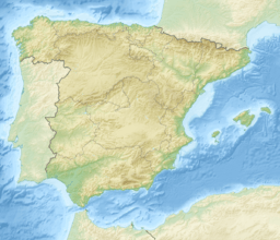
| Location | Málaga and Granada provinces, Andalusia |
| Country | Spain |
| Parent range | Penibaetic System |
| Geology | |
| Orogeny | Alpine orogeny |
| Type of rock | Karstic |
The Sierra de Alhama is a cool mountain range in southern Spain. It's part of a bigger mountain system called the Penibaetic System. You can find it in the Málaga and Granada areas of Andalusia.
The highest point in the Sierra de Alhama is a peak called Pico de la Torca. It stands tall at 1,500 meters (about 4,921 feet) above sea level. Other high points include Hoyo del Toro (1,353 m), Cerro de Marchamonas (1,272 m), and Morrón de la Cuna (1,222 m).
Exploring the Geography of Sierra de Alhama
This mountain range is known for its karstic landscape. This means the rocks, mostly limestone, have been shaped by water over a very long time. It creates cool features like caves, sinkholes, and underground rivers.
The Sierra de Alhama is located in the inner part of a region called Axarquia. To its west, you'll find the Sierra del Jobo and a mountain pass known as Puerto de los Alazores, which is 1,040 meters high. To the east, it connects with the Sierra de Tejeda, with a valley called the corridor of Periana in between.
The Guadalhorce river actually starts its journey right here in the Sierra de Alhama. The range also has an important mountain pass called Boquete de Zafarraya. It's 992 meters high and is a key route through the mountains of Axarquía.
See also
 In Spanish: Sierra de Alhama para niños
- Baetic System
- Geology of the Iberian Peninsula
 | Jessica Watkins |
 | Robert Henry Lawrence Jr. |
 | Mae Jemison |
 | Sian Proctor |
 | Guion Bluford |


