Slanchev Bryag Cove facts for kids
Quick facts for kids Slanchev Bryag Cove |
|
|---|---|

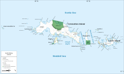
Map of the South Orkney Islands
|
|
| Coordinates | 60°41′30″S 45°17′50″W / 60.69167°S 45.29722°W |
| Max. length | 1.7 kilometres (1.1 mi) |
| Max. width | 2.05 kilometres (1.27 mi) |
Slanchev Bryag Cove (pronounced Slan-chev Bryag) is a bay found in Antarctica. It is located on the south coast of Coronation Island. This island is part of the South Orkney Islands. The cove is about 2.05 kilometers (1.27 miles) wide. It cuts into the land for about 1.7 kilometers (1.06 miles).
The cove has Saunders Point to its east and Tophet Point to its west. Mountains like Mount Sladen and Tophet Bastion rise nearby.
The name "Slanchev Bryag" comes from a Bulgarian fishing ship. This ship was called Slanchev Bryag. It belonged to a company named Ocean Fisheries – Burgas. Their ships fished in the waters around South Georgia, Kerguelen, the South Orkney Islands, South Shetland Islands, and the Antarctic Peninsula. They operated from the 1970s to the early 1990s. Fishermen from Bulgaria, along with those from the Soviet Union, Poland, and East Germany, were important in starting modern Antarctic fishing.
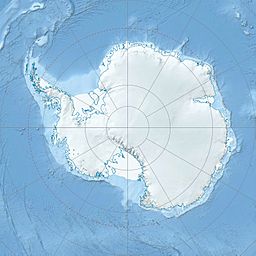
Where is Slanchev Bryag Cove?
Slanchev Bryag Cove is located at 60°41′30″S 45°17′50″W. British maps showed this area in 1963.


