Slickrock Trail facts for kids
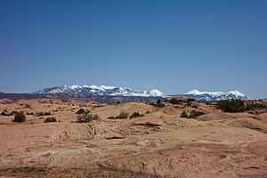
The Slickrock Trail is a super popular place for mountain biking in Utah, United States. It's located near the city of Moab in Grand County. This trail is famous for its unique landscape and challenging rides.
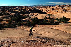
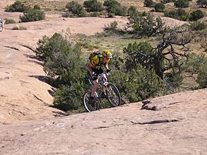
It's about 10.5 miles (17 km) long, but there are also shorter paths you can take. Riders go over ancient sand dunes that have turned into rock over millions of years. They also ride on parts of old sea beds that have been shaped by erosion. Many mountain bikers say the Slickrock Trail is one of the toughest rides in the Moab area. It tests both your riding skills and your fitness!
About the Slickrock Trail
The Slickrock Trail is part of the Sand Flats Recreation Area. This area is looked after by Grand County and the Bureau of Land Management, which is a government agency. The trail was first made in 1969 by Richard R. Wilson. He designed it for small motorcycles, even before mountain bikes were invented! Today, you can still ride motorcycles there.
If you like 4X4 vehicles, there's a challenging trail nearby called Hell's Revenge. It crosses the Slickrock Trail in a few spots.
What is "Slickrock"?
The rock that makes up most of the trail is called "slickrock" sandstone. It feels a lot like sandpaper. This rough surface gives your mountain bike tires amazing grip! However, if you fall, this texture can cause some pretty bad scrapes.
The name "slickrock" was first used by early settlers. They called it that because their horses' metal shoes would slip on the sloping rock surfaces. It's still true today for cyclists who use shoes with metal clips. Also, the slickrock really does become slippery when it gets wet!

In geology, which is the study of rocks, the Slickrock Trail is mostly made of Navajo Sandstone. The word "slickrock" now means any large, flat area of sandstone that's good for walking or riding.
There's a small fee to get into the Sand Flats Recreation Area. You can find restrooms at the start of the trail. But remember, there's no drinking water available, so bring your own!
How to Ride the Trail
You can enjoy the Slickrock Trail by mountain biking, hiking, or motorcycling. All four-wheeled vehicles are not allowed on most of the Slickrock Trail. They can only be on the parts where it crosses the Hell's Revenge 4X4 Trail.
The Slickrock Trail has three main parts:
- A starting path that goes out and back.
- The main loop, which is about 6.8 miles (10.9 km) long.
- An optional practice trail, about 2.3 miles (3.7 km) long.
The practice loop is just as tough as the main trail, but it's shorter. It's a great way for new riders to get a feel for the trail. It can also be used as a different way to start or finish your ride.
Staying on the Path
The paths are marked with white dashed lines painted on the rock. These lines help riders stay on the trail. This prevents people from getting lost or harming the delicate cryptobiotic soil nearby. This special soil is alive and helps the desert plants grow.
Trail workers also use yellow marks. These marks warn riders about steep drop-offs, narrow ledges, and other tricky spots. They help you know where to be extra careful!
 | Valerie Thomas |
 | Frederick McKinley Jones |
 | George Edward Alcorn Jr. |
 | Thomas Mensah |


