Solano, New Mexico facts for kids
Quick facts for kids
Solano, New Mexico
|
|
|---|---|
| Country | United States |
| State | New Mexico |
| County | Harding |
| Elevation | 5,627 ft (1,715 m) |
| Time zone | UTC-7 (Mountain (MST)) |
| • Summer (DST) | UTC-6 (MDT) |
| ZIP codes |
87746
|
| Area code(s) | 575 |
| GNIS feature ID | 894990 |
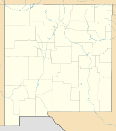
Solano is a small, quiet place in Harding County, New Mexico, in the United States. It's known as an unincorporated community. This means it's a group of homes and businesses that isn't officially a city or town with its own local government.
Solano was started in 1907. It sits along New Mexico State Road 39. You can also find it near the tracks of a Southern Pacific Railroad line. It's located about halfway between the towns of Roy and Mosquero. A post office was opened in Solano in the same year it was founded, 1907.
A Look Back: Solano's History
Solano began its story in 1907. A person named F. M. Hughes built the very first house and a store there. This was the start of the community.
The name "Solano" comes from a local mail carrier. His name was Cipriano Solano. The community was named in his honor.
Solano's Busy Years
For a while, Solano was the biggest community in Harding County. It was a lively place. It even had its own local newspaper. This newspaper was called The Solano Herald.
People in Solano could read about local news and events in their own paper. This showed how important and active the community was.
Changes Over Time
Solano's importance began to fade in the 1950s. This happened when the coal mines in a nearby town called Dawson closed down. Many people moved away from the area after the mines shut.
When the mines closed, there was less need for places like Solano to support the workers. This caused the community to become much smaller and quieter over time.
 | Selma Burke |
 | Pauline Powell Burns |
 | Frederick J. Brown |
 | Robert Blackburn |


