South Arm, Tasmania facts for kids
Quick facts for kids South ArmHobart, Tasmania |
|||||||||||||||
|---|---|---|---|---|---|---|---|---|---|---|---|---|---|---|---|

South Arm from kunanyi / Mount Wellington
|
|||||||||||||||
| Postcode(s) | 7022 | ||||||||||||||
| Location | 32 km (20 mi) SE of Rosny Park | ||||||||||||||
| LGA(s) | Clarence | ||||||||||||||
| Region | Hobart | ||||||||||||||
| State electorate(s) | Franklin | ||||||||||||||
| Federal Division(s) | Franklin | ||||||||||||||
|
|||||||||||||||
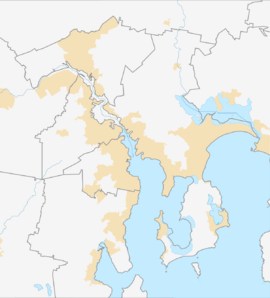
South Arm is a quiet, rural place where people live in Tasmania, Australia. It's part of the City of Clarence area, which is close to the bigger city of Hobart. You can find it on a piece of land called the South Arm Peninsula, about 32 kilometers (20 miles) south-east of Rosny Park. In 2016, about 880 people called South Arm home.
The Story of South Arm
South Arm became an official "locality" in 1967. This means it was formally recognized as a specific place on maps and for local government purposes. A post office opened in South Arm a long time ago, on February 6, 1856. This was an important step for the community, helping people send and receive mail.
Where is South Arm?
South Arm is located on the South Arm Peninsula, which is a piece of land sticking out into the water near Hobart. It has water on three sides!
- The Derwent River forms its western edge.
- To the south, you'll find Storm Bay.
- Most of its northern border is made up by Ralphs Bay.
This location gives South Arm beautiful views and access to the water.
Getting Around South Arm
The main road that helps people get to and from South Arm is called the B33 route, also known as South Arm Road. This road comes into the area from the south-east and then goes all the way through to the north-west, connecting South Arm to other places.
 | Delilah Pierce |
 | Gordon Parks |
 | Augusta Savage |
 | Charles Ethan Porter |


