City of Clarence facts for kids
Quick facts for kids Clarence City CouncilTasmania |
|||||||||||||||
|---|---|---|---|---|---|---|---|---|---|---|---|---|---|---|---|
| Population | 61,531 (2021 census) | ||||||||||||||
| • Density | 162.78/km2 (421.6/sq mi) | ||||||||||||||
| Established | 1 January 1860 | ||||||||||||||
| Area | 378 km2 (145.9 sq mi) | ||||||||||||||
| Mayor | Brendan Blomeley | ||||||||||||||
| Council seat | Rosny Park | ||||||||||||||
| Region | Hobart eastern shore | ||||||||||||||
| State electorate(s) | Franklin | ||||||||||||||
| Federal Division(s) | Franklin | ||||||||||||||
| Website | Clarence City Council | ||||||||||||||
|
|||||||||||||||
The Clarence City Council, also known as the City of Clarence, is a local government area in Tasmania, Australia. It is one of five councils that make up the Greater Hobart Area. The City of Clarence has about 61,531 people living there. It covers the eastern side of the Derwent River. This area stretches from Otago down to the South Arm Peninsula. It also includes smaller towns like Cambridge, Richmond, and Seven Mile Beach.
The main office and shopping area for Clarence is Rosny Park. This is about 5 kilometres from the main city centre of Hobart. Bellerive Oval, a famous sports ground, is just south of Rosny Park. The Hobart International Airport is a bit further north-west, along the Tasman Highway.
Long ago, the land that is now the City of Clarence belonged to the Moomairemener people. They were a group of Aboriginal Tasmanians. In 1803, the British started a colony in Tasmania, then called Van Diemen's Land. They set up Hobart Town. By the 1820s, people had started settling in the 'Clarence Plains' area. For a long time, it was mostly farmland. But in the mid-1900s, many new houses were built. Since then, Clarence has grown quickly into its own self-sufficient city.
Contents
Why is it Called Clarence?
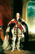
The City of Clarence gets its name from King William IV of the United Kingdom. Before he became king in 1830, he was known as His Royal Highness The Duke of Clarence and St Andrews. The British settlement of Hobart began in 1803, during this time.
Before the British arrived, Captain John Hayes sailed up the Derwent River in 1793. He was on ships called Duke of Clarence and Duchess of Bengal. After a tough journey across the Indian Ocean, Hayes was very happy to reach land. He named the area around Rokeby 'Clarence Plains'. This was to honour his ship, the Duke of Clarence, which had brought them safely to a safe place. The ship itself was named after the future King.
After Hobart was settled in 1803, Hayes' name 'Clarence Plains' became very common. For over 50 years, this was the name for the whole eastern side of the Derwent River. When the area officially became a municipality in 1860, it was called the 'Clarence Municipality'. This name stayed until 1988. That's when Clarence was officially declared a city, and its name changed to the 'City of Clarence'. People who live in Clarence are usually called 'Hobartians', like other people in Greater Hobart. But locally, they are often known as being 'from the eastern shore'.
A Look at Clarence's Past
Ancient Times
It is thought that Aboriginal Tasmanians have lived in Tasmania for at least 35,000 years. Along the coast of Clarence, you can often find Aboriginal middens. These are piles of shells and bones. They show that the people hunted and gathered seafood in the area.
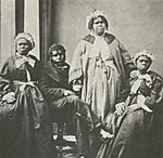
Before the British arrived, there were nine different 'nations' or 'tribes' in Tasmania. The eastern shore was home to the Moomairemener people. We don't know if they were a separate nation or a part of the Oyster Bay Clan. The Oyster Bay Clan's land stretched from the Tasman Peninsula to St Patrick's Head.
The Moomairemener people called the eastern shore of the Derwent 'Nannyelebata'. They loved this area because it had many birds, animals, seafood, and plants. Areas like the Coal River Valley, Flagstaff Gully, and Risdon Vale were important hunting grounds. These areas were used in spring and summer. This led to conflicts with the British settlers very soon after they arrived at Risdon Cove. These conflicts grew into the Black War. This war greatly reduced the number of native Tasmanians. Today, the descendants of these people call themselves 'Palawa'.
First European Settlers
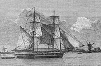
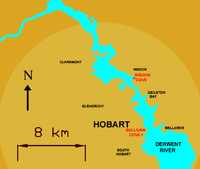
Clarence was where the first Europeans settled in Tasmania in 1803. This happened at Risdon Cove. At that time, France and Great Britain were at war. The Governor of New South Wales, Philip Gidley King, worried that French explorers might claim Tasmania. So, he sent a young officer named John Bowen to start a colony there. Bowen's first ship, Lady Nelson, arrived on September 8, 1803. Bowen himself arrived five days later on the ship Albion.
Bowen chose Risdon Cove because a nearby stream was full of water in spring. But within months, the stream dried up. His camp struggled because they didn't have enough water. The site at Risdon Cove had very unreliable water. It also had dirty water in late summer.
Governor King was not sure about Bowen's lack of experience. So, when David Collins arrived from England, King sent him to the Derwent River. Collins had been sent to start a colony at Port Phillip.
Collins' group arrived at the Derwent River on February 16, 1804. Their ships got stuck in Storm Bay. Collins sent soldiers to row ashore near Rokeby. They were to walk to Bowen's camp at Risdon and announce their arrival. The soldiers found it hard to walk through the thick Australian bushland. But they learned a lot about the area. They arrived just before the ships could sail up the river.
When Collins arrived, he saw that Bowen's camp was in trouble because of the water shortage. He immediately decided to move the colony. They moved it to the mouth of the Hobart Rivulet at Sullivans Cove. This is where the city of Hobart began to grow.
Moving the colony didn't stop people from wanting to settle the eastern shore. In the first few years, growing crops in Hobart Town was difficult. The soldiers' reports from Rokeby to Risdon Vale suggested the plains on the eastern shore were better for farming.
Successful farming on Clarence Plains was very important for Hobart Town to survive. In 1808, new settlers from Norfolk Island arrived. Some were given land in the Derwent Valley. Others received land on Clarence Plains. Soon, beautiful houses, small cottages, inns, and churches were built. But the population on the eastern shore grew much slower than in Hobart Town. By the 1810s, a ferryman regularly crossed the Derwent. He went between Sullivans Cove and 'Kangaroo Point'. This is near where the ferry still arrives at Bellerive Quay. The spot was called Kangaroo Point because many Kangaroos grazed there. By the late 1810s, farmers and pioneers had started settling on the eastern side of the Derwent River.
The 1800s
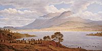
By the early 1820s, a small village grew around Kangaroo Point. This village soon became Bellerive. It was the first lasting settlement in Clarence Plains. Bellerive had a good supply of fresh water from a stream. This stream flowed into Kangaroo Bay. It still exists today as a storm water drain near Rosny Park Public Golf Course.
The next areas settled on the eastern shore were Rosny, and its neighbours Montagu Bay and Lindisfarne. By the late 1820s, private homes were built in these places. They had great views across the Derwent to Hobart Town and Mount Wellington. These three suburbs are named after the large houses built there. Even though private estates and farms appeared, settlements were often far apart. Only Bellerive, Cambridge, Lindisfarne, and Richmond were major towns.
In 1836, Lieutenant-Governor of Van Diemen's Land, George Arthur, divided Tasmania into administrative counties. Clarence Plains became part of Pembrokeshire. Despite this, the Clarence Plains region became its own municipality in 1860. In 1862, Bellerive became the main administrative centre. It also became the centre for the Eastern Police District. But for most of the late 1800s, Clarence Plains didn't grow much. It stayed mostly farmland.
In the 1870s, Hobart's coastal defences were reviewed. A new fortress called Kangaroo Battery was built near Bellerive. This happened between 1880 and 1888. Fruit growing was a successful industry in Clarence Plains. By the 1880s, many successful orchards were in the area. There was also a short-lived railway, the Bellerive-Sorell Railway. It ran from 1892 to 1926. Its station was on a long jetty that is now part of the Bellerive Boardwalk. People hoped it would connect to the main railway line. But building problems and money issues led to it being closed.
The 1900s
At the start of the 1900s, the eastern shore was still mostly small villages and farms. This didn't change for 40 years. Then, on December 22, 1943, the floating bridge called the Hobart Bridge opened.
This bridge was sometimes hard to cross in bad weather. It also had to open for boats, causing delays. But it made it much easier to get to the eastern shore. Demand for houses there quickly went up. By 1947, the population of Clarence Plains reached 5,000.
In the 1950s, after World War II, many new houses were needed. The government started a public housing program. This provided cheap homes for returning soldiers and new workers. Suburbs like Bellerive, Lindisfarne, Montagu Bay, Mornington, Rosny, and Warrane grew a lot. Many houses from this time still show the government's design style. For many parts of the city, electricity supply only arrived in the 1950s. Sealed roads, mains water, and sewage systems started in the 1960s.
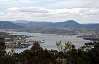
The housing boom on the eastern shore showed that the Hobart Bridge was not good enough. Bad weather made it hard to cross. The huge increase in cars in the 1950s caused bad traffic jams. The traffic problems, delays from opening the bridge for boats, and the toll were very unpopular. The government decided to build a new bridge. It would cost £7 million. In 1960, work began on the Tasman Bridge. It opened on August 18, 1964. This bridge greatly increased how many cars could cross the river. The new bridge also led to two new major highways. The Tasman Highway went east, and the East Derwent Highway went north. This made it much easier to get to and through Clarence.
More and more services opened on the eastern shore. The Metropolitan Transport Trust helped by creating an excellent network of bus routes. In 1963, the Clarence War Memorial Pool was built. In 1965, Eastlands Shopping Centre opened in Rosny Park. It was made bigger in 1971 and 1978. The shopping centre was very successful. It helped drive growth on the eastern shore. By the mid-1970s, the population had passed 40,000. This was an amazing growth rate after the war.
But the late 1900s also saw two terrible disasters in Clarence. Many homes were lost during the famous 1967 Tasmanian fires. A second disaster happened in 1975. The ship Lake Illawarra crashed into the Tasman Bridge. A part of the bridge collapsed in the Tasman Bridge Disaster. This event cut off 'The Eastern Shore' from Hobart for almost three years. But it also led to a lot of new buildings and services on 'The Eastern Shore'. This helped it become mostly self-sufficient. Because of this growth, it was declared a city in 1988.
In the 1970s and 1980s, Clarence continued to expand. Many rural areas became places where people lived. New suburbs appeared, like Flagstaff Gully and Geilston Bay to the north. To the south, new suburbs included Howrah and Rokeby. At the same time, Rosny Park became more important as the city's main centre. The Clarence Council offices, Bellerive Police Station, and Bellerive Post Office all moved there. Banks also moved their branches, and many new shops opened. They joined the successful Eastlands Shopping Centre. Government offices also started opening, like Centrelink and the Australian Taxation Office. The growth was so big that the municipality officially became a city on November 24, 1988. The population had grown to over 50,000. In 1993, the nearby town of Richmond became part of the City of Clarence.
The 2000s
In the early 2000s, Rosny Park kept growing as the city's main hub. Eastlands Shopping Centre and nearby businesses expanded. This led to strong growth in shopping. A movie theatre with many screens also opened in 2003. This meant more local services were available.
The council also launched a plan to improve the Kangaroo Bay area. This plan aimed to make the city centre more modern. It included new buildings, better facilities, a walkway along the waterfront, and nicer landscaping. The plan divides the Kangaroo Bay area into five different parts: Rosny Parklands, Kangaroo Bay East, Ferry Wharf, Bellerive Yacht Club, and 'The Village'.
Where is Clarence?
The City of Clarence is part of Greater Hobart. It is joined by Glenorchy, Hobart, and Kingborough. The city's borders stretch from the South Arm peninsula in the south, next to Ralph's Bay. To the east, it reaches Seven Mile Beach and Pitt Water, next to Frederick Henry Bay. To the north-east, it borders the Municipality of Sorell. To the north, it borders the Southern Midlands and Municipality of Brighton. The city's western border is the Derwent River along its entire length.
Clarence is one of the largest cities in Australia by area. It covers over 386 square kilometres. It has 191 kilometres of coastline, including more than 20 beaches. The most popular beaches are Bellerive Beach, Howrah Beach, Seven Mile Beach, and Clifton Beach. More than a third of the city is untouched bushland. It has many parks and large nature reserves.
The city has many houses mixed with natural flora. This is usually sclerophyll bushland. The city is dominated by the Meehan Range. This is a long, low range of hills that runs next to the river. A special thing about both sides of the Derwent is that houses are only built to a certain height. This keeps the natural look of the hills. There are also large areas of farmland and many vineyards. These are especially in the Coal River valley. Clarence also includes some rural areas, like the South Arm peninsula.
Clarence's Neighbourhoods
There are over 30 neighbourhoods, or suburbs, in the City of Clarence. They are named in different ways. Many are named after the first big house built there. Examples include Bellerive, Lindisfarne, and Rosny. Others are named for natural features, like Flagstaff Gully. Some, like Bellerive and Richmond, started as small villages. Others, like Mornington and Warrane, grew through government housing programs.
Most of the city along the eastern shore is a connected urban area. It is mainly residential. From Cremorne and Rokeby in the south, Clarence continues without a break to Old Beach in the north. Other suburbs, like Acton Park and Cambridge, are separate communities. Most suburbs get their services from central shopping areas. These are mainly in Rosny Park, which is the city's main business district. Other services are still found in older village centres like Bellerive, Howrah, Lindisfarne, and Richmond.
Other Towns and Areas
Weather in Clarence
Clarence is located at 42° South. It has a mild temperate maritime climate. This means it has mild summers and cool winters. The average summer temperature is 21°C. Clarence is generally warmer and gets less rain than Hobart or Glenorchy. The southern parts of the city are known for strong southerly winds. These are called the 'sea breeze', especially in summer. Clarence usually sees sunrise two to three minutes before Hobart and Glenorchy. sunset also happens slightly later than on the western shore. This is because of the shadow cast by Mount Wellington.
| Climate data for Hobart Airport | |||||||||||||
|---|---|---|---|---|---|---|---|---|---|---|---|---|---|
| Month | Jan | Feb | Mar | Apr | May | Jun | Jul | Aug | Sep | Oct | Nov | Dec | Year |
| Mean daily maximum °C (°F) | 22.4 (72.3) |
22.3 (72.1) |
20.7 (69.3) |
18.1 (64.6) |
15.2 (59.4) |
12.9 (55.2) |
12.4 (54.3) |
13.4 (56.1) |
15.3 (59.5) |
17.3 (63.1) |
18.9 (66.0) |
20.6 (69.1) |
17.5 (63.5) |
| Mean daily minimum °C (°F) | 12.0 (53.6) |
12.0 (53.6) |
10.7 (51.3) |
8.7 (47.7) |
6.6 (43.9) |
4.6 (40.3) |
4.1 (39.4) |
4.6 (40.3) |
6.0 (42.8) |
7.5 (45.5) |
9.1 (48.4) |
10.7 (51.3) |
8.0 (46.4) |
| Average precipitation mm (inches) | 41.6 (1.64) |
36.6 (1.44) |
36.1 (1.42) |
43.0 (1.69) |
34.5 (1.36) |
30.1 (1.19) |
44.1 (1.74) |
46.8 (1.84) |
41.2 (1.62) |
47.7 (1.88) |
42.9 (1.69) |
54.2 (2.13) |
498.6 (19.63) |
| Source: Bureau of Meteorology | |||||||||||||
How Clarence is Governed
People living in the City of Clarence are governed by three levels of government in Australia. The Clarence City Council is the local government area in Tasmania. This council is in charge of local services like roads, libraries, and building permits.
Services like education, policing, and health care are handled by the Tasmanian State Government. At the state level, Clarence makes up a big part of the State electoral division called Franklin. The highest level of government is the Australian Commonwealth Government. They are responsible for things like foreign policy, defence, and taxation. Clarence is also a big part of the Federal electoral division of Franklin.
Clarence is seen as an urban, fringe, and medium-sized area by the Australian Classification of Local Governments.
Who is on the Council Now?
The Clarence City Council has been around since January 1, 1860. It is responsible for local government in the city. The council offices were first in Bellerive. But they moved to Rosny Park in the early 1980s. The council uses a mayor-council system. It has twelve aldermen who serve for four years. Elections happen every four years in October. The last election was in 2022.
The current council members are:
| Name | Position | Party affiliation | |
|---|---|---|---|
| Brendan Blomeley | Mayor/Councillor | Liberal | |
| Allison Ritchie | Deputy Mayor/Councillor | Independent | |
| Heather Chong | Councillor | Labor | |
| Jade Darko | Councillor | Greens | |
| Emma Goyne | Councillor | One Nation | |
| Daniel Hulme | Councillor | Labor | |
| Bree Hunter | Councillor | Independent | |
| Tony Mulder | Councillor | Independent | |
| Richard James | Councillor | Independent | |
| Wendy Kennedy | Councillor | Independent | |
| Beth Warren | Councillor | Greens | |
| James Walker | Councillor | Liberal | |
Healthcare Services
Before the Tasman Bridge disaster, there were not many healthcare places in Clarence. There were mostly local doctor's offices. When the bridge collapsed, it cut off the eastern shore. This showed how much local health care services were needed. The Bayfield Healthcare Centre was built. It is now called the Clarence Community Health Centre. This centre became the main healthcare provider for the city. It is not a large hospital, but it has been upgraded to a 'super clinic'.
Schools and Learning
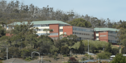
The first school in Clarence Plains was Kangaroo Point School (now Bellerive Primary School) in 1842. But before the Tasman Bridge disaster, there were few schools in Clarence. When the Tasman Bridge collapsed, it isolated the eastern shore. This led to many new facilities being built, including new schools.
Clarence has 13 government primary schools and 6 religious primary schools.
- Government primary schools: Bellerive, Cambridge, Clarendon Vale, Howrah, Lauderdale, Lindisfarne, Lindisfarne North, Montagu Bay, Richmond, Rokeby, South Arm, The Cottage School, and Warrane.
- Religious primary schools: Corpus Christi, Eastside Christian, Emmanuel Christian, John Paul II, St Cuthbert's, and St Johns.
During the time the Tasman Bridge was broken, The Friends' School opened a branch called Sherwood Primary School. This was for younger students on the eastern shore.
There are six High Schools in the City of Clarence: Clarence High School, Emmanuel Christian School, Geilston Bay High School, MacKillop College, Rokeby High School, and Rose Bay High School. The senior secondary college, Rosny College, is also in Clarence. There is also a campus of TAFE Tasmania, which is a Technical and Further Education college.
Clarence's Economy
Even though there is some small-scale manufacturing, agriculture, and viticulture (wine making), the main drivers of the local economy are retail (shops) and government administration. The city's main business area is Rosny Park. Retail is the biggest part of the local economy. Much of this comes from Eastlands Shopping Centre and the shops on Bligh and Bastick Streets nearby.
The main product that Clarence exports now is wine. The city's wine industry is mostly around the Coal River valley, between Richmond and Acton Park. The wines are similar to European styles. This is because Clarence is at a similar latitude to famous wine regions in France and Germany.
Getting Around Clarence
Transportation
Clarence has good bus connections. But many people own private cars. Many residents, especially those who work in Hobart, choose to use public transport for their daily commute.
Clarence is connected to Glenorchy by the Bowen Bridge. It is connected to Hobart by the Tasman Bridge. Both bridges cross the River Derwent. Clarence is connected to Sorell at Midway Point by the historic Sorell Causeway. This causeway was built by convicts in the 1800s. The Sorell Causeway and Tasman Bridge are both part of the Tasman Highway (A3). This is the main east-west road through the city. The East Derwent Highway (B32) also connects to the Tasman Bridge. But it goes north and eventually meets the Midland Highway (A1) at Bridgewater.
Rosny Park Transit Mall is the main hub for Metro Tasmania bus services in the city. Metro Tasmania is the main provider of public transportation in Clarence. Bus routes reach almost all major residential areas. Ferry services run between Bellerive Quay and Sullivans Cove during busy times on weekdays.
Utilities and Services
Most utility services in Tasmania have traditionally been provided by government groups. Mains water is still provided by the Clarence City Council. Their main public water source is Risdon Brook Dam. It's interesting that poor water supply from this source in summer led to the first British camp at Risdon Cove being abandoned. However, during wet months, there is plenty of water. The Risdon Brook Dam provides much of the city's water. This is also helped by pipes that run under the Tasman Bridge. During the Tasman Bridge disaster, many people saw a lot of water gushing from the western side of the broken bridge. This was because these water supply pipes had been cut.
Electricity supply in the City of Clarence is managed by Aurora Energy. They do this for Hydro Tasmania, which is the only electricity provider in the state. 99% of the energy comes from hydroelectricity (power from water). There is no mains gas supply anywhere in the City of Clarence.
Fun and Games in Clarence
Arts and Culture
For many years, the eastern shore of the Derwent River didn't have as many arts and cultural activities as Hobart. To change this, public libraries were opened in Bellerive and Lindisfarne. The old Bellerive Police Station was also turned into a Community Arts Centre.
The council now supports art exhibitions at the historic Rosny Farm property. In 2006, the farmhouse was updated. It now has new spaces for visual arts and performances.
The Clarence City Council has been very good at creating Community Arts events. For many years, the Carols by Candlelight festival has been held every year in Charles Hand Park. It attracts crowds of over 20,000 people. Other yearly events organised by the council include the City of Clarence Australia Day Festival, the Clarence Jazz Festival, and the Clarence Seafarers Festival, which includes the Bellerive Regatta.
Local News
The City of Clarence has few local media services. Instead, it gets media services that cover the whole Greater Hobart area. The most popular newspaper is the daily The Mercury. In 1985, a free weekly newspaper called The Southern Star started. But it couldn't compete with The Mercury and closed in 1995. The Eastern Shore Sun is a free newspaper delivered locally. It shares news and events in the City of Clarence.
Television is provided by five licensed operators. These include the government-funded Australian Broadcasting Corporation and Special Broadcasting Service. Commercial operators are WIN Television and Southern Cross Seven. In 2004, Tasmanian Digital Television was created. It was a joint effort by WIN and Southern Cross to offer digital broadcasting.
Top Sports Teams
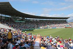
The City of Clarence has a very active sports culture. It is home to Bellerive Oval, one of Australia's nine test cricket grounds. This ground usually hosts Australian home tests every two years. It also hosts one-day internationals every year. It is also the home ground for the Tasmanian Tigers, Tasmania's top-level cricket team.
Bellerive Oval is also home to two of the city's top sports teams. The Clarence District Cricket Club plays in the Tasmanian Grade Cricket competition. The Clarence Football Club, known as 'The Roos', plays in the Tasmanian Football League. Both teams are semi-professional. Both teams also have local rivals within Clarence. For cricket, the Lindisfarne Cricket Club is 3 km north. For Australian Rules football, the Lauderdale Football Club is 7 km south.
Both teams have been very successful. The Clarence Football Club has won the Tasmanian Football League 9 times. They also won the Southern Football League 4 times. The Clarence District Cricket Club has won 11 TCA Premierships.
Other amateur cricket clubs in Clarence include Montagu Bay Cricket Club and Richmond Cricket Club. They play in the Kookaburra Southern Cricket Association.
Olympia FC Warriors (based in Warrane) and Clarence United (based in Howrah) are the city's top football (soccer) teams. They play in the National Premier League. Nelson Eastern Suburbs FC is also in Clarence and plays in the Southern Championship.
Other Sports and Activities
Clarence has excellent public sports facilities. Most popular sports can be played at places like the Clarence Aquatic Centre. This centre hosted the State Swimming Championships until 1998. The Clarence Sports Centre and Wentworth Park are also popular. Wentworth Park is home to Southern Touch (Touch Football) and hockey.
Along with Clarence Sports Centre, Bellerive Sports Centre and Warrane Sports Centre offer facilities for sports like basketball, indoor football, squash, tennis, and badminton. Edgeworth Street in Warrane has a baseball ground. It also has the Eastern Shore Action Indoor Sports Centre, which covers indoor cricket, soccer, and netball. North Warrane Oval is home to Eastern Suburbs, who play in the Tasmanian Rugby Union league.
There is also a very active club sports community for most of these sports. Tennis, golf, and bowls are also popular, especially among older adults. Rosny Park Public Golf Course is a 9-hole golf course in the city centre. There are also seven other golf courses in Clarence, including Tasmania's top club, the Tasmanian Golf Club.
Most local schools take part in sports competitions. These include popular sports like association football (soccer), Australian rules football, cricket, hockey, netball, Touch Football, swimming, and athletics. Many schools have their own sports grounds, and almost all have cricket grounds.
Fun and Outdoors
The city of Clarence has many open spaces, parks, and bushland areas. Besides hills, it has 191 km of shoreline. Much of this has paths, and there are over 30 beaches.
Bellerive Yacht Club is in Kangaroo Bay, on the shore of the Derwent River. It is the second largest sailing club in southern Tasmania. It has over 800 members. The club also hosts the annual Bellerive Regatta every February.
Other water sports and boating activities are also popular. These include sailing, boating, fishing, and diving. The city has eleven boat ramps and many jetties. Cycling is also popular, with several kilometres of cycleways, especially along the shoreline. Horse riding facilities are at Acton. surfing is popular at Clifton and Goats Beaches.
Who Lives in Clarence?
In the 2016 Census, the population of the City of Clarence was almost 55,000. This made it the largest local government area in Greater Hobart. About 10,000 people (18%) were under 15 years old. Around 11,000 people (20%) were over 65. The average age of Clarence residents is 43. About 3.5% of residents said they were Indigenous Australians. 60% of Clarence residents over 15 were married.
The City of Clarence is mainly a residential city. It has 20,737 homes. But there is also some small-scale manufacturing, agriculture, viticulture (wine making), retail (shops), and government administration.
Most homes (17,298) in Clarence are separate detached houses (90%). About 998 homes were attached housing (5%). There were 831 flats (4%). There were also 94 other types of homes. On average, there were 2.5 people per home. Out of 20,737 homes, 1,532 (7%) were empty. 37% of occupied homes were owned outright. Another 37% had a mortgage. 20% were rented. The rest were rent-free or had other arrangements. The average house price in Clarence is A$ 310,000. The average weekly mortgage cost is $243, and the average rent is $150.
The main job sectors are retail (20%), education (12%), health and Community services (12%), property management and business services (5%), and construction and trades (5%). The average weekly income for Clarence residents (August 2006) was $458. This was $60 more than the state average. The average household income was $1,124. This was $92 more than the state average. It was an 8% increase from the 2001 average.
85% of Clarence residents were born in Tasmania. This is similar to the state average of 83%. Of those, 92% identified as being Anglo-Celtic Australian. However, this percentage has gone down by 1.1% since 2001. 91% of residents were Australian citizens, which is the same as the state figure. For those not born in Tasmania, the most common birthplaces were England (1,996 people or 4.0% of total), New Zealand (335, 0.7%), Scotland (288, 0.6%), Germany (228, 0.5%), and the Netherlands (182, 0.4%).
92% of Clarence residents spoke English as their main language. Other languages often spoken in the city were Greek (199 speakers), German (157), Italian (107), Spanish (80), and Dutch (60). 3,155 residents said they regularly spoke various other languages.
The most common religious beliefs among Clarence residents were Anglicanism (16,217, or 21%), Roman Catholic (10,610, or 19%), and Uniting (2,331, or 2%). 9,917 residents (20%) belonged to other faiths. 9,611 (5%) said they had no religion.
 | Victor J. Glover |
 | Yvonne Cagle |
 | Jeanette Epps |
 | Bernard A. Harris Jr. |


