Howrah, Tasmania facts for kids
Quick facts for kids HowrahHobart, Tasmania |
|||||||||||||||
|---|---|---|---|---|---|---|---|---|---|---|---|---|---|---|---|
| Population | 9,545 (2021 census) | ||||||||||||||
| Postcode(s) | 7018 | ||||||||||||||
| Location |
|
||||||||||||||
| LGA(s) | Clarence | ||||||||||||||
| Region | Hobart | ||||||||||||||
| State electorate(s) | Franklin | ||||||||||||||
| Federal Division(s) | Franklin | ||||||||||||||
|
|||||||||||||||
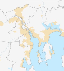
Howrah is a suburb located in the south-east part of Tasmania, Australia. It's part of the City of Clarence, which is like its local council area. Howrah is about 5 kilometers (3 miles) south-east of Rosny Park. In 2021, a count of people called the Census showed that 9,545 people lived in Howrah.
This suburb is found within the City of Clarence. It sits to the east of Bellerive and north of Tranmere.
Howrah is known for being a beachside area. You can enjoy great views of Hobart city across the Derwent River from Howrah Beach. A main road, Clarence Street, goes through the middle of the suburb. It separates the homes on the hills from those closer to the beach.
Howrah has several parks where people can play and relax. One important park is Wentworth Park. It's a popular spot for sports like soccer, field hockey, and touch football on the Eastern Shore.
While Clarence High School is very close and often thought to be in Howrah, it's actually located in Bellerive. Howrah does have its own primary school for younger students. For shopping, Shoreline Plaza is the biggest shopping center in Howrah.
How Howrah Got Its Name
Howrah was named after a large property called Howrah House. This property was started in the 1830s by a retired army officer from India. He named it after a place in India near Calcutta.
In 1945, a woman named Dora Isabel Baudinet passed away. She left her land and money to create the Tasmanian Sunshine Centre in Howrah. This center opened in 1951. It provided holidays for children who were less fortunate until 1980. Howrah officially became a recognized locality in 1963.
Where Howrah Is Located
The River Derwent forms the south-western edge of Howrah. Its waters create a natural border for the suburb.
Getting Around Howrah
A main road, Route B33, also known as the South Arm Highway, runs through Howrah. It goes from the north-west part of the suburb towards the east. This highway helps people travel in and out of Howrah.
 | James Van Der Zee |
 | Alma Thomas |
 | Ellis Wilson |
 | Margaret Taylor-Burroughs |


