South Bowers, Delaware facts for kids
Quick facts for kids
South Bowers, Delaware
|
|
|---|---|

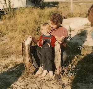
A father and son celebrating the day's catch, South Bowers, DE, in 1976
|
|
| Country | United States |
| State | Delaware |
| County | Kent |
| Elevation | 3 ft (0.9 m) |
| Time zone | UTC-5 (Eastern (EST)) |
| • Summer (DST) | UTC-4 (EDT) |
| Area code(s) | 302 |
| GNIS feature ID | 214676 |
South Bowers is a small, quiet community in Kent County, Delaware, United States. It is called an "unincorporated community" because it does not have its own local government like a city or town.
South Bowers is located right on the edge of the Delaware Bay. It sits on the south side of the Murderkill River, which flows into the bay. Across the river, you can see another community called Bowers.
History of South Bowers
South Bowers was once part of a large farm. This farm belonged to a person named James D. Sipple. The farm was very big, covering 421 acres. It included dry land, marsh areas, and even beachland.
Before James D. Sipple passed away in 1890, he divided a small part of his farm into smaller pieces of land. These pieces became the lots that make up South Bowers today. His son, James H. Sipple, later took over the farm. In 1920, he gave the farm to his daughter, Sarah E. Webb. The Webb family still owns this land today.
Island Field Site
The Island Field Site is an important historical place near South Bowers. It was added to the National Register of Historic Places in 1972. This means it's a special location that the United States government wants to protect because of its historical importance.
 | James B. Knighten |
 | Azellia White |
 | Willa Brown |


