South Fork Flathead River facts for kids
Quick facts for kids South Fork Flathead River |
|
|---|---|

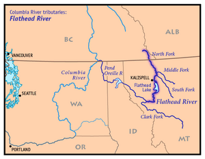
Map of the Flathead River drainage basin showing the South Fork
|
|
| Country | United States |
| State | Montana |
| County | Flathead |
| Physical characteristics | |
| Main source | 47°26′44″N 113°11′01″W / 47.44556°N 113.18361°W |
| River mouth | 3,031 feet (924 m) 48°23′22″N 114°05′18″W / 48.38944°N 114.08833°W |
| Length | 98 miles (158 km) |
| Basin features | |
| River system | Columbia River |
| Basin size | 1,663 sq mi (4,310 km2) |
The South Fork Flathead River is an important river in northwestern Montana, in the United States. It is one of the three main branches of the Flathead River. The Flathead River eventually flows into the Clark Fork River, which is part of the larger Columbia River system.
This river flows mostly north-northwest and is about 98 miles (158 km) long. This makes it the second longest branch of the Flathead River.
Journey of the River
The South Fork Flathead River starts in a wild area called the Bob Marshall Wilderness. This wilderness is located south of Glacier National Park. The river begins where two smaller streams, Danaher Creek and Youngs Creek, meet. This meeting point is nestled between the Flathead Range and the Swan Range mountains.
Flowing Through Nature
For about 40 miles (64 km), the river flows freely. It winds its way through a valley filled with forests and untouched nature. There are no towns or major developments in this part of the river.
As it continues its journey, the river enters a narrow canyon. It flows north through this canyon. After a while, it starts to slow down as it enters the waters of Hungry Horse Reservoir.
Hungry Horse Reservoir
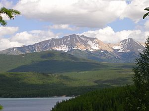
The Hungry Horse Reservoir covers a large part of the lower half of the river. This huge lake covers about 97 square miles (250 km2) of land. The reservoir stretches north and then northwest.
The river then passes through the impressive Hungry Horse Dam. This dam is a few miles before the river joins the main Flathead River.
Final Stretch
After leaving the dam, the South Fork Flathead River enters another narrow canyon. Once it exits this canyon for the last time, it flows northwest. It passes by the town of Hungry Horse.
Finally, the South Fork Flathead River joins the main Flathead River. This meeting point is just a few miles downstream from where the North Fork and Middle Forks of the Flathead River come together.
 | John T. Biggers |
 | Thomas Blackshear |
 | Mark Bradford |
 | Beverly Buchanan |


