South Komelik, Arizona facts for kids
Quick facts for kids
South Komelik, Arizona
|
|
|---|---|

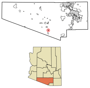
Location of South Komelik in Pima County, Arizona.
|
|
| Country | United States |
| State | Arizona |
| County | Pima |
| Area | |
| • Total | 3.90 sq mi (10.10 km2) |
| • Land | 3.90 sq mi (10.10 km2) |
| • Water | 0.00 sq mi (0.00 km2) |
| Population
(2020)
|
|
| • Total | 176 |
| • Density | 45.13/sq mi (17.42/km2) |
| Time zone | UTC-7 (MST (no DST)) |
| ZIP code |
85634
|
| Area code(s) | 520 |
| FIPS code | 04-68670 |
South Komelik is a small community located in Pima County, Arizona, in the United States. Its name comes from the O'odham people, meaning "South Flat." It is known as a census-designated place (CDP). This means it's an area defined by the government just for counting people, not an official city or town with its own local government.
South Komelik is found in the southern part of the Tohono O'odham Nation reservation. This reservation is the home of the Tohono O'odham people. The community is also quite close to the border with Mexico. In 2020, about 176 people lived there.
Contents
Life in South Komelik
South Komelik is a quiet place with a small number of residents. The community is part of the larger Tohono O'odham Nation, which is a self-governing Native American tribe. Life here is often connected to the traditions and culture of the Tohono O'odham people.
Population and Homes
According to the 2020 census, there were 176 people living in South Komelik. These people lived in about 39 different homes. Around 27 of these homes were families. The area is not very crowded, with about 45 people living in each square mile. There were also about 68 housing units in total.
Money and Income
The average income for a household in South Komelik was about $23,620 per year. The average income for each person in the community was around $12,561. These numbers help us understand the economic situation of the people living there.
Location and Environment
South Komelik is located in a desert area known as the Sonoran Desert. This desert is famous for its unique plants and animals, like the tall Saguaro cactus. The weather here is usually hot and dry for most of the year.
The community's location near the Mexican border means it's in a unique geographical spot. It is also part of a large reservation, which covers a significant area of land in southern Arizona.
See also
 In Spanish: South Komelik para niños
 | Madam C. J. Walker |
 | Janet Emerson Bashen |
 | Annie Turnbo Malone |
 | Maggie L. Walker |


