South Roanoke, Roanoke, Virginia facts for kids
Quick facts for kids
South Roanoke
|
|
|---|---|

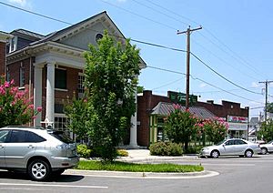
Crystal Springs area of South Roanoke
|
|
| Country | United States |
| State | Virginia |
| City | Roanoke |
| Elevation | 991 ft (302 m) |
| Population
(2000)
|
|
| • Total | 4,857 |
| Time zone | UTC-5 (EST) |
| • Summer (DST) | UTC-4 (EDT) |
| ZIP Codes |
24014
|
| Area code(s) | 540 |
South Roanoke is a neighborhood in Roanoke, Virginia. It is located in the southeast part of the city. The Roanoke River is to its north, and Mill Mountain is to its east. The neighborhood is mainly centered around Crystal Spring Avenue.
South Roanoke shares borders with other neighborhoods. To the south, it meets Southern Hills. To the north, it borders South Jefferson. On the east side, you'll find Mill Mountain, and to the west is Franklin-Colonial.
History of South Roanoke
The area we now call South Roanoke was first settled a long time ago. A person named Daniel Evans moved there in 1750. He settled near a place called Crystal Springs.
Over the years, the land changed owners many times. In the late 1800s, the McClanahan family owned much of the property. They sold it to the Roanoke Gas & Water Company in 1889.
Just one year later, in 1890, a company called the Crystal Spring Land Company started to develop the area. They built factories, homes, and other important buildings. The people living there first wanted South Roanoke to become its own city. However, in 1915, the area officially became part of Roanoke City. This process is called being "annexed."
Today, South Roanoke has some interesting places to visit. One is the Crystal Spring Steam Pumping Station. This old building is so important that it is listed on the National Register of Historic Places. There is also the Crystal Springs entertainment district, which is a fun area.
 | William L. Dawson |
 | W. E. B. Du Bois |
 | Harry Belafonte |

