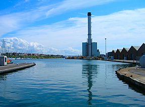
Southwick Ship Canal facts for kids
The Southwick Ship Canal, also known as the Southwick Canal, is a waterway in Southwick, West Sussex. It connects to the estuary of the River Adur near Hove. This canal is about 1.75 miles long. It runs east to west, right next to the coast. It helps ships get to the port of Shoreham.
Interestingly, this canal used to be part of the River Adur itself. The river's mouth was moved further west. This allowed the old riverbed to be used for the canal.
Contents
A Look Back: The Canal's Story
Shoreham, Southwick, and Portslade are towns on the West Sussex coast. The River Adur flows from the north and turns east near Shoreham. It then reaches the English Channel. This area has always been important for shipping.
Early Days: Roman and Saxon Times
Long ago, in Roman times, there were ports at Old Shoreham and Beeding. These were on the lower part of the River Adur. A road from London to the port passed through a place called Portus Ladus. This name eventually became Portslade.
Southwick got its name from the Saxons. They landed at the river's mouth. Later, in Norman times, the port was busy. It imported wine and exported wool. King John landed here in 1199. It even became a Royal Arsenal.
Building Ships for Kings
A shipbuilding industry grew in Shoreham. In 1346, Shoreham provided 26 ships to King Edward III. These ships were used in his wars with the French.
Creating the Canal: A New River Mouth
The original river mouth was not great for ships. There was a lot of shingle (small stones) that moved with the tides. In 1760, people started planning a new river entrance.
A new channel was dug through the shingle bank in 1816. This is where the river mouth is today. This left about 1.75 miles of the old river channel. This old channel was turned into a harbor. A lock was built near where the dry dock is now. This channel became the Southwick Ship Canal. Ships first used it in 1855.
Busy Times: Coal and Power
A gas works was built between the canal and the sea in 1870. A power station was built in 1897. Both needed coal. The coal arrived on the canal and was unloaded at the wharfs.
Making the Canal Better
Several improvements were made to the canal over the years.
- The canal bed was dredged to make it deeper.
- A new lock, called the Prince George Lock, was finished in 1933. This lock is 170.5 feet long and 18 feet wide. It can fit ships with a depth of 18 feet.
In 1944, the port was used for D-Day landings. Troops left from here to go to France. Trade grew even more when a second coal-fired power station opened in 1953.
New Locks and Modern Use
The entrance from the sea was improved in 1957. East and west breakwaters were added. In 1958, Prince Philip, Duke of Edinburgh opened another lock. This lock is named after him. It is much bigger than the Prince George Lock. It is 374 feet long and 57 feet wide. It can handle ships with a depth of up to 22 feet.
The larger lock is mainly used by big commercial ships. The smaller Prince George Lock is used by fishing boats and yachts. There was less ship traffic after 1987. That's when the old power station was shut down. But a new power station was completed in 2000, bringing new activity to the canal.
 | Kyle Baker |
 | Joseph Yoakum |
 | Laura Wheeler Waring |
 | Henry Ossawa Tanner |


