Special Areas Board facts for kids
Quick facts for kids
Special Areas Board
|
|
|---|---|

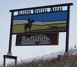
Boundary sign
|
|
|
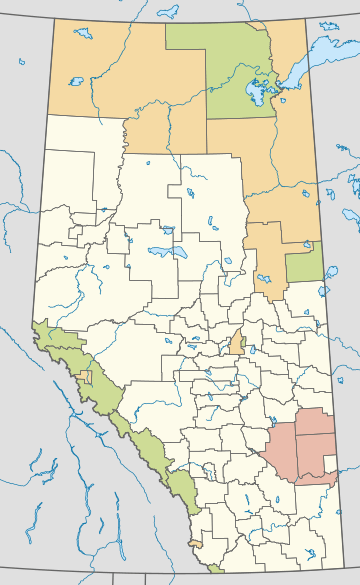
Distribution of Alberta's three special areas
|
|
| Country | Canada |
| Province | Alberta |
| Regions | Central and Southern Alberta |
| Census division | No. 4 |
| Special Areas Act | 1938 |
| Area
(2016)
|
|
| • Land | 20,375.79 km2 (7,867.14 sq mi) |
| Population
(2016)
|
|
| • Total | 4,184 |
| • Density | 0.21/km2 (0.5/sq mi) |
| Time zone | UTC-7 (MST) |
| • Summer (DST) | UTC-6 (MDT) |
| Website | Special Areas Board |
The Special Areas Board is like the local government for certain rural parts of Alberta, Canada. These areas are called "special areas" because they are managed a bit differently from other towns or counties. Instead of having a fully elected council, their local decisions are guided by a board of four people chosen by the province of Alberta. This board works closely with the Alberta Municipal Affairs department.
These three special areas were created way back in 1938. This happened because a big drought in the 1930s, during the Great Depression, made life very hard for people living in southeastern Alberta. The Special Areas Board was set up to help these communities manage their land and resources better during tough times.
The special areas are located in southeast Alberta within Census Division 4.
How Special Areas Started
The Special Areas Board was created in 1938. This was a time when many people in Alberta were struggling. A long period of dry weather, called a drought, made farming very difficult. This happened during the Great Depression, a time when many people lost their jobs and money.
To help the communities most affected, especially in southeastern Alberta, the government passed the Special Areas Act. This law created six "special areas" to begin with. They were called Tilley East, Berry Creek, Sullivan Lake, Sounding Creek, Neutral Hills, and Bow West.
Changes Over Time
Over the years, these special areas changed. In 1939, the six areas were combined into four larger ones. Then, in 1959, they were renamed and reorganized into the three special areas we have today: Special Area No. 2, Special Area No. 3, and Special Area No. 4.
The original six areas covered a huge amount of land, about 3.2 million hectares. The three special areas today are still very large, covering about 2.1 million hectares.
- Tilley East Special Area, No. 1: This area was later split up. Part of it became part of Special Area No. 2. The rest is now part of Cypress County.
- Berry Creek-Sullivan Lake Special Area, No. 2: This area also changed. Some parts were added to Special Area No. 3, and some parts from Tilley East were added to it. It was officially renamed Special Area No. 2 in 1959.
- Sounding Creek-Neutral Hills Special Area, No. 3: This area grew when parts of Berry Creek-Sullivan Lake were added to it. It was renamed Special Area No. 3 in 1959. Later, in 1969, its northern part became Special Area No. 4.
- Bow West Special Area, No. 4: This area no longer exists as a special area. It is now part of Vulcan County and the Municipal District of Taber.
The Special Areas Today
Today, Alberta has three special areas. In 2016, a total of 4,184 people lived in these areas combined.
| Special area | Incorporation date (special area) |
Population (2016) |
Population (2011) |
Change (%) | Area (km2) | Population density (/km2) |
|---|---|---|---|---|---|---|
| Special Area No. 2 | April 7, 1959 | 1,905 | 2,025 | -5.9 | 9,347.57 | 0.20 |
| Special Area No. 3 | April 7, 1959 | 1,042 | 1,122 | -7.1 | 6,625.58 | 0.16 |
| Special Area No. 4 | January 1, 1969 | 1,237 | 1,352 | -8.5 | 4,402.64 | 0.28 |
| Total special areas | — | 4,184 | 4,499 | -7.0 | 20,375.79 | 0.21 |
 | Aaron Henry |
 | T. R. M. Howard |
 | Jesse Jackson |


