Spitlers Edge facts for kids
Quick facts for kids Spitlers Edge |
|
|---|---|
| Highest point | |
| Elevation | 1,286 feet (392 m) |
| Geography | |
| Location | Anglezarke Moor, Chorley, Lancashire, England |
| Parent range | West Pennine Moors |
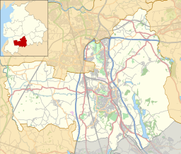
Spitlers Edge is a long, high ridge located in Anglezarke Moor, near Chorley in Lancashire, England. It stretches from Standing Stones Hill to Hordern Stoops. This ridge is the highest point of the moorland, reaching about 1,286 feet (392 m) (392 meters) above sea level. You can find a stone cairn, which is a pile of stones, at its very top.
Contents
Exploring Spitlers Edge
Spitlers Edge is like a natural pathway running along the eastern side of Anglezarke Moor. It connects to another path called Redmonds Edge, which leads to Great Hill. Part of Redmonds Edge is already paved, making it easier to walk on.
There are plans to make Spitlers Edge even more accessible. Money has been set aside by the Lancashire Environmental Fund and United Utilities to pave the entire length of the ridge. This will help protect the moorland and make it easier for people to explore.
A Wall with a Story
Along Spitlers Edge, you will see an old stone wall. This wall is very important because of its history. It was built in 1841 to help people who were struggling during a difficult time known as the "Hungry Forties." This was a period when many people in Europe, including England, faced hardship due to a widespread potato crop failure. Building the wall provided much-needed work and income for families.
This wall also marks an important boundary. It divides the parliamentary areas of Chorley and Blackburn. This means it shows where one political district ends and another begins.
How Spitlers Edge Got Its Name
The name "Spitlers Edge" has a long history, going back to the Middle Ages. In those times, a group of knights known as the Knights Hospitallers of St. John of Jerusalem used this route. They were a religious and military order who cared for pilgrims and the sick. They traveled along this ridge when visiting their lands and properties in the area. The name "Spitlers" likely comes from "Hospitallers."
Source of the River Yarrow
Spitlers Edge is also important for local water. The peaks and high points along this ridge collect rainwater. This water then flows down and forms the very beginning of the River Yarrow. So, this ridge plays a key role in the natural water cycle of the region.


