Chorley facts for kids
Quick facts for kids Chorley |
|
|---|---|
| Town | |
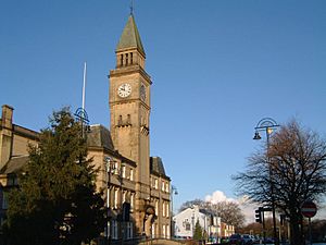
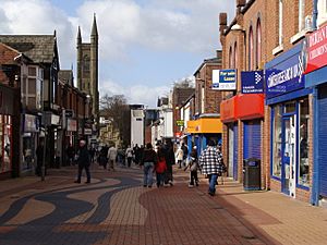
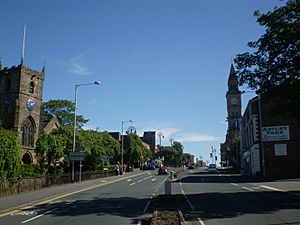 Entering Chorley town centre |
|
| Population | 36,682 (2020) |
| Demonym | Chorlean |
| OS grid reference | SD5817 |
| District |
|
| Shire county | |
| Region | |
| Country | England |
| Sovereign state | United Kingdom |
| Post town | CHORLEY |
| Postcode district | PR6, PR7 |
| Dialling code | 01257 |
| Police | Lancashire |
| Fire | Lancashire |
| Ambulance | North West |
| EU Parliament | North West England |
| UK Parliament |
|
Chorley is a town in Lancashire, England. It's the main town of the wider Borough of Chorley. The town is about 8 kilometres (5 miles) north of Wigan and 19 kilometres (12 miles) south of Preston.
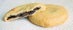
For a long time, Chorley was famous for its cotton factories. In the 1970s, you could see many tall factory chimneys in the sky. Most of these are gone now, but some old buildings and streets of workers' houses still remind us of the past. Chorley is also the home of the delicious Chorley cake.
Contents
Chorley's Story
What's in a Name?
The name Chorley comes from two old Anglo-Saxon words. Ċeorl means a "peasant" or a "freeman," and lēah means a "clearing in a woodland." So, Chorley probably means "the peasants' clearing."
Ancient Times
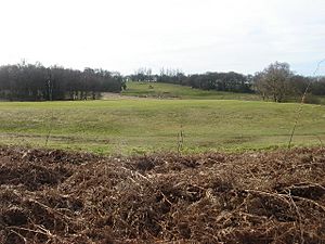
People have lived around Chorley since at least the Bronze Age, which was thousands of years ago. On nearby Anglezarke Moor, you can find old remains like the Round Loaf, a burial mound from around 3500 BC.
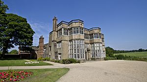
In 1963, a special pot used for burials was found near Astley Hall. Later, more burial pots and cremation pits from the Bronze Age were discovered there.
Roman Times
During the time of the Romans in Britain, a Roman road passed close to Chorley. This road connected Wigan and Walton-le-Dale. Roman treasures have also been found nearby.
Medieval Period
Chorley wasn't mentioned in the famous Domesday Book of 1086. It first appeared in records in the mid-1200s. Around 1250, a powerful Earl named William de Ferrers made Chorley a small town with houses along what is now Market Street.
However, this early town didn't last long. It might have been attacked by the Scots in 1322. After this, a strong tower called a Peel tower was built for protection near Duxbury Hall.
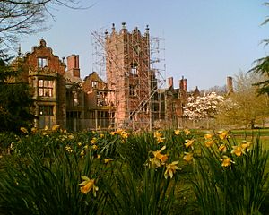
During this time, Chorley didn't have one main lord, so different families owned parts of it. There were several manor houses, like Chorley Hall, built in the 1300s. It's believed that the old Chorley Hall was where The Parish of St Laurence Church of England Primary School is today.
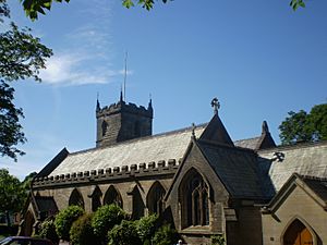
St Laurence's Church is the oldest building still standing in Chorley. It was officially opened in 1362, but there might have been an even older church there before. The church is named after Saint Laurence, whose bones were brought to the church a long time ago.
In 1498, King Henry VII gave Chorley the right to hold a market every Tuesday.
From the 1800s to Today
Like many towns in Lancashire, Chorley grew rich during the Industrial Revolution in the 1800s. It became an important cotton town with many mills. Most of these mills were taken down between the 1950s and 2000s. The last mill to make textiles closed in 2009.
Chorley was also important for coal mining because it was near the Lancashire Coalfield. Many coal mines were in the area, especially in Coppull. The last mine nearby, Ellerbeck Colliery, closed in 1987.
During the Second World War, Chorley played a big part. A large factory that made weapons, called the Royal Ordnance Factory, was in Euxton, close to the town.
Places of Worship
St Laurence's Church has been a place of Christian worship for over 800 years. Another important church is St George's, built in 1822.
St Mary's Roman Catholic Church is in the town centre. It was first built in 1853 and can hold 750 people.
Chorley United Reformed Church is one of the oldest and largest of its kind in the North West. It started in 1792. This church is also home to the town's oldest Scout Troop, which began in 1919.
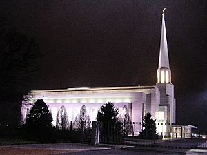
In the north of Chorley, there is a large park with a meeting house and a temple of the Church of Jesus Christ of Latter-day Saints. This temple, called the Preston England Temple, is the biggest of its kind in Europe and is seen as a local landmark. It was finished in 1998.
Chorley also has two mosques. The first one opened in 2006, and a second one opened in 2020.
How Chorley is Governed
In 1837, Chorley joined with other local areas to manage support for people in need, under something called the Poor Law Union.
Chorley became a municipal borough in 1881, which meant it had its own local government with a mayor and councillors.
Today, Chorley is part of the Borough of Chorley. This larger area has 42 councillors who represent different parts of the town.
The Member of Parliament (MP) for Chorley since 1997 is Lindsay Hoyle. He is also the Speaker of the House of Commons, which is a very important job in the UK government.
Chorley's Location
The main river in Chorley is the Yarrow. Another small river, the River Chor, runs through Astley Park. Chorley is at the bottom of the West Pennine Moors, and a small hill called Healey Nab overlooks the town.
In 2001, Chorley had about 33,424 people. The wider Borough of Chorley had over 100,000 people. Chorley is part of a larger built-up area that includes Preston and Leyland.
 |
Euxton | Preston | Blackburn |  |
| Leyland | Darwen | |||
| Dalton | Wigan | Adlington |
What Chorley Makes and Does
The first industries in Chorley were mining, and you can still see old quarries on the edge of town. Later, cotton mills became very important.
Chorley also used to make trucks, including military vehicles and tanks during the Second World War. This factory closed in 2008.
Over the years, Chorley has lost many of its old manufacturing jobs in coal, textiles, and vehicle making. However, companies like Leyland Trucks and BAE Systems are still big employers nearby.
Other companies in the area include Telent, FedEx, and DXC Technology.
In 2011, Chorley Council started a plan called Choose Chorley to encourage businesses to move to the town. They offer help and support to companies that want to grow there.
Chorley is famous for the Chorley cake, a flat, round fruit cake. Every October, there's a Chorley Cake Street Fair where local bakers compete to make the biggest Chorley cake!
Hospitals and Health
Chorley has a local NHS hospital called Chorley and South Ribble Hospital. There's also a private hospital in Euxton. The town used to have other hospitals, but they closed in the 1990s.
Getting Around Chorley
Roads
The A6 Roman road goes right through Chorley town centre. The town is also close to the M61 motorway and the M6.
Buses
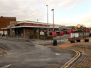
Chorley's bus station, called Chorley Interchange, opened in 2003. Buses connect Chorley to places like Bolton, Blackburn, Preston, and Wigan.
Trains
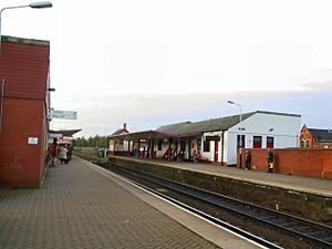
Chorley railway station has trains that go to Bolton, Preston, Blackpool, Manchester Piccadilly, and Manchester Airport.
Other train stations in the area include Euxton, Adlington, Buckshaw Village, and Croston.
Canals
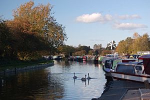
The Leeds and Liverpool Canal runs alongside Chorley. You can find several marinas and locks (water lifts for boats) in the area.
Schools and Learning
Chorley has many primary schools. The town also has six high schools:
- Holy Cross Catholic High School
- Albany Academy
- Bishop Rawstorne CE Academy
- Parklands High School
- Southlands High School
- St. Michael's CE High School
Many students from Chorley go on to Runshaw College in Leyland for further education.
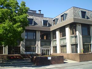
Lancashire College, located in Chorley, offers many courses for adults. The building that is now Chorley Public Library used to be Chorley Training College, which trained teachers.
Sports and Fun
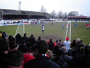
Chorley is home to the semi-professional football team, Chorley F.C., also known as the Magpies. They were founded as a rugby team in 1875 but switched to football eight years later. They became famous for reaching the 4th round of the FA Cup in 2021.
Chorley has several cricket clubs. Chorley Cricket Club has won national trophies.
The town also has the Chorley Buccaneers American Football Club. They have won three National Championship titles.
Chorley RUFC is the town's rugby union club, started in the 1970s.
Chorley has been home to famous track cyclists like Olympic gold medal winners Jason Queally and Bradley Wiggins. Paralympic medal winners Rik Waddon and Natalie Jones are also from Chorley.
The town's leisure centre has a swimming pool, sports hall, and squash courts. There are also other gyms and pools in the area.
Duxbury Park has a public golf course.
Chorley has many amateur sports teams for football, rugby, and cricket. You can also find public football pitches, bowling greens, and tennis courts.
News and Entertainment
Chorley has two local newspapers: The weekly Lancashire Evening Post and the free Chorley Citizen.
Local TV news comes from BBC North West and ITV Granada.
You can listen to local radio stations like BBC Radio Lancashire and Central Radio North West.
The British comedy show Phoenix Nights featured a fictional radio station called Chorley FM, with the funny slogan "Coming in your ears." This station later became a real community radio station.
Several famous actors and comedians are from Chorley, including Joseph Gilgun (from Brassic) and Steve Pemberton (from The League of Gentlemen).
Fun Places to Visit
| Key | |
| Owned by the National Trust | |
| Owned by English Heritage | |
| Owned by the Forestry Commission | |
| A Country Park | |
| An Accessible open space | |
| Museum (free) | |
| Museum (charges entry fee) | |
| Heritage railway | |
| Historic House | |
- Astley Park and Astley Hall

- Bank Hall

- Preston England Temple

- Duxbury Park and Golf Course

- White Coppice & Great Hill

- Heskin Hall

- Healey Nab

- Leeds & Liverpool Canal

- Rivington Pike


- Winter Hill

- Worden Park


- Yarrow Valley Country Park


Partner Towns
Chorley is twinned with:
- Székesfehérvár, Hungary (since 1992)
- Lanzhou, China (since 2019)
Famous People from Chorley
- Loui Batley (born 1987), actress and dancer
- Bill Beaumont (born 1952), former England rugby captain
- Walter Berg (born 1947), astrologer
- Blackhaine (experimental rapper)
- Leonora Carrington (1917–2011), painter
- Phil Cool (born 1948), comedian
- C. D. Darlington (1903–1981), biologist
- Derek Draper (born 1967), former political advisor
- Simon Farnworth (born 1963), footballer
- John Foxx (born 1948), musician
- Joseph Gilgun (born 1984), actor
- Paul Grayson (born 1971), England rugby player
- Rick Guard (jazz singer and songwriter)
- James Hatton Hall (1866–1945), planter and soldier
- Sir Walter Haworth (1883–1950), Nobel Prize winner
- Trevor Hemmings (1935-2021), businessman
- Adam Henley (born 1994), footballer
- Teddy Hodgson (1885–1919), footballer
- Anna Hopkin (born 1996), swimmer and Olympic gold medallist
- Lindsay Hoyle (born 1957), MP and Speaker of the House of Commons
- Conrad Hunte (1932–1999), former West Indian cricketer
- Charles Lightoller (1874–1952), highest-ranking crew member to survive the sinking of the RMS Titanic
- Paul McKenna (born 1977), footballer
- Paul Mariner (1953–2021), England international footballer
- Rifleman William Mariner (1882–1916), soldier awarded the Victoria Cross
- Barry Mason (1935–2021), songwriter
- Ken Morley (born 1943), actor
- Sheila Parker (born 1947), former captain of the England women's national football team
- Phil Parkinson (born 1967), footballer and manager
- Steve Pemberton (born 1967), actor
- Adam Nagaitis (born 1985), actor
- Jason Queally (born 1970), cyclist and Olympic gold medallist
- Thomas Rawlinson (18th-century industrialist)
- Kevin Simm (born 1980), musician
- Tom Smith (born 1985), cricketer
- Myles Standish (c. 1584 – 1656), founder of the Pilgrim Fathers
- Starsailor (pop group)
- Tom Criddle Stephenson (1893–1987), journalist and walker's rights champion
- Sir Henry Tate (1819–1899), sugar businessman and founder of the Tate Gallery
- Josh Charnley (born 1991), rugby league footballer
- David Unsworth (born 1973), Everton footballer and manager
- Mickey Walsh (born 1954), former Irish international footballer
- Sir Holburt Jacob Waring (1866–1953), former vice-chancellor of the University of London
- Rosemarie Wright (1931–2020), pianist
See also
 In Spanish: Chorley para niños
 | Delilah Pierce |
 | Gordon Parks |
 | Augusta Savage |
 | Charles Ethan Porter |


