West Pennine Moors facts for kids
The West Pennine Moors is a large area of moorland and reservoirs in Lancashire and Greater Manchester, England. It covers about 90 square miles (233 km²) and is a special place for nature, known as a Site of Special Scientific Interest.
This area is separate from the main Pennines mountain range. It includes several moors like Withnell, Anglezarke, Rivington, Darwen, Turton, Oswaldtwistle, and Holcombe Moors. These moors are not as high as the main Pennines. The highest point is Winter Hill, which is 1,496 feet (456 meters) tall. The West Pennine Moors have a long history, with signs of people living here since the Stone Age. They are a beautiful backdrop to nearby towns like Bolton, Blackburn, and Bury, offering amazing views across the land. The area is surrounded by towns such as Bolton, Chorley, Darwen, Horwich, Ramsbottom, Haslingden, and Oswaldtwistle. You can see famous buildings like Rivington Pike Tower, the Winter Hill transmitting station, Peel Monument near Holcombe, and the Jubilee Tower on Darwen Moor.
A company called United Utilities owns about 40% of the land. They use it to collect water for people. They also have information centers at Rivington, Jumbles Country Park, Roddlesworth, and Haslingden Grane where you can learn more.
Contents
A Journey Through Time
Ancient History
It's thought that people might have had hunting camps on the moors during the Middle Stone Age, but there isn't much proof. Back then, the area was covered in thick forests. People from the Stone Age and Bronze Age started clearing these forests. More trees were cut down by the Anglo-Saxons and Vikings. Some place names, like "clough" (a steep valley) and "fell" (a hill), come from Norse settlers.
In the Middle Ages, parts of the moorland were used as royal hunting grounds. The landscape changed even more in the 1500s when land was divided up.
Cheetham Close near Edgworth is a very old Bronze Age stone monument. It's now a protected ancient site. On Anglezarke Moor, you can find two other ancient spots: Pikestones and Round Loaf. Round Loaf is a landmark you can easily see from a path across Great Hill. A burial mound from around 1500 BC was found on Winter Hill. Another burial site, called Noon Hill Saucer Tumulus, was found nearby. It had two stone walls, burnt human bones, broken pottery, and flint tools. This site is from about 1100 BC.
Modern Discoveries
In 1690, people found lead in Lead Mines Clough at Anglezarke. The mines grew in the 1790s, and they also dug for copper and galena (a lead ore). A mineral called witherite was found around 1700 and used to glaze porcelain. Stone was also dug up from places like Anglezarke. This stone was used to build farmhouses, barns, mills, and stone walls. There were even small coal mines on Winter Hill and Quarlton.
Belmont had a factory that bleached and dyed cloth. It used water power from Eagley Brook. A reservoir was built there, even though some people didn't want it. A special law said that two million gallons of water had to be released every day to keep the factories working. Other streams on the edge of the moors were also used for water power. They were very important for the bleaching and textile industries in places like Wallsuches, Horwich, and Barrow Bridge.
Near the Winter Hill TV mast, there's a memorial called Scotsman's Stump. It's an iron post with a plaque. It remembers George Henderson, a salesman from Scotland, who was shot on the moor in 1838. He was on his way to meet a friend but never arrived. His friend found him shot. Someone was charged with the crime, but they were not found guilty.
A park ranger on Winter Hill built two stone piles, called cairns. He built them to remember two young men who supposedly died tragically there many years ago. The local council took them down, saying they were unsafe. But the ranger rebuilt them and fought to keep them. In the 1980s, there were plans to dig up the site, but it didn't happen. So, the full story behind the cairns is still a mystery.
The moors have also seen two plane crashes. Near Lead Mines Clough, there's a war memorial for the crew of an RAF bomber that crashed during World War II. On February 27, 1958, a commercial plane flying from the Isle of Man to Manchester Airport crashed on Winter Hill. The weather was terrible with heavy snow and poor visibility. This was the area's worst air disaster. Plaques remembering this event are on the Arqiva Winter Hill building and at Ronaldsway Airport.
Nature and Landscape
The ground under the West Pennine Moors is made of a type of rock called Millstone Grit, with layers of sandstone and shale. During the Ice Age, the area was covered by ice. When the ice melted, it left behind clay and rocks. The rounded hilltops are covered with shallow soil or peat, especially above 400 meters. People have mined for lead, tin, and coal here. Witherite was also found at White Coppice.
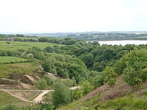
The hills of the West Pennine Moors are generally lower than the main Pennine range to the east. There are rocky cliffs and steep slopes, creating dramatic landscapes with "V"-shaped valleys. Fast-flowing streams drain these valleys. Winter Hill, at 456 meters, is the highest point. The moors also have wooded valleys and cloughs (steep-sided valleys). The largest is in the Roddlesworth valley near Tockholes. There are some small pine tree forests, especially around the reservoirs, but not many trees overall.
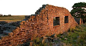
Most of the bigger towns are around the edges of the moors in the valleys. On the moors themselves, you'll find scattered farmhouses built from local stone. Some of these old farms are now empty or ruined. The main use of the land is for sheep farming. Unlike some other moorland areas, these moors are not managed for grouse hunting. They are mostly rough grassland and peat bogs. There was a big loss of heather plants between 1946 and 1988.
Water Wonders: Reservoirs
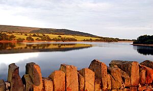
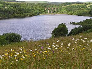
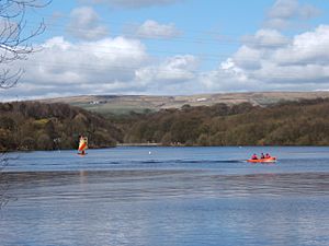
In the mid-1800s, valleys on the moors were flooded to create reservoirs. These provided water for local factories first, and then clean water for the towns nearby, including Liverpool. There are several groups of reservoirs that add to the beautiful scenery and offer places for fun activities and tourism.
The Anglezarke, Upper Rivington, Lower Rivington, and Yarrow reservoirs were built to give Liverpool clean water. This big project, called the 'Rivington Pike Scheme', was started by Thomas Hawksley between 1850 and 1857. Water from two higher reservoirs, Rake Brook and Lower Ruddlesworth, was carried south in a man-made channel called 'The Goit'. This channel connected them to the main reservoirs. The project grew in 1856 to include High Bullough Reservoir, which was built in 1850 to supply water to Chorley. The Upper Roddlesworth Reservoir was built later, from 1867 to 1875. Yarrow Reservoir was started in 1867 and designed by Thomas Duncan, Liverpool's city engineer.
The Rivington area that collects water covers 10,000 acres (40 km²). The water flows through filters at Horwich at a rate of about 8.96 million liters (2.24 million gallons) per day.
To the east, you can find other groups of reservoirs. These include Belmont, Delph, Turton and Entwistle, Wayoh, and Jumbles reservoirs.
In the northeast is Haslingden Grane, a valley shaped by glaciers. It has three reservoirs: Calf Hey, Ogden, and Holden Wood. There's a car park and an information center at Clough Head.
Exploring the Moors
In 1896, a large group of people marched onto the moors. This happened after a man bought land for shooting and tried to stop people from using public paths. Reports say 10,000 people gathered. They faced a barrier and police, but the crowd pushed past them and walked across the land. Today, a lot of the open moorland is open to everyone thanks to a law called the Countryside and Rights of Way Act 2000. This law gives walkers the "right to roam" over the moorland. However, some parts of the area can be very wet and boggy, making walking difficult.
The area around High Bullough reservoir is a nature reserve and part of the Anglezarke trail. Mountain biking has become popular here since 2002. In that year, the area was used for the biking events of the 2002 Commonwealth Games.
In March 2020, during the Coronavirus lockdown, the West Pennine Moors had a fire, probably caused by a barbecue.
Amazing Landmarks
The main mast at Winter Hill transmitting station on Winter Hill is very tall, reaching 1,014 feet (309 meters) high. It belongs to a company called Arqiva. This mast sends out radio and TV signals for the North West region of England.
Other masts and towers nearby are used for mobile phones, emergency services like police and fire, and various communication links.
Because of its high position, Rivington Pike was used as a beacon on July 19, 1588. A fire was lit there to warn people that the Spanish Armada (a fleet of Spanish ships) had been seen off the coast of Cornwall. Beacons were also lit to mark the end of World War I in 1918, the coronations of King George V and Queen Elizabeth II, and a Royal wedding in 1981. The tower on top of the Pike was built in 1733 by John Andrews of Rivington Hall as a shelter. It stopped being used when the land was bought by William Lever in 1900. It is now a Grade-II-listed building, meaning it's protected for its historical importance.
The eight-sided Jubilee Tower on Beacon Hill, overlooking Darwen, was finished in 1898. It was built to celebrate Queen Victoria's Diamond Jubilee and the local people's success in gaining the right to access the moor. It's often called "Darwen Tower." It is 85 feet (26 meters) tall, and you can climb an internal staircase to the top. From there, you can see Yorkshire, Morecambe Bay, Lancashire, Cumbria, and the surrounding moorland. On clear days, you might even see the Isle of Man far away to the northwest.
The Peel Tower stands on Holcombe Hill. It's a memorial to a former Prime Minister. You can see it from many miles away. When the tower is open, you can climb its 148 steps.
Wildlife and Habitats
The West Pennine Moors and the farmland around them have a lot of different plants and animals. This variety is often not fully appreciated.
On the open moorland, there are large areas of blanket bog with deep peat soils. Even though grazing, burning, and drainage have changed them, you can still find special plants. These include cotton-grass, heather, cross-leaved heath, cranberry, and many kinds of sphagnum moss. Rare plants like bog rosemary are also found here. Other parts of the moorland have upland heath and grassy areas. Moorland birds include peregrine falcons, merlins, dunlins, wheatears, short-eared owls, and golden plovers. Luckily, the West Pennine Moors have not had many pine trees planted, unlike some other northern uplands.
At lower heights, the land has pasture and meadows surrounded by dry stone walls. Grasslands with many different species are now rare, mostly found in steep valleys or cloughs. Some of these wet areas, like Oak Field SSSI, are rich in species. Some improved pastures still have breeding wading birds like northern lapwings, snipes, and curlews. Around Belmont Reservoir, you might see oystercatchers, redshanks, and common sandpipers. The reservoir itself is important for its large numbers of black-headed and Mediterranean gulls.
Native broad-leaved woodlands are mostly found in valleys (cloughs). There are examples of oak woodlands, ash woodlands, and wet woodlands with alder and willow trees, like at Longworth Clough SSSI. Along many reservoir valleys, there are large areas of broad-leaved and pine tree plantations, such as around Roddlesworth Reservoir and Turton and Entwistle Reservoirs.
 | Aurelia Browder |
 | Nannie Helen Burroughs |
 | Michelle Alexander |


