Rivington facts for kids
Quick facts for kids Rivington |
|
|---|---|
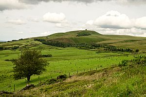 Rivington Pike, from Georges Lane |
|
| Area | 3.97 sq mi (10.3 km2) |
| Population | 109 (2011 Census) |
| • Density | 27/sq mi (10/km2) |
| OS grid reference | SD626144 |
| Civil parish |
|
| District |
|
| Shire county | |
| Region | |
| Country | England |
| Sovereign state | United Kingdom |
| Post town | BOLTON |
| Postcode district | BL6 |
| Dialling code | 01204 |
| Police | Lancashire |
| Fire | Lancashire |
| Ambulance | North West |
| EU Parliament | North West England |
| UK Parliament |
|
Rivington is a small village and civil parish in Lancashire, England. It covers about 4 square miles (10 square kilometers). Rivington is located about 6 miles (10 km) southeast of Chorley and 8.5 miles (14 km) northwest of Bolton.
This area is mostly countryside with farms and moorland. You'll find hills like Rivington Pike and Winter Hill here. Rivington is a popular spot for tourists. People come to see the large reservoirs built in the Victorian era to supply water to Liverpool. They also enjoy Lever Park, a public park created by William Lever over 100 years ago. The village is home to Rivington and Blackrod High School. In 2011, Rivington had a population of 109 people.
Contents
- Discovering Rivington's Past
- How Rivington is Governed
- Rivington's Geography and Landscape
- Rivington's People and Population Changes
- Rivington's Economy: Tourism and More
- Getting Around Rivington: Transport Links
- Learning in Rivington: Schools and Education
- Faith and Worship in Rivington
- Important Campaigns and Protests
- Sports and Activities in Rivington
- Rivington's Cultural Connections
Discovering Rivington's Past
What's in a Name? The Meaning of Rivington
The name Rivington comes from old English words. Riv means "rough" or "rugged," and tūn means "farm" or "settlement." So, Rivington likely means "a farm or settlement in a rough place." Some people also think it might mean a place with rowan trees.
Over the centuries, the name was spelled in many ways. These included Rowinton, Rawinton, Revington, and Rovington.
Ancient Times: Early Settlements in Rivington
People have lived in the Rivington area for a very long time. In 1999, a stone with a special "cup and ring mark" was found. This mark dates back to the Neolithic or Bronze Age, between 2000 and 3000 BC.
Archaeologists have also found Arrowheads, a flint knife, and remains of ancient fires. These were found in a Bronze Age burial mound at Noon Hill. In 2024, a neolithic axe head was discovered near a footpath. These finds show that people lived and buried their dead here thousands of years ago.
Historic Buildings and Views in Rivington
One of the most famous buildings is the tower on Rivington Pike. It's one of 28 listed buildings in the area.
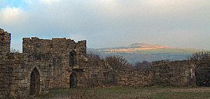
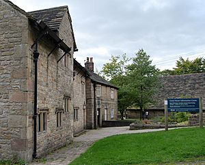
Other important spots include Rivington Hall and its large Hall Barn. At Lever Park, near the Lower Rivington Reservoir, you can see a small replica of Liverpool Castle. Both barns were turned into tea rooms in the early 1900s. The old Lever Park Information Centre is now a gift shop run by the Heritage Trust.
Along George's Lane, which leads to Rivington Pike, you'll find Pike Snack Shack. It offers amazing views of the hills and valleys.
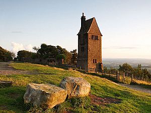
On the hillside, there are remains of the former Bungalow Grounds. These were once beautiful gardens designed by T.H. Mawson. You can still see stone summer houses, paths, and the Pigeon Tower. The Pigeon Tower is now surrounded by a new woodland.
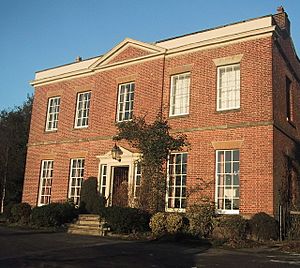
In the village itself, you'll find historic buildings like Wilkinson's, Rivington School, Rivington Church, and the Unitarian Chapel. The church and chapel are still used for worship. Fisher House, once a school and then a hotel, is now a private home. Don't miss the old village stocks on Rivington village green, which date back to 1719.
Near Horrobin Embankment, there's a car park. This was once the site of the Black O'Moors Hotel. Next to it is Rivington Bowling Club, which also has a tea room.
How Rivington Changed: From Farms to Tourism
Rivington used to be mainly a farming area. People grew crops and raised animals. After 1850, everything changed when the Rivington Reservoir Scheme began. Many workers came to build the reservoirs, and new businesses opened to serve them.
As the reservoirs were finished, tourism started to grow. Today, tourism is a big part of Rivington's economy, along with farming. Before the reservoirs, Rivington was a quiet village with farms and a few cottages.
People also earned money from the textile industry and quarries. There was even a small coal mine on Rivington Moor.
Water Power and Mills
Before the reservoirs, the Rivington valley was mostly farmland. A stream flowed through it, powering several mills. One mill was used as a smithy in the 1800s. Another water mill was located near Rivington Hall.
The building of the reservoirs in the 1800s reduced farming in the area. The Unitarian Chapel area was once called Mill Hill, showing how important water mills were here.
The Big Change: Reservoirs and Water Supply
The Industrial Revolution changed how people worked. Small home-based industries like weaving disappeared. The population of Rivington also decreased as land was cleared for the reservoirs. These reservoirs were built to supply clean water to Liverpool.
Building the reservoirs was a huge project. It meant demolishing some homes and flooding farmland. At first, there was a lot of opposition. However, the project did bring jobs and money to the local area.
Originally, there were plans to knock down all the buildings in the village. But local people fought against this. William Lever (later Lord Leverhulme) helped save the village. He used his influence to protect it through the Liverpool Corporation Act 1902.
In the early 1900s, tourism boomed. Rivington had hotels, pubs, and tea rooms. The opening of Lever Park in 1904 made it even more popular.
Rivington's Reservoirs: A Vital Water Source
The construction of the Rivington Reservoir Chain completely changed the area. This project, called the 'Rivington Pike Scheme', was built to provide clean drinking water to Liverpool. Today, it mostly supplies 70,000 homes in the Wigan area. It can also supply Liverpool and Manchester.
The scheme, built by Thomas Hawksley between 1850 and 1857, flooded the valley. Nine properties were demolished before construction began. The Liverpool Corporation Act 1902 allowed the purchase of large areas of land. Five reservoirs and a water treatment plant were built. A 17-mile (27 km) pipeline carried water to storage reservoirs in Prescot.
During World War II, secret files show that German bombers used the reservoirs for navigation.
Lord Leverhulme's Influence on Rivington
In 1900, Liverpool Corporation wanted to buy all of Rivington and clear the village. This plan faced huge opposition. Many old farmhouses and mansions were cleared across the water catchment area.
However, William Hesketh Lever (Lord Leverhulme) helped save the village. He bought Rivington Hall and its lands. He then sold them to Liverpool Corporation under special terms in the Liverpool Corporation Act 1902. This act allowed the corporation to buy properties in the west of the village, like the Black-a-Moors Head pub and New Hall, which were then demolished. Most farms were also cleared. Thanks to Leverhulme, a small part of the village remained, and it has stayed mostly the same since then.
Leverhulme kept some rights over his former land, like shooting rights. He also made sure that no new buildings could be built there without his family's permission. Until his death in 1925, he lived on the hillside and used Rivington Hall as a museum. The 1902 act protects Lever Park and its Terraced Gardens.
Rivington's "Little Lake District"
The chain of reservoirs became known as 'The Little Lake District'. It attracted many tourists. This led to Rivington's economy changing from farming to tourism. A new railway station at Blackrod in 1841 also helped bring visitors. The nearby Horwich Railway Works also brought more people to the area.
The beautiful countryside and moorland became very important to working-class people. They wanted to keep access to these open spaces. This led to the famous Winter Hill mass trespass in 1896, where people protested for their right to roam.
Lever Park: A Gift for Everyone
Lord Leverhulme loved the Rivington area. He knew it well from his childhood. He was very interested in its history and even helped publish a book called 'A Short History of Rivington' in 1904. He also strongly supported public access to the fields and moorland.
In 1901, Leverhulme gave 364 acres (147 hectares) of land to Bolton to create a public park. Rivington Hall became part of Lever Park. The Crompton family, who owned the hall, lived there until 1910 as part of the sale agreement. After that, it was a museum until Leverhulme died in 1925. By the 1950s, the hall was falling apart, but the Salmon family saved it and leased it as a home.
Lever Park was officially created and protected by the Liverpool Corporation Act 1902. This law stated that the corporation must manage Lever Park. It was to be kept open for the "free and uninterrupted enjoyment of the people of his native town of Bolton."
Today, United Utilities owns and manages the park. The main part of the park is next to the Lower Rivington Reservoir. It stretches behind Rivington and Blackrod High School towards Rivington Hall Barn. Even Rivington Pike, though now owned by Chorley Council, is considered part of Lever Park. It is protected under the 1902 act.
The park opened in 1904. It still has its tree-lined paths and many footpaths. A special ceremony took place on October 10, 1911, to dedicate the park to the people of Bolton.
The park was most popular until Leverhulme's death in 1925. After that, many things were sold off, including the museum contents and even the animals from Rivington Hall Zoo. Work on the replica castle stopped. During World War II, the park was used by troops, and its barns stored food. The park suffered a lot during this time, and the hall became derelict. However, it was saved and remains a popular attraction today.
Lever Park now has woodlands, bridleways, and footpaths. These lead to the replica castle. The main road for cars is Rivington Lane, which has limited parking. Two converted barns now serve as tea rooms. Rivington Pike Tower is a famous landmark. The valley offers great views of the Lower Rivington Reservoir. The area is popular with hikers and mountain bikers. You can also find boating at the Anderton Centre and a Go Ape adventure course near Great House Barn.
Rivington Castle: A Replica Folly
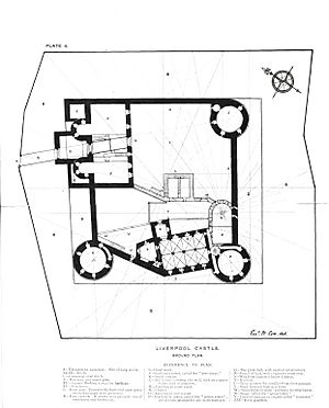
In 1911, Lord Leverhulme started building a folly called Rivington Castle. It's a smaller copy of Liverpool Castle. This replica is located on Coblowe Hillock near the Lower Rivington Reservoir. It has been a Grade II listed building since 1967 and is a very important part of Lever Park.
Construction began in 1912. The first foundation stone was laid in 1913. Building stopped when Leverhulme died in 1925. After that, all the building equipment was sold off.
After World War II, the inside of the castle was blocked off with steel bars for safety. But now, it's open to the public again. The castle walls have been changed several times. For example, a spiral staircase and stone steps were removed to stop visitors from climbing. This work was done in 2012 to make the site safer.
Leverhulme's Amazing Gardens
On the slope of Rivington Pike, there's a wooded area that was once Lord Leverhulme's gardens. His bungalow there was demolished in 1948. But you can still see many stone structures from his Italian-style gardens. These include stone summer houses, paths, steps, bridges, and three ponds. The Pigeon Tower has also been restored.
A Japanese-style garden was added in 1923, but its features are mostly gone now. However, its special pulhamite pond remains. Further down the hillside, a man-made ravine was built in 1921. Since 1939, the site has been managed by United Utilities. It is now leased to Rivington Heritage Trust, who use the grounds for outdoor events.
There's a public footpath and a bridleway that run from Lever Park to Rivington Pike and the Terraced Gardens. Public footpath number 82 goes through the gardens. This area is also "open access land," meaning you have the right to roam freely.
How Rivington is Governed
Rivington used to be a small part of the larger ecclesiastical parish of Bolton le Moors. In 1866, it became its own civil parish.
Since 1974, Rivington has been part of the Borough of Chorley. This borough has 47 councillors who are elected every four years. Rivington is part of the Heath Charnock and Rivington ward. Chorley is also part of Lancashire County Council. Rivington has its own local parish council.
Rivington is part of the Chorley parliamentary area. The current Member of Parliament (MP) for Chorley is Lindsay Hoyle. He became the Speaker of the House of Commons after the 2019 General Election.
Rivington's Geography and Landscape
| Weather chart for Rivington | |||||||||||||||||||||||||||||||||||||||||||||||
|---|---|---|---|---|---|---|---|---|---|---|---|---|---|---|---|---|---|---|---|---|---|---|---|---|---|---|---|---|---|---|---|---|---|---|---|---|---|---|---|---|---|---|---|---|---|---|---|
| J | F | M | A | M | J | J | A | S | O | N | D | ||||||||||||||||||||||||||||||||||||
|
70
7
3
|
58
7
3
|
59
10
4
|
52
12
5
|
46
16
8
|
67
17
10
|
80
20
13
|
66
20
12
|
76
17
10
|
98
13
8
|
81
10
5
|
86
7
3
|
||||||||||||||||||||||||||||||||||||
| temperatures in °C precipitation totals in mm |
|||||||||||||||||||||||||||||||||||||||||||||||
|
Imperial conversion
|
|||||||||||||||||||||||||||||||||||||||||||||||
Rivington is located where the moorland meets the lower fields. The landscape features pastures, isolated farms, reservoirs, and old mines and quarries. There are many footpaths for people to explore. The reservoir valleys are dominated by large bodies of water and the Victorian-era dams. These are surrounded by woodlands.
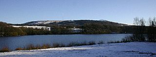
To the east of Rivington is Rivington Pike. To the west is the flatter land of the Lancashire Plain. Rivington is north of Horwich and Bolton. To its south are Anglezarke Moor and Yarrow Reservoir. West of the village is a wide valley with the Anglezarke, Upper, and Lower Rivington reservoirs.
You can reach the village from the west by a road on top of the 876-foot (267 m) long Horrobin Embankment. This dam separates the Upper and Lower Rivington reservoirs. The River Douglas starts on Winter Hill and forms part of the southern boundary. The River Yarrow starts on Anglezarke Moor and forms the northern boundary. The total area of the township is about 2,768 acres (11.20 km²). The reservoirs and filter beds cover 275 acres (111 hectares).
The ground beneath Rivington is made up of Millstone Grit, a type of sandstone with thin layers of coal. Stone was quarried here for local use.
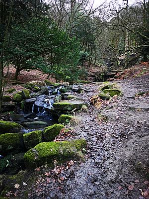
Around Rivington, you can find chalybeate springs (springs with iron in the water). In Dean Wood, there's a beautiful waterfall that drops 32 feet (10 meters).
 |
Chorley | Anglezarke, Anglezarke Reservoir | West Pennine Moors |  |
| Upper and Lower Rivington Reservoirs, M61 motorway | Winter Hill, Belmont, Sharples | |||
| Adlington, Anderton, Grimeford Village | Blackrod, Horwich | Bolton |
Rivington's People and Population Changes
In 2001, 144 people lived in Rivington. There were 63 males and 81 females. Most homes (34) were detached houses, and 14 were terraced or semi-detached. About 60% of homes were owned by the people living in them, while the rest were rented. The average age of people in Rivington was 53.4 years.
In 2001, most employed people (47) worked in service industries. Ten worked in mining and manufacturing. Three males were unemployed. On average, people traveled 20.5 kilometers (12.7 miles) to get to work.
How Rivington's Population Has Changed Over Time
| Population changes in Rivington since 1801 | |||||||||||||||||||||||||||||||||||||||||||||||||||||||||||||||||||||||
|---|---|---|---|---|---|---|---|---|---|---|---|---|---|---|---|---|---|---|---|---|---|---|---|---|---|---|---|---|---|---|---|---|---|---|---|---|---|---|---|---|---|---|---|---|---|---|---|---|---|---|---|---|---|---|---|---|---|---|---|---|---|---|---|---|---|---|---|---|---|---|---|
|
|
|
|||||||||||||||||||||||||||||||||||||||||||||||||||||||||||||||||||||
| Sources: | |||||||||||||||||||||||||||||||||||||||||||||||||||||||||||||||||||||||
Rivington's Economy: Tourism and More
Today, Rivington is a popular tourist spot. Many people visit for day trips and special events like weddings. The park, woodlands, replica castle, tea houses, and historic buildings are all popular attractions. United Utilities, through its Heritage Trust, uses money from tourism to help maintain the land and properties. The trust also hosts events at Leverhulme's old gardens and sells souvenirs.
Farming, especially sheep farming, is still important here. Local schools are also big employers. Other businesses include the Hall Barn, GoApe, and the Anderton Centre, which offers boating and event hosting at the Lower Reservoir.
Getting Around Rivington: Transport Links
Rivington is located east of the M61 motorway. This motorway connects the M6 and Preston to the north with the M60 and Greater Manchester to the south. The closest motorway exit is Junction 6.
You can reach the village by smaller roads from Horwich to the south and Adlington to the west. A winding road to the north goes through Anglezarke. Another road over the moors to the east leads to Belmont. The closest places with regular bus services are Horwich and Adlington. These buses travel between Bolton and Chorley or Preston.
The arrival of the Manchester and Bolton Railway in 1841, with a station at Blackrod railway station, brought many visitors to the area. The train line is still open today. Stations at Blackrod and Horwich Parkway provide access to Bolton, Manchester, Chorley, and Preston.
Learning in Rivington: Schools and Education
Rivington Grammar School was founded in 1566 by Bishop James Pilkington, with a special charter from Queen Elizabeth I. It opened in 1575 and was rebuilt in 1714. At first, it was only for boys.
In 1875, Blackrod Grammar School merged with Rivington Grammar School. In 1882, the new Rivington & Blackrod Grammar School opened. Today, it is known as Rivington and Blackrod High School. It's a specialist technology college, focusing on design, technology, math, and science. Younger students (Year Seven) use the former Horwich County Secondary School building.
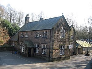
The old grammar school building in the village center is now home to Rivington Foundation Primary School.
Faith and Worship in Rivington
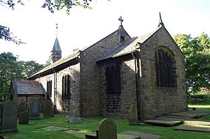
Rivington Church was founded in 1566, at the same time as the school. It is still an active Anglican church, holding services every Sunday.
The church stands on the site of an even older chapel from 1476. The area covered by the chapel included Rivington and nearby places like Anglezarke. The current church building was rebuilt in 1666 and restored in 1861. It's a simple building made of sandstone with a bell tower. It's unusual because it's not named after a saint, but simply called Rivington Church.
Rivington Unitarian Chapel is also an active place of worship. It holds regular services and hosts baptisms, weddings, and blessings. The chapel was built in 1703 with local stone. It started as a Presbyterian church and became Unitarian in the late 1700s. The chapel still has its original box pews and was restored in 1990.
Important Campaigns and Protests
The 1896 Winter Hill Mass Trespass
In 1896, a huge protest happened at Winter Hill. About 12,000 people took part. It was a response to Colonel Henry Ainsworth, a landowner who blocked a public path. This path, Coal Pit Road, was used by many workers traveling to and from Bolton. It was also used by people going to pick berries or visit the Pike Fair.
At that time, fresh air and open countryside were very important for people escaping polluted towns. Rivington was a popular day trip spot. When the path was blocked, people broke down the gate and fought to get through. This protest is remembered with a stone on Coalpit Road. It was an early fight for the "right to roam" and one of the biggest rights-of-way battles in British history. Eventually, people were able to use the path freely, and in 1996, it was officially declared a public right of way.
The 1989 Water Privatisation Protest
Lever Park was a gift from Lord Leverhulme to the people of Bolton, meant for everyone to enjoy freely. He wanted to make sure people could always access the fields and moorland.
However, in 1989, the "right to roam" was threatened. Water supplies and the land around them were moved from public ownership to private companies. This led to a sudden increase in gates and fences on footpaths. In response, 3,000 local campaigners in Rivington protested. They pledged to protect the area. This rally was organized by groups like the Ramblers Association. Even after this, the water company continued to try and block access to roads.
The 1997 Lever Park Bill Challenge
Lever Park faced another threat in 1997. The water company, supported by Horwich Town Council, tried to remove the park's legal protection. They wanted to move ownership of the land to a new trust and make money from it. This would also remove the cost of maintaining the park from the water company, even though they had a legal duty to do so under the Liverpool Corporation Act 1902.
Local people strongly opposed this plan. A petition with 5,807 signatures was presented against the "Lever Park Bill." A group of MPs from different parties blocked the act of Parliament. This showed how important the park's protection was to the community.
Protecting Public Paths and Access
Lever Park is protected by law under the Liverpool Corporation Act 1902. This law ensures "free and uninterrupted enjoyment" for everyone. The area is very popular with walkers, cyclists, and horse riders. There are many footpaths, bridleways, and roads that provide access to the park, hillside, and moorland.
Rivington moor, Winter Hill, Rivington Pike, Brown Hill, and the former Japanese and Kitchen Gardens are all part of a large area of "open access land." This means people have a right to roam freely, protected by the Countryside and Rights of Way Act 2000.
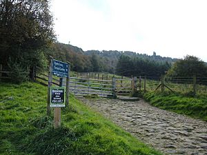
There are many roads that lead to Rivington. The main road for vehicles into Lever Park is Rivington Lane. Many old roads in Lever Park are now gated and used as bridleways or footpaths. Near Rivington Pike, the old coach road, Belmont Road, is a public road from Horwich. It becomes rougher as it climbs the hill towards the Pigeon Tower.
Sports and Activities in Rivington
The Rivington Pike Fell Race has been held every Easter Saturday since 1892. This fell race originally started from the Horwich railway works. Since 1930, it starts from the park entrance at Lever Park Avenue. Around 400 runners take part. The course is about 3.25 miles (5.2 km) long and climbs 700 feet (213 meters).
The area around Rivington and Anglezarke was used for the 2002 Commonwealth Games mountain biking competition. The area is still very popular with hikers and hillwalkers.
Some four-wheel drive vehicle owners use a section of Belmont Road for Off-roading. This road is a public road and is also used by walkers. However, the off-roading has caused a lot of controversy because it damages the road surface and nearby land.
Rivington's Cultural Connections
The poet Phoebe Hesketh lived at Fisher House in the village. She wrote several poetry books and two books about Rivington: Rivington: the story of a village and Rivington: village of the mountain ash. She also wrote a biography about her aunt, Edith Rigby, who was a suffragette.
The artist Alfred East stayed at Roynton Cottage in 1909. Lord Leverhulme asked him to paint the local landscape, including the reservoirs, park, village, and the pike. Leverhulme gave 15 of these paintings to Bolton Art Gallery. Others went to Bolton School, the Walker Art Gallery in Liverpool, and the Lady Lever Art Gallery at Port Sunlight. East also gave two watercolors to Kettering Museum and Art Gallery.
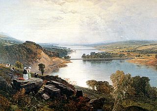
The Bolton Museum has a painting called "Rivington Lakes" from 1872. The Walker Art Gallery has a similar painting called Rivington Valley from 1857. Both were painted by Frederick William Hulme.
 | May Edward Chinn |
 | Rebecca Cole |
 | Alexa Canady |
 | Dorothy Lavinia Brown |


