Rivington Pike facts for kids
Quick facts for kids Rivington Pike |
|
|---|---|
 |
|
| Highest point | |
| Elevation | 1,191 ft (363 m) |
| Prominence | c. 50 ft |
| Geography | |
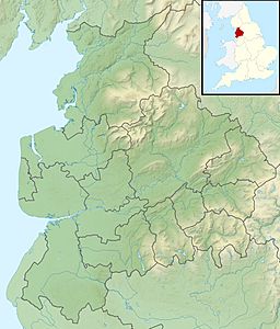
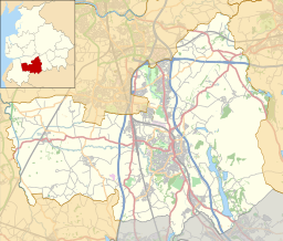
| Location | Lancashire, England |
| Parent range | West Pennine Moors |
| OS grid | SD643138 |
| Topo map | OS Landranger 109 |
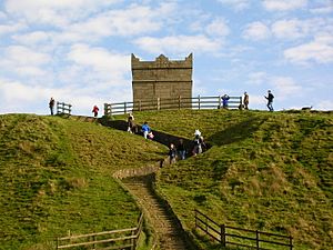
Rivington Pike is a famous hill in Lancashire, England. It's part of the West Pennine Moors and stands tall near the town of Chorley. People love to visit Rivington Pike for its amazing views and fun outdoor activities. The land and its special tower are looked after by Chorley Council.
Contents
Discovering Rivington Pike: Its Location and Landscape
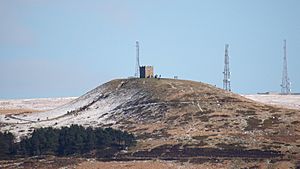
Rivington Pike is a high point on Winter Hill. It reaches 1,191 feet (363 meters) into the sky. This makes it the most westerly high spot in the West Pennine Moors.
What You Can See From the Top
From the very top of Rivington Pike, you can see incredibly far! On a clear day, you might spot Blackpool Tower. You can also see the mountains of the Lake District and even the Welsh mountains. Sometimes, you can even see as far as the Isle of Man!
A Look Back in Time: The History of Rivington Pike
The hill has a very old name. In ancient English, it meant "the rough or rugged hill" with a "pointed top." The earliest name recorded was Winterhold Pike in 1250. Later, it was called "Roun pic" in 1280.
There are signs of ancient people living here. You can find prehistoric sites nearby, like Noon Hill tumulus (an ancient burial mound). It's even possible that a large standing stone once stood on the summit.
In the early 1900s, the hill was used for exciting car and motorcycle races. Clubs like the North-East Lancs Automobile Club held hill climbs here.
The Beacon: A Signal Through History
Rivington Pike was an important spot for a series of beacons. These were like an old-fashioned warning system across England. They were first set up around 1139 to warn of attacks.
One of the most famous times the beacon was lit was on July 19, 1588. This was to warn everyone that the Spanish Armada was coming! Beacons have also been lit more recently. They celebrated the coronation of King George V in 1910. They also marked peace after World War I in 1919. And in 1977, 2012, and 2016, they celebrated the jubilees and birthday of Queen Elizabeth II.
The Pike Tower: A Landmark Building
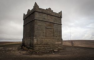
The Pike Tower is a special building on the summit. It's so important that it's a Grade II* listed building. John Andrews of Rivington Hall built it in 1733. He used stones from an old beacon that was there before.
The tower was built as a hunting lodge. It's square, about 16 feet (4.9 meters) on each side and 20 feet (6.1 meters) high. It once had a wooden roof, three windows, and a door. These are now blocked up.
For a while, the tower was not looked after well. But after people spoke up, it was given to Chorley Council in 1971. They rebuilt the outside of the tower in 1974. Today, Chorley Council owns and manages the Pike Hill and its tower.
Fun Events and Activities at Rivington Pike
Rivington Pike is a popular place for events and outdoor fun.
Easter Fair and Fell Race
The Rivington Pike Easter Fair used to be held on Whit Saturday. But in 1900, it moved to Good Friday, which is now a bank holiday. Lots of people still come to this fair every year.
There's also the Rivington Pike Fell Race. This exciting race has been held on the Saturday before Easter Sunday since 1892. Runners tackle a 3¼-mile course with a 700-foot climb! Many walkers also keep the Good Friday tradition of walking to the summit.
Protecting Access to the Hills
People have worked hard to make sure everyone can enjoy Rivington Pike. In 1896, a huge group of 10,000 people marched here. This was called the Winter Hill mass trespass. They wanted to protect their right to walk freely on the land. A landowner had tried to block access for his own use. This event helped lead to similar actions, like the Kinder Scout mass trespass.
Lord Leverhulme also helped. He used his own money to make sure people could access the countryside. Today, the Pike and the surrounding moorland are open to the public. Everyone has the legal right to roam here.
Getting to Rivington Pike: Public Access
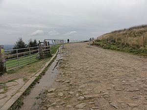
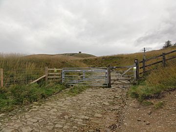
There are two main roads that lead up the hillside: Belmont Road and Roynton Road. These roads are open to the public and are looked after by Lancashire County Council. Gates on these roads should never be locked. The suggested speed limit is 5mph.
The area is very popular with walkers, horse riders, and mountain bikers. There are also many footpaths and bridleways (paths for horses and walkers) that give access to the hillside. These are protected by law, so everyone can enjoy them.
One popular way to reach the summit is by following footpath 82. This path goes through the beautiful terraced gardens. Another route is bridleway 98, which passes Higher Knoll farm. Steps were even built on the hillside in the 1990s to make the climb easier and protect the land.
Nearby Hill Summits
Here are some other hills close to Rivington Pike:
| Name | Locality | Elevation |
|---|---|---|
| Winter Hill † | Rivington | 1,496 feet (456 m) |
| Counting Hill | Smithills/Belmont | 1,421 feet (433 m) |
| Two Lads Hill † | Horwich | 1,276 feet (389 m) |
| Noon Hill † | Rivington | 1,247 feet (380 m) |
| Crooked Edge Hill | Horwich | 1,230 feet (375 m) |
| Rivington Pike | Rivington | 1,191 feet (363 m) |
| Adam Hill | Horwich | 1,181 feet (360 m) |
| White Brow | Horwich | 1,175 feet (358 m) |
| Whimberry Hill | Belmont | 1,115 feet (340 m) |
| Egg Hillock | Belmont | 1,076 feet (328 m) |
| Brown Hill | Rivington | 1,066 feet (325 m) |
| Brown Lowe | Smithills | 1,066 feet (325 m) |
| Burnt Edge | Horwich | 1,066 feet (325 m) |
| † Means there's a walker's cairn (stone pile) or something similar. | ||
 | Victor J. Glover |
 | Yvonne Cagle |
 | Jeanette Epps |
 | Bernard A. Harris Jr. |


