Spring Branch (Murderkill River tributary) facts for kids
Quick facts for kids Spring Branch |
|
|---|---|
|
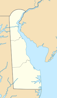
Location of Spring Branch mouth
|
|
| Other name(s) | Tributary to Murderkill River |
| Country | United States |
| State | Delaware |
| County | Kent |
| Physical characteristics | |
| Main source | Fan Branch divide about 0.5 miles south of Felton, Delaware 53 ft (16 m) 38°59′32″N 075°33′59″W / 38.99222°N 75.56639°W |
| River mouth | Murderkill River about 0.5 miles southeast of Roesville, Delaware 7 ft (2.1 m) 38°59′23″N 075°31′26″W / 38.98972°N 75.52389°W |
| Length | 2.63 mi (4.23 km) |
| Basin features | |
| Progression | east |
| River system | Murderkill River |
| Basin size | 2.69 square miles (7.0 km2) |
| Tributaries |
|
| Bridges | US 13, Chimney Hill Road, Scrap Tavern Road |
Spring Branch is a small river, about 2.63 miles (4.23 km) long. It's like a smaller stream that flows into a bigger river called the Murderkill River. You can find it in Kent County, Delaware, in the United States.
Contents
Where Spring Branch Flows
Starting Point
Spring Branch begins near a place called Fan Branch. This spot is about 1 mile south of Felton, Delaware. It's like the starting point of the stream, where the water first gathers.
Journey to the Murderkill River
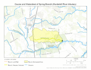
From its start, Spring Branch flows towards the east. It travels until it joins the Murderkill River. This meeting point is about 0.5 miles southeast of Roesville, Delaware.
The Spring Branch Area
What is a Watershed?
A watershed is like a big bowl that collects all the rain and snow that falls in an area. All this water then flows into a specific river or stream. The Spring Branch watershed covers about 2.69 square miles (6.97 square kilometers).
How Much Rain Does it Get?
The Spring Branch area gets a good amount of rain each year. This rain helps keep the stream flowing.
Forests and Nature
About 9.8% of the land around Spring Branch is covered by forests. These trees and plants are important for keeping the water clean and providing homes for animals.
Maps
 | Valerie Thomas |
 | Frederick McKinley Jones |
 | George Edward Alcorn Jr. |
 | Thomas Mensah |


