
St. George Island, Maryland facts for kids
Quick facts for kids
St. George Island, Maryland
|
|
|---|---|

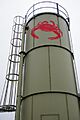
Water Tower on St. George Island
|
|

St. George Island, Maryland
Location in Maryland

St. George Island, Maryland
Location in the United States
|
|
| Country | United States |
| State | Maryland |
| Area | |
| • Total | 0.93 sq mi (2.41 km2) |
| • Land | 0.79 sq mi (2.04 km2) |
| • Water | 0.14 sq mi (0.37 km2) |
| Population
(2020)
|
|
| • Total | 265 |
| • Density | 336.29/sq mi (129.79/km2) |
| Time zone | UTC−5 (Eastern (EST)) |
| • Summer (DST) | UTC−4 (EDT) |
| FIPS code | 24-69425 |
| GNIS feature ID | 594921 |
St. George Island is a small area in St. Mary's County, Maryland, United States. It is not a separate town but a "census-designated place." This means it's a special area the government uses for counting people.
The island is connected to the mainland by a short bridge. The post office in Piney Point serves the island. In 2020, about 265 people lived here.
Contents
A Brief History of St. George Island
St. George Island has a rich history, playing a part in important events in American history.
War of 1812 Events
During the War of 1812, British forces used St. George Island as their main base. From here, they launched attacks on shipyards and farms along the rivers. Many tall pine trees on the island were cut down. These trees were then sent to England to be used as masts for ships.
Settlement and Growth
For a long time, the Roman Catholic Church owned St. George Island. In the 1800s, the Church finally allowed people to settle there. Some of the new settlers came from Smith Island, another island nearby.
Revolutionary War Battle
St. George Island was also important during the American Revolutionary War. On July 17, 1776, a battle took place here. British forces, led by John Murray, 4th Earl of Dunmore, tried to land on the Maryland mainland.
However, a group of Maryland soldiers called the Flying Camp militia stopped them. These soldiers were led by Captain Rezin Beall. He was hurt during the battle, but his troops successfully pushed back the British. This prevented the British from invading the mainland.
Images for kids
-
A water tower on St. George Island.
See also
 In Spanish: St. George Island para niños
