
St Leonards, Dorset facts for kids
Quick facts for kids St Leonards |
|
|---|---|
| Village | |
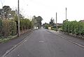
 Braeside Road |
|

St Leonards
|
|
| Area | 9.58 sq mi (24.8 km2) |
| Population | 6,859 (2011) |
| • Density | 716/sq mi (276/km2) |
| OS grid reference | SU115034 |
| Civil parish |
|
| Unitary authority |
|
| Ceremonial county | |
| Region | |
| Country | England |
| Sovereign state | United Kingdom |
| Post town | RINGWOOD |
| Postcode district | BH24 |
| Dialling code | 01425 |
| Police | Dorset |
| Fire | Dorset |
| Ambulance | South Western |
| EU Parliament | South West England |
| UK Parliament |
|
St Leonards is a friendly village located in the south-east of Dorset, England. It sits near the A31 road, about 2.5 miles south-west of Ringwood and 8 miles north of Bournemouth. St Leonards is also about 3 miles north-east of Ferndown.
Together with the nearby areas of St Ives and Ashley Heath, St Leonards forms a larger area called the civil parish of St Leonards and St Ives. In 2011, this whole area had a population of 6,859 people. Even though it's now part of Dorset for local government, St Leonards used to be part of the historic county of Hampshire. This change happened after a law called the Local Government Act 1972.
Contents
Fun Activities in St Leonards
St Leonards offers some great places for young people to hang out and be active.
Youth Club for Teens
The village has a special youth club for young people aged 10 to 18. It's open on Mondays and Wednesdays. You can find the youth club in Braeside Park, which is close to the village hall and the scout hut. It's a perfect spot to meet friends and have fun.
Parks and Sports Facilities
There are also places to play and enjoy sports in St Leonards.
Children's Playground
You can find a fun playground in the park, perfect for younger kids to enjoy.

Tennis Club
For those who love sports, St Leonards has a tennis club. It's a great place to learn or play tennis with friends and family.

Images for kids
-
Braeside Road
See also
 In Spanish: St Leonards para niños
