Stevenston Canal facts for kids
The Stevenston Canal was a special waterway in North Ayrshire, Scotland. It was built to move coal from mines in Ardeer and Stevenston to the port of Saltcoats. It also had many short branches that led to different coal pits.
This canal opened on September 19, 1772. It was the very first canal in Scotland built for business! It closed around the 1830s because the coal mines ran out of coal. Also, the nearby port of Ardrossan became more important. When it was built, people said it was the "most complete water system for moving coal ever made in Britain."
Contents
Why the Canal Was Built
The canal was built by the coal mine owners. They wanted to avoid paying tolls (fees) on the roads that led to Saltcoats harbour. Also, the ground was very sandy and soft. This made it hard for horses to pull heavy coal wagons.
Part of the canal in the Ardeer area followed old bogs and lochs. These were left over from when the River Garnock used to flow there. This made Ardeer an island a long time ago.
Patrick Warner built a drainage ditch called the 'Master Gott'. He used it to dry out the bogs on his Ardeer Estate. Parts of this ditch were later used to build the canal. Robert Cunninghame built the harbour at Saltcoats. He also developed the mines and made salt. He used the coal to produce salt, which was then shipped out from the new harbour.
How the Canal Worked
The canal was about 2.25 miles (3.6 km) long. It was 13 feet (4 meters) wide at the top and 12 feet (3.6 meters) wide at the bottom. It was usually 4 feet (1.2 meters) deep. However, it was deeper and wider in some places because of the land's shape. The sides of the canal were angled at 45 degrees.
The canal got its water from the Stevenston Burn. A special dam controlled the water level there. Water also came from pumps in the coal pits, like the Dip Pit and the Raise Pit in Ardeer Park.
Coal Barges and Transport
Eight barges were built to carry coal on the canal. Each boat could carry between 12 and 15 tons of coal. This was as much as fifty horses and carts could carry on the road!
Wind-blown sand from the dunes could fill the canal. To stop this, waste from the coal pits was piled up on both sides of the canal. This created a protective barrier.
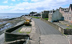
The canal ended at a coal yard in Saltcoats. This yard might have had offices and was about 600 yards (550 meters) from the harbour. This area is now called Canal Street.
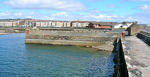
The canal never went directly into the harbour. There was a very hard rock area called the Shott that was too difficult to dig through. Later, a railway was built along the Shott to the old harbour quay. This happened after tolls were put on the coal carts.
John Warner, who was Patrick Warner's brother, oversaw the building of the canal. They used a special method called 'puddling' with clay to seal the canal. This stopped water from leaking out. It took four months to build and cost the Stevenston Coal Company £4857.
Moving coal along the canal cost 3 pence per ton. Transferring the coal from the barge to a cart, and then to a ship, cost another 8 pence per ton.
Canal Branches
The canal had four branches within what is now Ardeer Park. One branch went all the way to where Ardeer House used to be. It took a winding path to avoid a stone quarry.
The eastern end of the canal also had branches. One went to a pit in Hill Side Field. The other went to the Bogpit, which was just below the small Broom Estate.
The Waggonway and Railway
In 1805, the Earl of Eglinton got permission to set up a toll gate. He charged fees that started at £30 a year. But in 1811, he increased them ten times! Because of this, Robert Cunninghame decided to build his own waggonway to avoid the toll.
At first, the waggonway had wooden rails attached to stone sleepers. It was built along the rocks of the seashore. However, the Earl of Eglinton argued about who owned the land. Local people also complained that the waggonway blocked their way to the beach. A high wall was built to protect the railway from the sea.
By 1812, the track reached the Saracen's Head Inn. Since the Earl did not continue his legal case, the waggonway was finished. It was actively used, and the Stevenston Coal Company owned fifty horses to pull the wagons and tow the barges.
Another report says the railway used cast-iron rails from the start. Robert Cunninghame had visited the Kilmarnock and Troon Railway and liked their design. By 1827, the line reached the coal quay after an agreement with the Earl.
This waggonway was used until 1852. That's when coal was no longer shipped from Saltcoats. The railway tracks were then removed for scrap metal. The waggonway had been extended eastward towards the Bowbridge Pit. It employed twenty men and horses. The canal might have been used less because of this new railway.
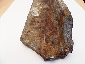
In the storms of 2014, parts of old cast iron 'L' shaped plateway rails were found. They were about three feet long and were exposed from the old Auchenharvie Pit No.5.
Moving Coal to Ships
In 1798, Patrick Warner passed away. Before he died, he challenged the legal agreement with Robert Cunninghame. He said it was no longer valid. The courts then appointed an inspector to check the canal.
The inspector reported on a new way of loading coal called a 'hurry'. This hurry separated different sizes of coal. But it also caused a lot of coal to break into smaller pieces. The larger pieces of coal were put in the middle of the barge. The ends were used for 'panwood', 'line coal', or 'slack'. These were smaller pieces made from the coal breaking. All of this coal was taken to the coal yards in Saltcoats and the salt works there.
At the Saltcoats coal yards, workers shoveled the coal into carts. Then, it was taken about half a mile to the waiting ships. The coal was simply tumbled into the ship's hold. This caused even more breakage. However, these smaller pieces of coal were said to be good for the Irish market. The boats using the harbour could carry about 300 cart loads of coal at a time. 'Panwood' was a lower quality coal not usually shipped out. It was suitable for the saltpans.
Where the Canal Is Now
The 1856 OS map shows where the canal likely ran. It even marks 'Canal Bank' and a 'Canal Cottage'. The cottage was probably used by canal workers.
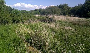
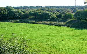
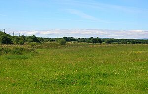
Today, in 2013, the only parts of the canal that are still visible are in Ardeer Park at Stevenston. An information board there helps explain where it was.
The canal is remembered by street names like Canal Street and Canal Place. The 1860 OS map shows a sluice (a gate to control water) near the old Stevenston coal pits. This was the eastern end of the canal. It also marks a coal yard where the old canal coal yard used to be.
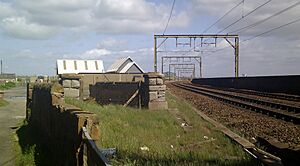
The building of the Glasgow and South Western Railway helped to remove the old canal at its western end. It also removed the railway that went with it. The old coal yard and canal basin are now open ground. A pair of old gatepiers (stone posts) at the railway boundary might be from the waggonway that went down to the harbour.
 | Selma Burke |
 | Pauline Powell Burns |
 | Frederick J. Brown |
 | Robert Blackburn |


