Stevensville, Michigan facts for kids
Quick facts for kids
Stevensville, Michigan
|
||
|---|---|---|
|
Village
|
||
|
||

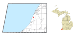
Location within Berrien County
|
||
| Country | United States | |
| State | Michigan | |
| County | Berrien | |
| Township | Lincoln | |
| Area | ||
| • Total | 1.05 sq mi (2.71 km2) | |
| • Land | 1.04 sq mi (2.70 km2) | |
| • Water | 0.00 sq mi (0.01 km2) | |
| Elevation | 636 ft (194 m) | |
| Population
(2020)
|
||
| • Total | 1,147 | |
| • Density | 1,098.66/sq mi (424.36/km2) | |
| Time zone | UTC-5 (Eastern (EST)) | |
| • Summer (DST) | UTC-4 (EDT) | |
| ZIP code(s) |
49127
|
|
| Area code(s) | 269 | |
| FIPS code | 26-76500 | |
| GNIS feature ID | 0638824 | |
Stevensville is a small village located in Berrien County, in the state of Michigan, United States. It is part of Lincoln Township. In 2020, about 1,147 people lived there.
Contents
A Look Back: Stevensville's History
Stevensville was first planned out in the 1840s. A man named Thomas Stevens, who was a banker from Niles, Michigan, owned a lot of land in the area. He decided to create the village.
Later, another person named A.D. Brown added more land to the village. Stevensville officially became an incorporated village in 1893. This means it was given its own local government. In 1906, the village had a population of 250 people.
Where is Stevensville? Geography Facts
Stevensville is a small place, covering about 1.04 square miles (2.69 km2) of land. According to the United States Census Bureau, the village is made up entirely of land, with no large bodies of water inside its borders.
Who Lives in Stevensville? Population Details
The number of people living in Stevensville has changed over the years. Here's how the population has grown and shrunk:
| Historical population | |||
|---|---|---|---|
| Census | Pop. | %± | |
| 1900 | 251 | — | |
| 1910 | 243 | −3.2% | |
| 1920 | 206 | −15.2% | |
| 1930 | 271 | 31.6% | |
| 1940 | 382 | 41.0% | |
| 1950 | 480 | 25.7% | |
| 1960 | 697 | 45.2% | |
| 1970 | 1,107 | 58.8% | |
| 1980 | 1,268 | 14.5% | |
| 1990 | 1,230 | −3.0% | |
| 2000 | 1,191 | −3.2% | |
| 2010 | 1,142 | −4.1% | |
| 2020 | 1,147 | 0.4% | |
| U.S. Decennial Census | |||
2010 Census: A Snapshot of Residents
In 2010, there were 1,142 people living in Stevensville. These people lived in 526 households. A household is a group of people living together in one home.
Most residents were White (about 94.6%). Smaller groups included African American (2.1%), Native American (1.0%), and Asian (1.2%). About 2.4% of the population identified as Hispanic or Latino.
The average age in Stevensville was about 44.2 years old. Around 19.4% of the people were under 18 years old. About 20.5% were 65 years old or older. The village had slightly more females (51.9%) than males (48.1%).
Learning and Schools in Stevensville
Students in Stevensville attend schools in the Lakeshore School District. This district also serves the nearby town of Baroda.
There are also two private schools in Stevensville:
- Christ Lutheran School is for students from Pre-Kindergarten to 8th grade. It is part of the Lutheran Church Missouri Synod.
- St. Paul's Lutheran School also teaches students from Pre-Kindergarten to 8th grade. It is part of the Wisconsin Evangelical Lutheran Synod.
See also
 In Spanish: Stevensville para niños
 | Emma Amos |
 | Edward Mitchell Bannister |
 | Larry D. Alexander |
 | Ernie Barnes |


