Stirum, North Dakota facts for kids
Quick facts for kids
Stirum
|
|
|---|---|
| Country | United States |
| State | North Dakota |
| County | Sargent |
| Elevation | 1,355 ft (413 m) |
| Time zone | UTC-6 (Central (CST)) |
| • Summer (DST) | UTC-5 (CDT) |
| ZIP codes |
58069
|
| Area code(s) | 701 |
| GNIS feature ID | 1032325 |
Stirum is a small, quiet place in North Dakota, United States. It's known as an unincorporated community. This means it's a group of homes and buildings that aren't officially a city or town with its own local government. Instead, it's part of a larger area called Sargent County.
What is an Unincorporated Community?
An unincorporated community like Stirum is a place where people live, but it doesn't have its own separate city government. This means it doesn't have a mayor or a city council just for Stirum. Instead, services like roads and law enforcement are usually handled by the larger county government, which in this case is Sargent County.
Location and Geography
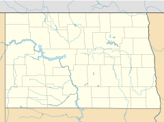
Stirum is located in the northwestern part of Sargent County. It's not far from North Dakota Highway 13, which is an important road in the state. The community lies northwest of Forman, which is the county seat of Sargent County. A county seat is like the main town or city in a county, where the county government offices are located.
Stirum sits at an elevation of about 1,355 feet (413 meters) above sea level. This means it's quite a bit higher than the ocean.
Post Office and ZIP Code
Even though Stirum is an unincorporated community, it has its own post office. This post office helps people in Stirum and the surrounding area send and receive mail. It uses the ZIP code 58069. A ZIP code is a special number that helps the postal service sort mail quickly and make sure it gets to the right place.
 | Ernest Everett Just |
 | Mary Jackson |
 | Emmett Chappelle |
 | Marie Maynard Daly |


