Stockton, Utah facts for kids
Quick facts for kids
Stockton, Utah
|
|
|---|---|

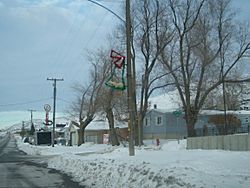
Main Street in winter
|
|

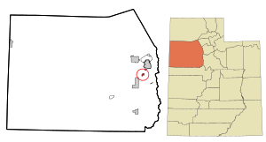
Location in Tooele County and the state of Utah
|
|

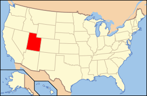
Location of Utah in the United States
|
|
| Country | United States |
| State | Utah |
| County | Tooele |
| Settled | 1863 |
| Incorporated | 1901 |
| Named for | Stockton, California |
| Government | |
| • Type | Mayor/Council |
| Area | |
| • Total | 1.69 sq mi (4.38 km2) |
| • Land | 1.68 sq mi (4.36 km2) |
| • Water | 0.01 sq mi (0.02 km2) |
| Elevation | 5,013 ft (1,528 m) |
| Population
(2010)
|
|
| • Total | 616 |
| • Estimate
(2019)
|
682 |
| • Density | 405.23/sq mi (156.46/km2) |
| Time zone | UTC-7 (Mountain (MST)) |
| • Summer (DST) | UTC-6 (MDT) |
| ZIP code |
84071
|
| Area code(s) | 435 |
| FIPS code | 49-73050 |
| GNIS feature ID | 2413337 |
| Website | www.stocktontown.org |
Stockton is a small town in Tooele County, Utah, United States. It is part of the larger Salt Lake City area. In 2010, the town had a population of 616 people.
Contents
History of Stockton
Stockton began because of the first big mining boom in the Utah Territory. This mining activity started in the early 1860s. It happened when Colonel Patrick E. Connor arrived. He was the leader of the Third California Volunteers. His group was sent to Utah in 1862. Their job was to watch over mail routes during the Civil War.
Connor wanted to balance the power of local leaders. He thought that if valuable metals were found in Utah, many miners would come. This would bring more people from outside the area. So, he sent his soldiers to look for minerals. They helped start the precious metals industry in Utah in 1863. They found deposits, claimed land, and set up mining areas. Mines were dug on the western side of the Oquirrh Mountains. Stockton became a base camp for some of these mining operations.
Early Town Life
The small town was first settled in 1863. As mining grew, the population quickly increased to 4,000 people. Stockton was the first town in the Utah Territories to have its streets planned and named. It was also the first to get electric lights. Later, it was the first to get a telephone.
A town cemetery was created north of the settlement in the early 1900s. Over time, Stockton added more services for its residents. These now include a baseball field, a city park, and a city hall. There is also a fire station, a water system, and a wastewater system.
Celebrating Stockton's Past
On April 27, 2013, Stockton held a special event. This event celebrated 150 years since the town was founded. As part of the ceremony, a new welcome sign was revealed. This sign is on the north side of town. You can see it from the main highway, SR-36, which runs through the town's business area.
Where is Stockton?
According to the United States Census Bureau, Stockton covers about 0.9 square miles (2.4 square kilometers). All of this area is land.
People of Stockton
| Historical population | |||
|---|---|---|---|
| Census | Pop. | %± | |
| 1870 | 80 | — | |
| 1880 | 515 | 543.8% | |
| 1890 | 326 | −36.7% | |
| 1900 | 443 | 35.9% | |
| 1910 | 258 | −41.8% | |
| 1920 | 238 | −7.8% | |
| 1930 | 351 | 47.5% | |
| 1940 | 332 | −5.4% | |
| 1950 | 414 | 24.7% | |
| 1960 | 362 | −12.6% | |
| 1970 | 469 | 29.6% | |
| 1980 | 437 | −6.8% | |
| 1990 | 426 | −2.5% | |
| 2000 | 443 | 4.0% | |
| 2010 | 616 | 39.1% | |
| 2019 (est.) | 682 | 10.7% | |
| U.S. Decennial Census | |||
In 2010, there were 616 people living in Stockton. There were 216 households and 173 families. The town had about 597 people per square mile (257 people per square kilometer). There were 237 homes in total.
Most of the people in Stockton were White (96.6%). A small number were Native American (0.6%). Some were from other races (1.7%), and 1.3% were from two or more races. About 6.7% of the population was Hispanic or Latino.
Households and Families
Out of 216 households, 38% had children under 18 living with them. About 64.8% were married couples living together. Some households (7.4%) had a female head with no husband present. About 19.9% were not families.
About 16.2% of all households were single individuals. Only 3.7% had someone living alone who was 65 or older. On average, there were 2.85 people per household. The average family size was 3.18 people.
Age and Income
The population in Stockton was spread out by age. About 23.7% were 14 years old or younger. About 11.2% were between 15 and 24. People aged 25 to 44 made up 25.1% of the population. Those aged 45 to 64 were 29.7%. About 10.3% were 65 years or older. The average age in Stockton was 36.8 years. About 52.4% of the population were males.
In 2000, the average income for a household in Stockton was $40,938. For families, the average income was $45,179. Men earned an average of $36,250, while women earned $25,000. The average income per person in the town was $15,894. About 7.2% of families and 6.6% of all people lived below the poverty line. This included 4.9% of those under 18 and 8.9% of those 65 or older.
See also
 In Spanish: Stockton (Utah) para niños
 | Charles R. Drew |
 | Benjamin Banneker |
 | Jane C. Wright |
 | Roger Arliner Young |

