Strong Island (Michigan) facts for kids

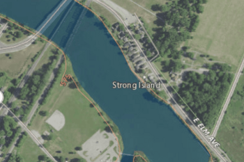
USGS aerial imagery of Strong Island
|
|
| Geography | |
|---|---|
| Location | Southeast Michigan |
| Coordinates | 41°54′39″N 83°22′44″W / 41.91083°N 83.37889°W |
| Adjacent bodies of water | River Raisin |
| Highest elevation | 571 ft (174 m) |
| Administration | |
|
United States
|
|
| State | |
| County | Monroe |
Strong Island is a small piece of land surrounded by water. It is located in the River Raisin in Michigan. This island is quite close to Lake Erie.
What is Strong Island?
Strong Island is an island found in the River Raisin. An island is a piece of land completely surrounded by water. This island is part of Monroe County, Michigan.
Where is Strong Island Located?
Strong Island is in the southeastern part of Michigan. It sits within the River Raisin. The River Raisin flows into Lake Erie, one of the Great Lakes. The island's exact spot is at coordinates 41°54′39″N 83°22′44″W / 41.91083°N 83.37889°W.
How High is Strong Island?
The United States Geological Survey (USGS) measured the height of Strong Island. The USGS is a science agency that studies the Earth. In 1980, they found its elevation to be 571 ft (174 m) above sea level. This means it is 571 feet (about 174 meters) high.
 | Audre Lorde |
 | John Berry Meachum |
 | Ferdinand Lee Barnett |


