
Stryker, Montana facts for kids
Quick facts for kids
Stryker, Montana
|
|
|---|---|

Stryker post office
|
|

Stryker, Montana
Location in Montana

Stryker, Montana
Location in the United States
|
|
| Country | United States |
| State | Montana |
| County | Lincoln |
| Area | |
| • Total | 1.03 sq mi (2.67 km2) |
| • Land | 1.03 sq mi (2.67 km2) |
| • Water | 0.00 sq mi (0.00 km2) |
| Elevation | 3,297 ft (1,005 m) |
| Population
(2020)
|
|
| • Total | 25 |
| • Density | 24.27/sq mi (9.37/km2) |
| Time zone | UTC-7 (Mountain (MST)) |
| • Summer (DST) | UTC-6 (MDT) |
| ZIP code |
59933
|
| Area code(s) | 406 |
| GNIS feature ID | 791609 |
| FIPS code | 30-71575 |
Stryker is a very small community in Lincoln County, Montana, in the United States. It's known as a "census-designated place" (CDP). This means it's a special area defined by the government for counting people.
As of the 2020 census, only 25 people lived in Stryker. The community has its own ZIP code, which is 59933.
Contents
History of Stryker
Stryker was named after some of the first families who settled there. It used to be an important stop for stagecoaches traveling between Kalispell and Fort Steele in British Columbia.
In 1926, a big forest fire swept through the town. Later, when the Libby Dam was built, Stryker's train station closed down.
Where is Stryker Located?
Stryker is in the northeastern part of Lincoln County. You can find it along U.S. Route 93. It is about 20 miles (32 km) southeast of a town called Eureka. It's also about 45 miles (72 km) northwest of Kalispell.
The community is located just south of a "drainage divide." This is a high point of land that separates different river systems. The Stillwater River flows east of Stryker and goes into the Flathead River. Summit Creek flows northwest and is part of the Tobacco River system, which leads to the Kootenai River.
According to the U.S. Census Bureau, the Stryker CDP covers an area of about 1.0 square mile (2.7 km2). All of this area is land.
Population of Stryker
The number of people living in Stryker has changed over time. Here's a look at the population counts from recent years:
| Historical population | |||
|---|---|---|---|
| Census | Pop. | %± | |
| 2020 | 25 | — | |
| U.S. Decennial Census | |||
Images for kids
-
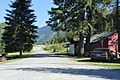
A building in Stryker
-
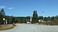
Railroad crossing


See also
 In Spanish: Stryker (Montana) para niños
