Sugar Notch, Pennsylvania facts for kids
Quick facts for kids
Sugar Notch, Pennsylvania
|
|
|---|---|
|
Borough
|
|

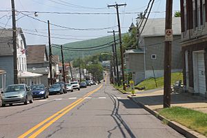
Street in Sugar Notch
|
|

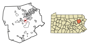
Location of Sugar Notch in Luzerne County, Pennsylvania.
|
|
| Country | United States |
| State | Pennsylvania |
| County | Luzerne |
| Incorporated | 1867 |
| Government | |
| • Type | Borough Council |
| Area | |
| • Total | 0.99 sq mi (2.58 km2) |
| • Land | 0.99 sq mi (2.58 km2) |
| • Water | 0.00 sq mi (0.00 km2) |
| Population
(2020)
|
|
| • Total | 996 |
| • Estimate
(2021)
|
995 |
| • Density | 966.83/sq mi (373.20/km2) |
| Time zone | UTC-5 (Eastern (EST)) |
| • Summer (DST) | UTC-4 (EDT) |
| Zip code |
18706
|
| Area code(s) | 570 |
| FIPS code | 42-75072 |
Sugar Notch is a small town, called a borough, located in Luzerne County, Pennsylvania, in the United States. In 2020, about 996 people lived there.
Contents
History of Sugar Notch
Sugar Notch became an official borough on April 3, 1867. It got its name from the many sugar maple trees that grew around the area. Before becoming a borough, it was part of Hanover Township.
The first leader of the borough, called a burgess, was Charles Parrish. The first council members were David Caird, Henry B. Plumb, Samuel Roberts, Adam Shiedel, and George Cyphers.
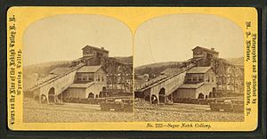
Coal Mining and Railroads
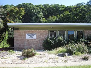
In 1869, the Lehigh and Susquehanna Railroad was built near Sugar Notch. This railroad was very important for moving coal out of the area. Sugar Notch was a busy coal mining town during the 1800s and 1900s. The building where the local government meets today was built in 1921.
Roosevelt Memorial Dedication
After World War II ended, a special memorial was built in Sugar Notch in 1946. It was dedicated to President Franklin D. Roosevelt. Eleanor Roosevelt, his wife, even came to the ceremony.
Geography of Sugar Notch
Sugar Notch is located at coordinates 41°11′46″N 75°55′50″W / 41.19611°N 75.93056°W.
The United States Census Bureau says that the borough covers a total area of about 2.8 square kilometers (1.1 square miles). All of this area is land, meaning there are no large bodies of water within the borough limits.
Population and People
| Historical population | |||
|---|---|---|---|
| Census | Pop. | %± | |
| 1870 | 724 | — | |
| 1880 | 1,582 | 118.5% | |
| 1890 | 2,586 | 63.5% | |
| 1900 | 1,887 | −27.0% | |
| 1910 | 2,439 | 29.3% | |
| 1920 | 2,612 | 7.1% | |
| 1930 | 2,768 | 6.0% | |
| 1940 | 2,505 | −9.5% | |
| 1950 | 2,002 | −20.1% | |
| 1960 | 1,524 | −23.9% | |
| 1970 | 1,333 | −12.5% | |
| 1980 | 1,191 | −10.7% | |
| 1990 | 1,044 | −12.3% | |
| 2000 | 1,023 | −2.0% | |
| 2010 | 989 | −3.3% | |
| 2020 | 996 | 0.7% | |
| 2021 (est.) | 995 | 0.6% | |
| Sources: | |||
In 2000, there were 1,023 people living in Sugar Notch. These people lived in 417 households, and 288 of these were families. The population density was about 1,003 people per square mile.
Most of the people living in Sugar Notch were White (99.41%). A small number were Asian (0.10%), or from other backgrounds. About 0.29% of the population identified as Hispanic or Latino.
About 25.2% of households had children under 18 living with them. The average household had 2.45 people, and the average family had 2.97 people.
The median age in the borough was 42 years old. This means half the people were older than 42, and half were younger.
The population of Sugar Notch was highest in 1930, with 2,768 residents. Since then, the number of people living in the borough has slowly decreased. By 2017, the population had fallen to 964.
Education
Students in Sugar Notch attend schools within the Hanover Area School District.
See also
 In Spanish: Sugar Notch para niños
 | James B. Knighten |
 | Azellia White |
 | Willa Brown |


