Surveyor Lake (Algoma District) facts for kids
Quick facts for kids Surveyor Lake |
|
|---|---|
| Location | Algoma District, Ontario |
| Coordinates | 46°45′19″N 82°06′06″W / 46.75528°N 82.10167°W |
| Primary inflows | Four unnamed creeks |
| Primary outflows | Cee Creek |
| Basin countries | Canada |
| Max. length | 2.8 km (1.7 mi) |
| Max. width | 1.7 km (1.1 mi) |
| Surface elevation | 427 m (1,401 ft) |
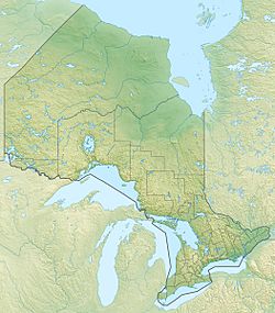
Surveyor Lake is a beautiful lake located in the Algoma District of Ontario, Canada. It's about 60 kilometres (37 mi) northwest of a town called Espanola. Imagine a quiet place surrounded by nature, and that's Surveyor Lake!
You can find a private road with public access about 4 kilometres (2.5 mi) west of the lake. This makes it a bit easier for people to visit and enjoy the area.
About Surveyor Lake
Surveyor Lake is a medium-sized lake, perfect for exploring. It stretches about 2.8 kilometres (1.7 mi) long and 1.7 kilometres (1.1 mi) wide. That's like walking almost three kilometers from one end to the other!
The lake sits at an elevation of 427 metres (1,401 ft) above sea level. This means it's quite a bit higher than the ocean.
Where the Water Goes
All the water in Surveyor Lake is part of a much bigger system called the Lake Huron drainage basin. Think of a drainage basin as a giant bowl where all the rain and melting snow collect and flow towards one main body of water. For Surveyor Lake, that main body is Lake Huron.
The lake gets its water from four small streams, which are called "unnamed creeks" because they don't have official names. These creeks are the "inflows" – where water flows into the lake.
The water then flows out of Surveyor Lake through a stream called Cee Creek. This is the "outflow." Cee Creek then joins a larger river called the Wakonassin River.
From the Wakonassin River, the water continues its journey into the Spanish River. Finally, the Spanish River empties into the North Channel of Lake Huron. So, a drop of water from Surveyor Lake eventually makes its way to one of the Great Lakes!
 | Toni Morrison |
 | Barack Obama |
 | Martin Luther King Jr. |
 | Ralph Bunche |


